Cutoff low over northern Alaska
![GOES-17 Mid-level Water Vapor (6.9 µm) images, with contours of PV1.5 Pressure plotted in red [click to play animation | MP4]](https://cimss.ssec.wisc.edu/satellite-blog/images/2020/06/200612_goes17_waterVapor_pv1.5pressure_AK_anim.gif)
GOES-17 Mid-level Water Vapor (6.9 µm) images, with contours of PV1.5 Pressure plotted in red [click to play animation | MP4]
![GOES-17 Mid-level Water Vapor (6.9 µm) images, with contours of PV1.5 Pressure plotted in red and available NUCAPS sounding profiles denoted by green/yellow points [click to enlarge]](https://cimss.ssec.wisc.edu/satellite-blog/images/2020/06/ak_wv_nucaps-20200612_215031.png)
GOES-17 Mid-level Water Vapor (6.9 µm) images, with contours of PV1.5 Pressure plotted in red and available NUCAPS sounding profiles denoted by green/yellow points [click to enlarge]
![NUCAPS sounding profile [click to enlarge]](https://cimss.ssec.wisc.edu/satellite-blog/images/2020/06/200612_22utc_nucaps_profile_AK.png)
NUCAPS sounding profile [click to enlarge]
![GOES-17 "Red" Visible (0.64 µm) images, with hourly surface reports plotted in red [click to play animation | MP4]](https://cimss.ssec.wisc.edu/satellite-blog/images/2020/06/200612_goes17_visible_AK_anim.gif)
GOES-17 “Red” Visible (0.64 µm) images, with hourly surface reports plotted in red [click to play animation | MP4]
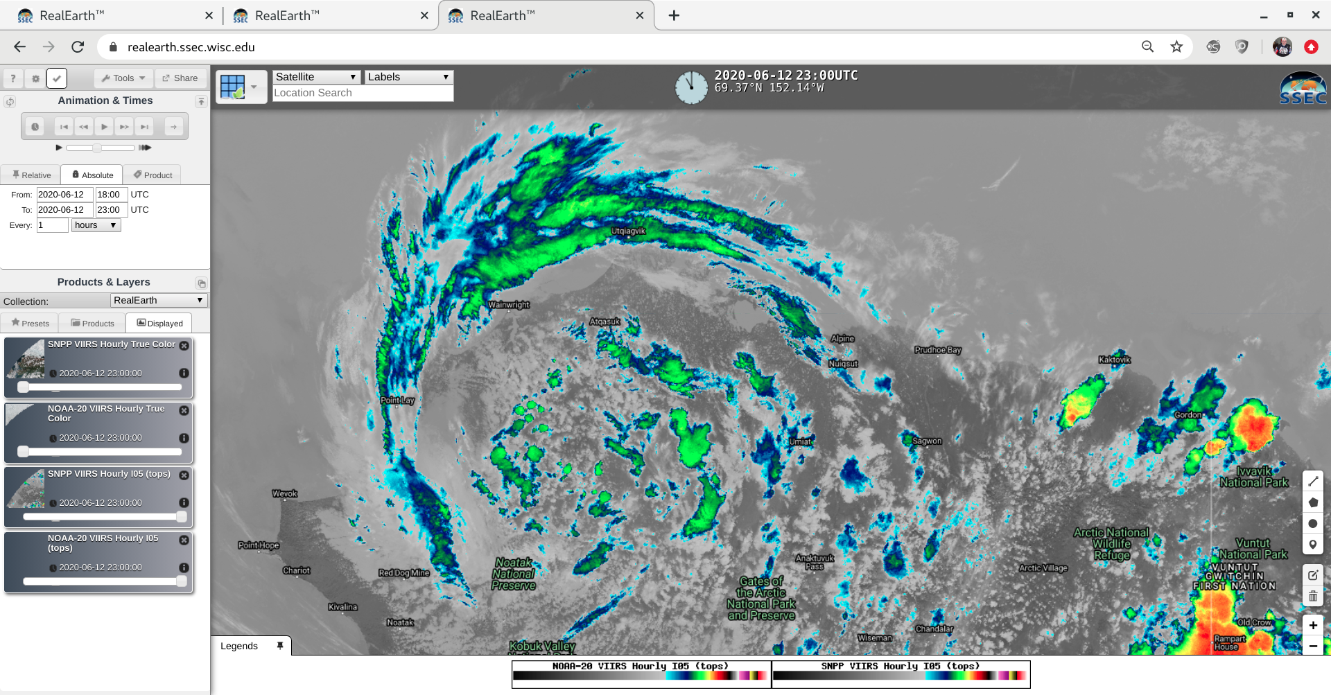
![VIIRS True Color (RGB) and Infrared Window (11.45 µm) images from NOAA-20 and Suomi NPP [click to enlarge]](https://cimss.ssec.wisc.edu/satellite-blog/images/2020/06/200612_noaa20_suomiNPP_trueColorRGB_infraredWindow_AK_anim.gif)
VIIRS True Color (RGB) and Infrared Window (11.45 µm) images from NOAA-20 and Suomi NPP [click to enlarge]
Summer thunderstorms stretched across the North Slope and near the Arctic Coast today. Data from the GLD360 depicted over 800 Cloud-to-Ground lightning events in the area! Here is the scene at Atqasuk, Utqiagvik, Nuiqsut, and Deadhorse this afternoon and evening. #akwx #lightning pic.twitter.com/tGeqswONW5
— NWS Fairbanks (@NWSFairbanks) June 13, 2020