This website works best with a newer web browser such as Chrome, Firefox, Safari or Microsoft Edge. Internet Explorer is not supported by this website.

Archive: Feb 2020

Gridded NUCAPS fields over the Pacific Ocean

GOES-17 ABI Imagery on 6 February suggests the presence of a cold front over the Pacific Ocean northeast of Hawaii. The Clean Window imagery shows a flat region between 30º N and 40º N around 140º W. The Night Fog Brightness temperature difference shows a signal — cyan — in... Read More

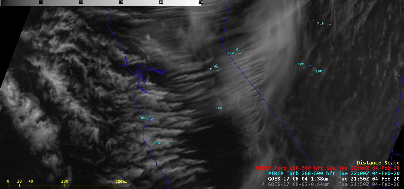
Transverse banding over California

1-minute Mesoscale Domain Sector GOES-17 (GOES-West) “Red” Visible (0.64 µm) and Near-Infrared “Cirrus” (1.37 µm) images (above) displayed widespread “transverse banding” — elongated cirrus elements oriented perpendicular to the ambient jet stream flow — that was migrating southward across California on 04 February 2020. This satellite signature is an indicator of potential turbulence, which in this... Read More

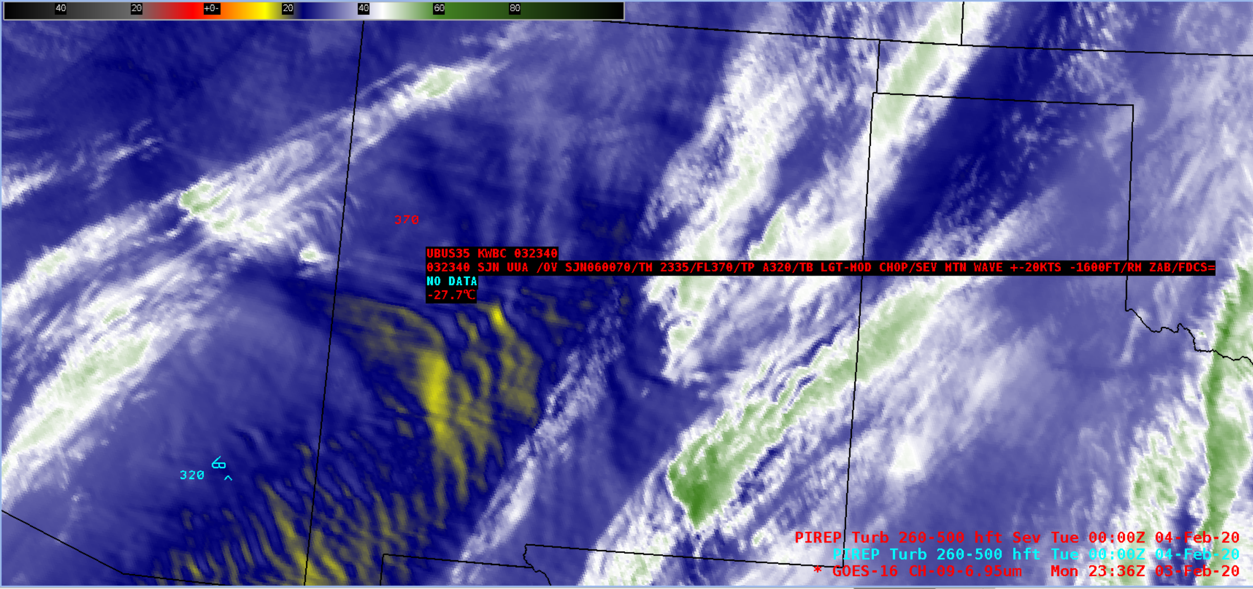
Severe turbulence over Arizona and New Mexico

GOES-16 (GOES-East) Mid-level Water Vapor (6.9 µm) images (above) showed numerous orographic waves over eastern Arizona and western New Mexico on 03 February 2020. There were several high-altitude pilot reports of turbulence across that region, including severe turbulence associated with mountain waves at 43,000 feet and at 39,000 feet (below). The... Read More

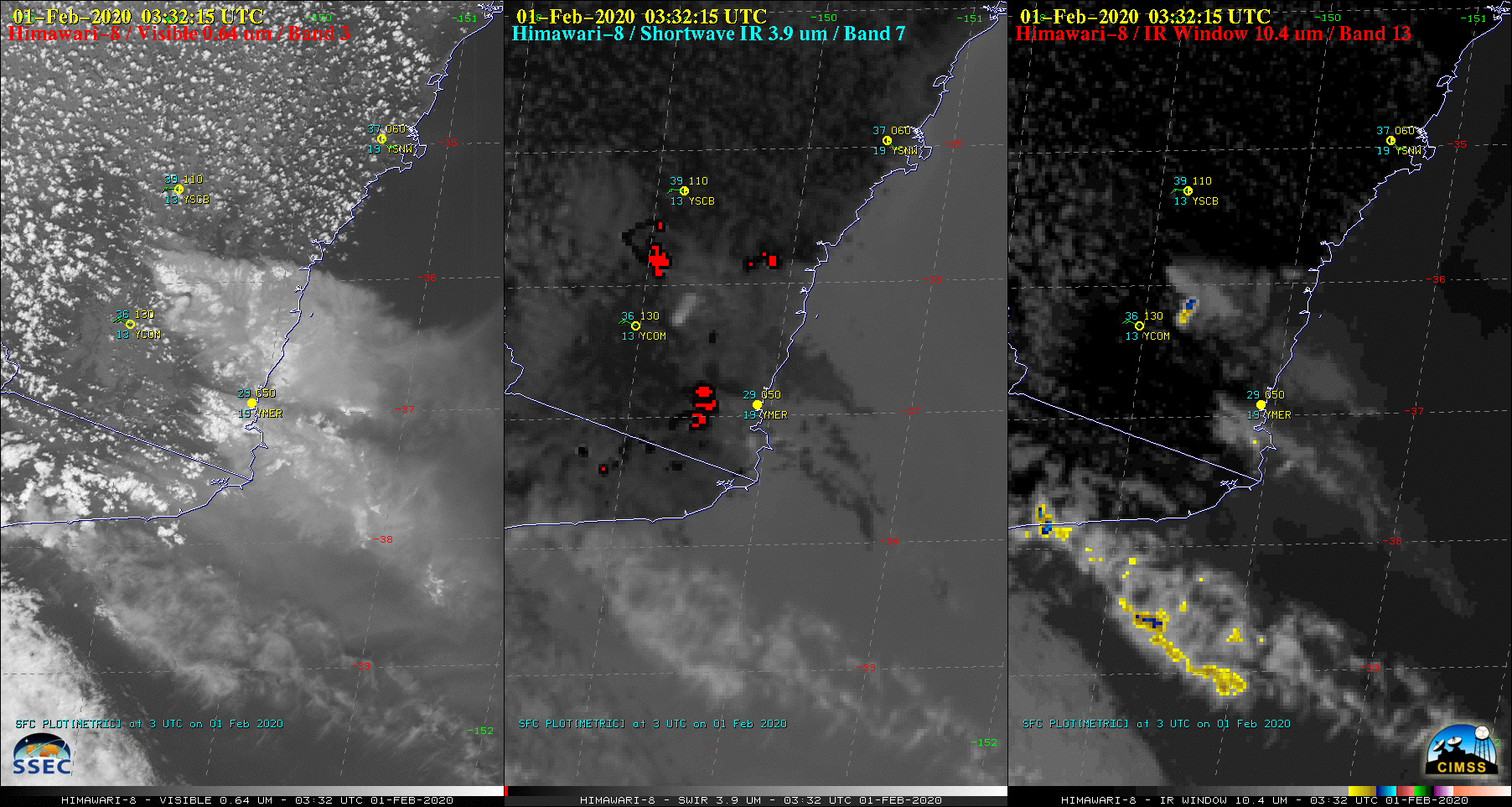
Pyrocumulonimbus clouds in Australia

2.5-miute Rapid Scan JMA Himawari-8 “Red” Visible (0.64 µm), Shortwave Infrared (3.9 µm) and Infrared Window (10.4 µm) images (above) showed the formation of 2 small, fairly short-lived pyrocumulonimbus (pyroCb) clouds spawned by large, hot bushfires in southern New South Wales, Australia on 01 February 2020. The pyroCb clouds developed... Read More