Transverse banding over California
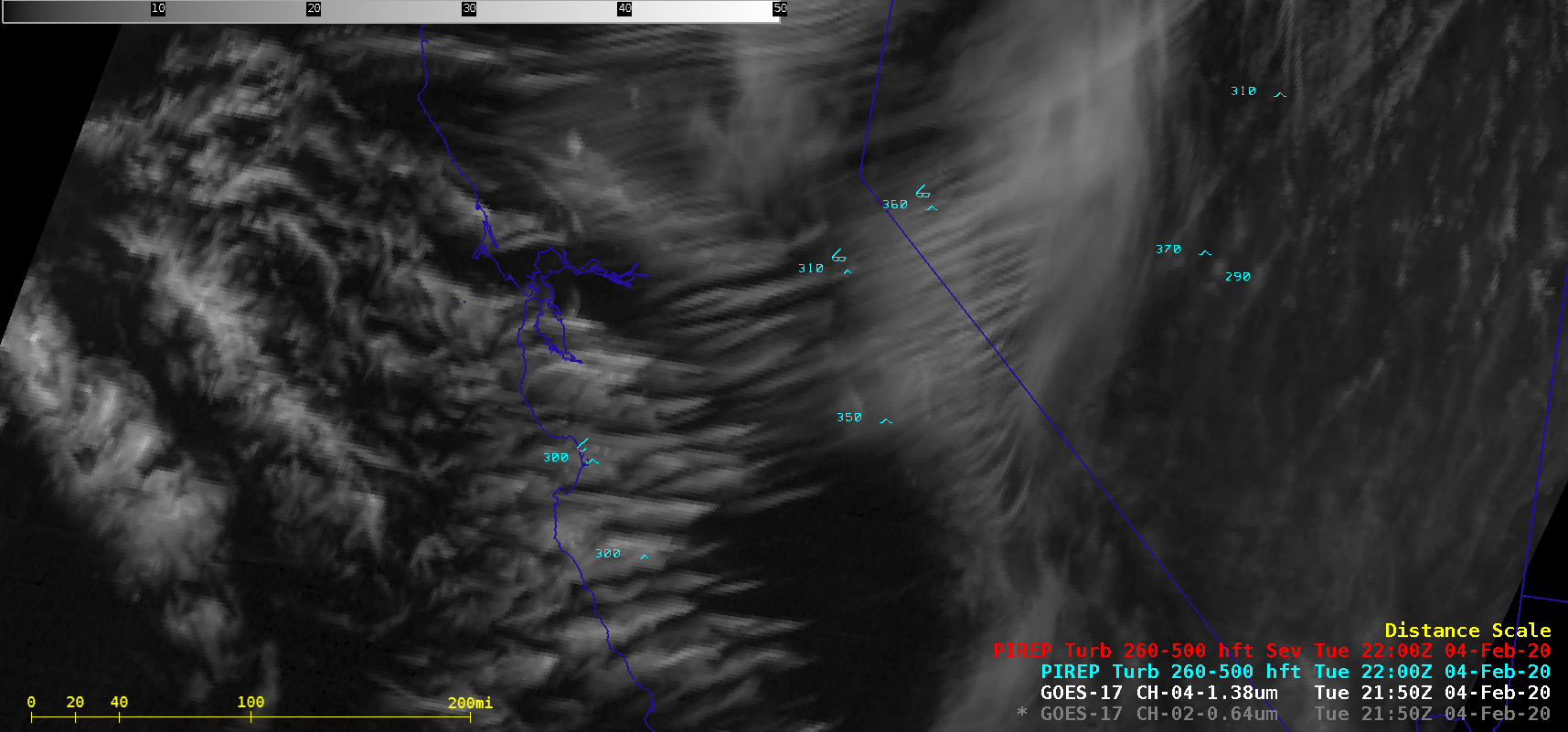
1-minute Mesoscale Domain Sector GOES-17 (GOES-West) “Red” Visible (0.64 µm) and Near-Infrared “Cirrus” (1.37 µm) images (above) displayed widespread “transverse banding” — elongated cirrus elements oriented perpendicular to the ambient jet stream flow — that was migrating southward across California on 04 February 2020. This satellite signature is an indicator of potential turbulence, which in this... Read More
