This website works best with a newer web browser such as Chrome, Firefox, Safari or Microsoft Edge. Internet Explorer is not supported by this website.

Archive: Thu Feb 2020

Bore-like feature over Lower Michigan

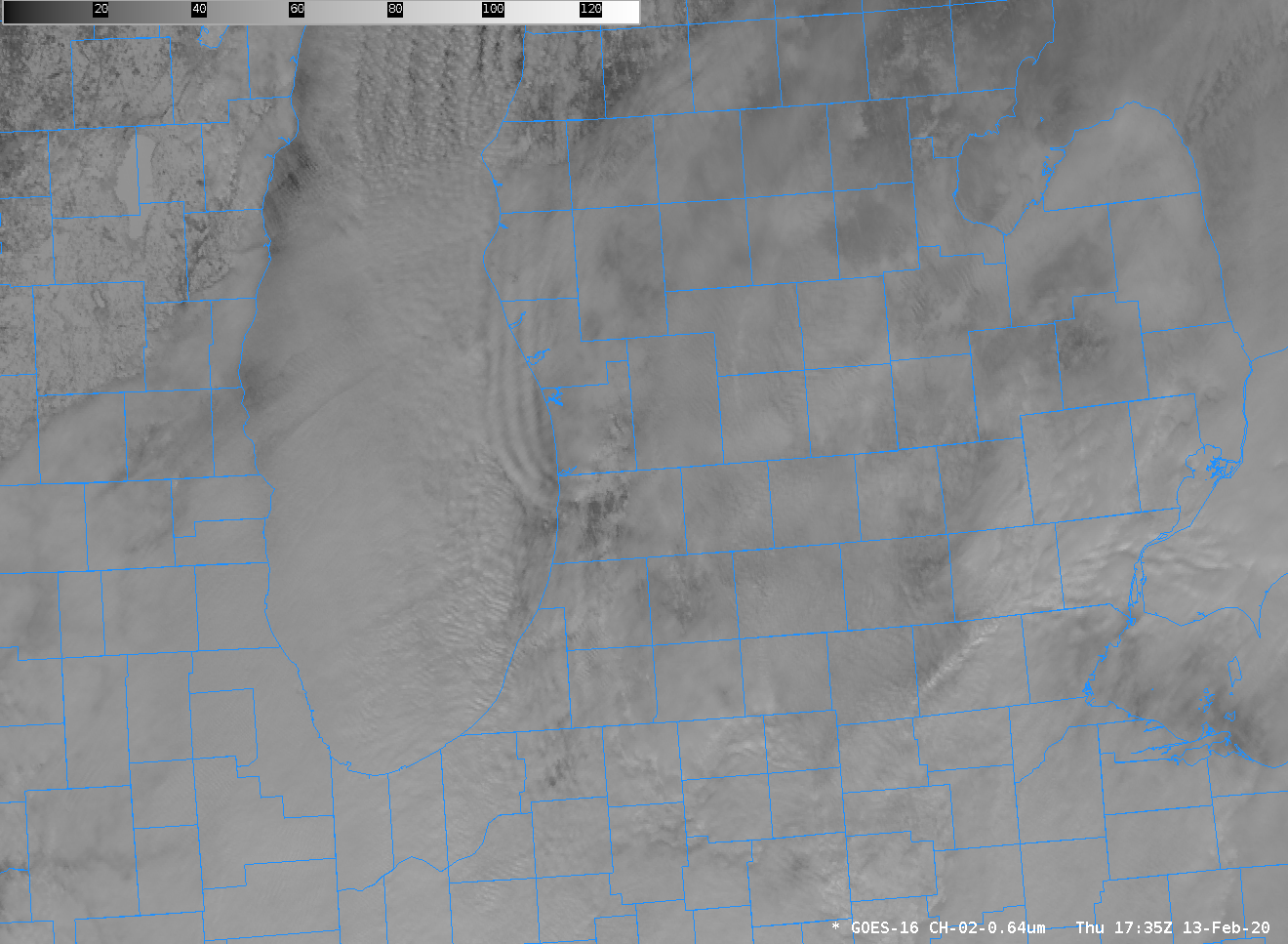
TJ Turnage, the Science and Operations Officer (SOO) at the National Weather Service forecast office in Grand Rapids, noted today the presence of smooth, curving bands over Lake Michigan. The animation above shows their development — and the smooth appearance of the bands (just offshore of Ottawa Co, and curving into... Read More

GOES-17 IFR Probability Fields in Testing at CIMSS

GOES-17 IFR Probability fields are being evaluated at CIMSS (the Cooperative Institute for Meteorological Satellite Studies), with a plan to release them to the field via an LDM request in the near future.  The toggle above compares GOES-16 IFR Probability and GOES-17 IFR Probability for the same time over central... Read More

Can you use gridded NUCAPS fields to diagnose the rain/snow line?

Gridded NUCAPS fields include a wide range of thermodynamic variables. The plot above shows the 900-mb temperature field. Is it possible to use this data to diagnose a rain/snow transition line? Over southern New England, the relationship between 900-mb temperatures and surface precipitation observations seems robust: snow is restricted to... Read More