Pyrocumulonimbus cloud in South Africa
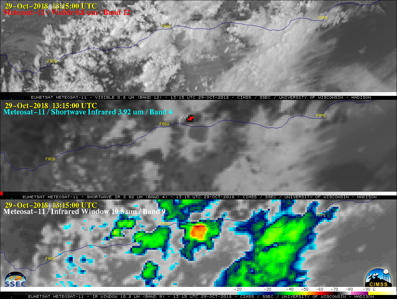
The Garden Route Fires had been burning since about 24 October 2018 near George along the southern coast of South Africa (media story). On 29 October, EUMETSAT Meteosat-11 High Resolution Visible (0.8 µm), Shortwave Infrared (3.92 µm) and Longwave Infrared Window (10.8 µm) images (above) showed an elongated west-to-east oriented thermal... Read More
