This website works best with a newer web browser such as Chrome, Firefox, Safari or Microsoft Edge. Internet Explorer is not supported by this website.

Archive: Mon Oct 2018

Hurricane Walaka

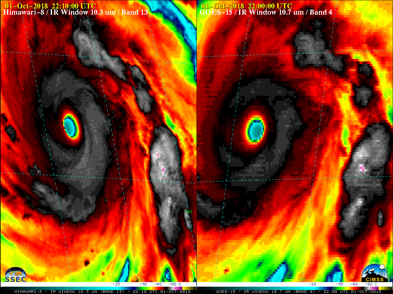
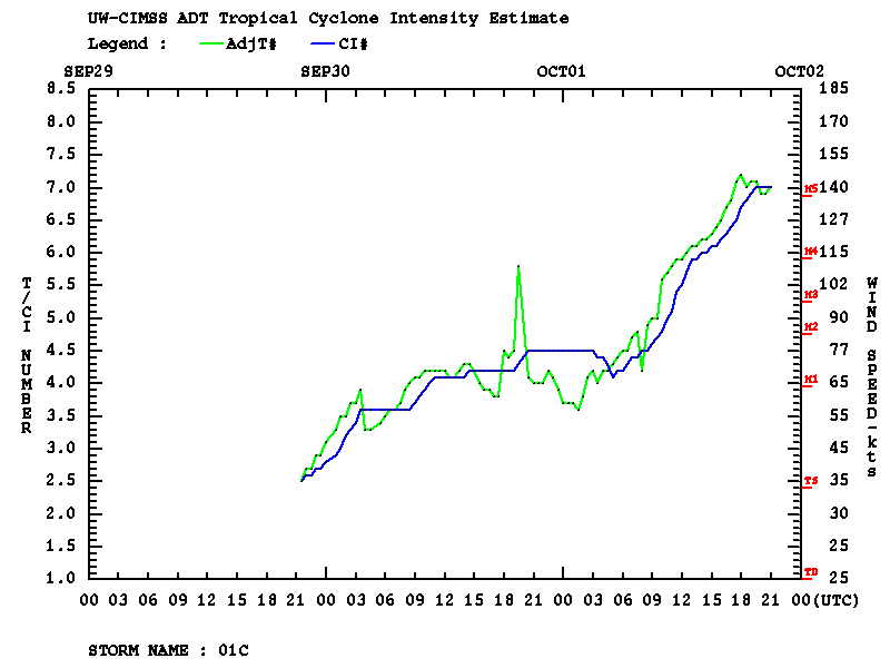
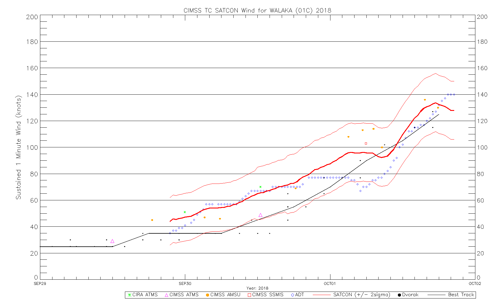
GOES-15 (GOES-West) Infrared Window (10.7 µm) images (above) showed the formation of a well-defined eye of Hurricane Walaka during a period of rapid intensification (ADT | SATCON) from 0000-2330 UTC on 01 October 2018; Walaka was classified a Category 5 hurricane as of the 02 October 00 UTC advisory. Walaka was moving... Read More

Mode 4 Testing for both GOES-16 and GOES-17

GOES-17 Data shown in this post are preliminary and non-operational.Continuous Full Disk (Mode 4) Testing is occurring on October 1 2018.   Mode 4 is the highest data flow rate for the ABI and results in a Full Disk image every 5 minutes.  No mesoscale sectors are produced during Mode 4... Read More