Hurricane Fernanda
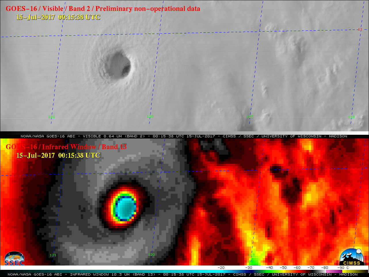
* GOES-16 data posted on this page are preliminary, non-operational and are undergoing testing *On 15 July Hurricane Fernanda became the first Category 4 tropical cyclone of the 2017 Northern Hemisphere season. GOES-16 “Red” Visible (0.64 µm) and “Clean” Infrared Window (10.3 µm) images (above) showed the development of a well-defined eye during... Read More