Mesoscale Convective Vortex over Arizona
![Terra MODIS Infrared Window (11.0 µm) image, with SPC storm reports of severe winds plotted in cyan [click to enlarge]](https://cimss.ssec.wisc.edu/satellite-blog/wp-content/uploads/sites/5/2017/07/170717_0558utc_terra_modis_infrared_spc_storm_reports_AZ_anim.gif)
Terra MODIS Infrared Window (11.0 µm) image, with SPC storm reports of severe winds plotted in cyan [click to enlarge]
Strong summer monsoon season thunderstorms developed over Arizona in the pre-dawn nighttime hours on 17 July 2017, producing damaging winds across the Phoenix area (SPC storm reports). A Terra MODIS Infrared Window (11.0 µm) image (above) revealed cloud-top brightness temperatures as cold as -77ºC at 0508 UTC.
GOES-16 “Clean” Infrared Window (10.3 µm) images (below) showed the development and eventual dissipation of the overnight convection.
![GOES-16 Infrared Window (10.3 µm) images, with station identifiers plotted in yellow and SPC storm reports plotted in cyan [click to play animation]](https://cimss.ssec.wisc.edu/satellite-blog/wp-content/uploads/sites/5/2017/07/170717_goes16_infrared_AZ_pre-MCV_anim.gif)
GOES-16 Infrared Window (10.3 µm) images, with station identifiers plotted in yellow and SPC storm reports plotted in cyan [click to play animation]
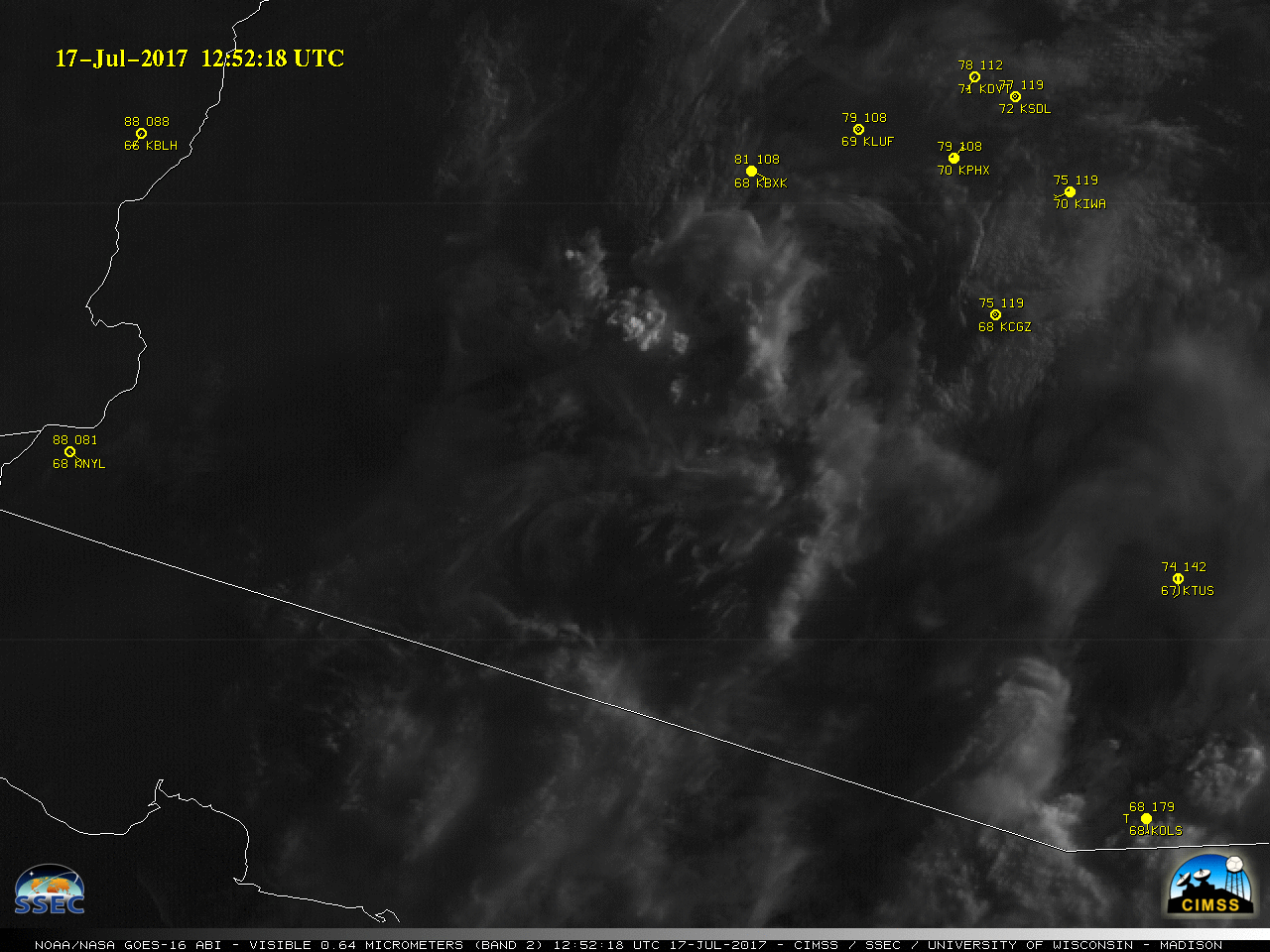
GOES-16 “Red” Visible (0.64 µm) images, with hourly surface reports [click to play animation]
![SPC Mesoscale Discussion [click to enlarge]](https://cimss.ssec.wisc.edu/satellite-blog/wp-content/uploads/sites/5/2017/07/170717_AZ_spc_mcd.png)
SPC Mesoscale Discussion [click to enlarge]