Aircraft dissipation trail in Iowa
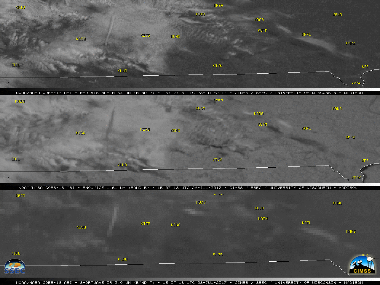
* GOES-16 data posted on this page are preliminary, non-operational and are undergoing testing * Can you find the plane near Des Moines? #contrail #GOES16 pic.twitter.com/H6kQQzrlc6 — NWS Des Moines (@NWSDesMoines) July 28, 2017 An aircraft “dissipation trail” formed over far southern Iowa during the late morning hours on 28 July 2017 — which... Read More
