Rapid intensification of Typhoon Chanthu in the West Pacific
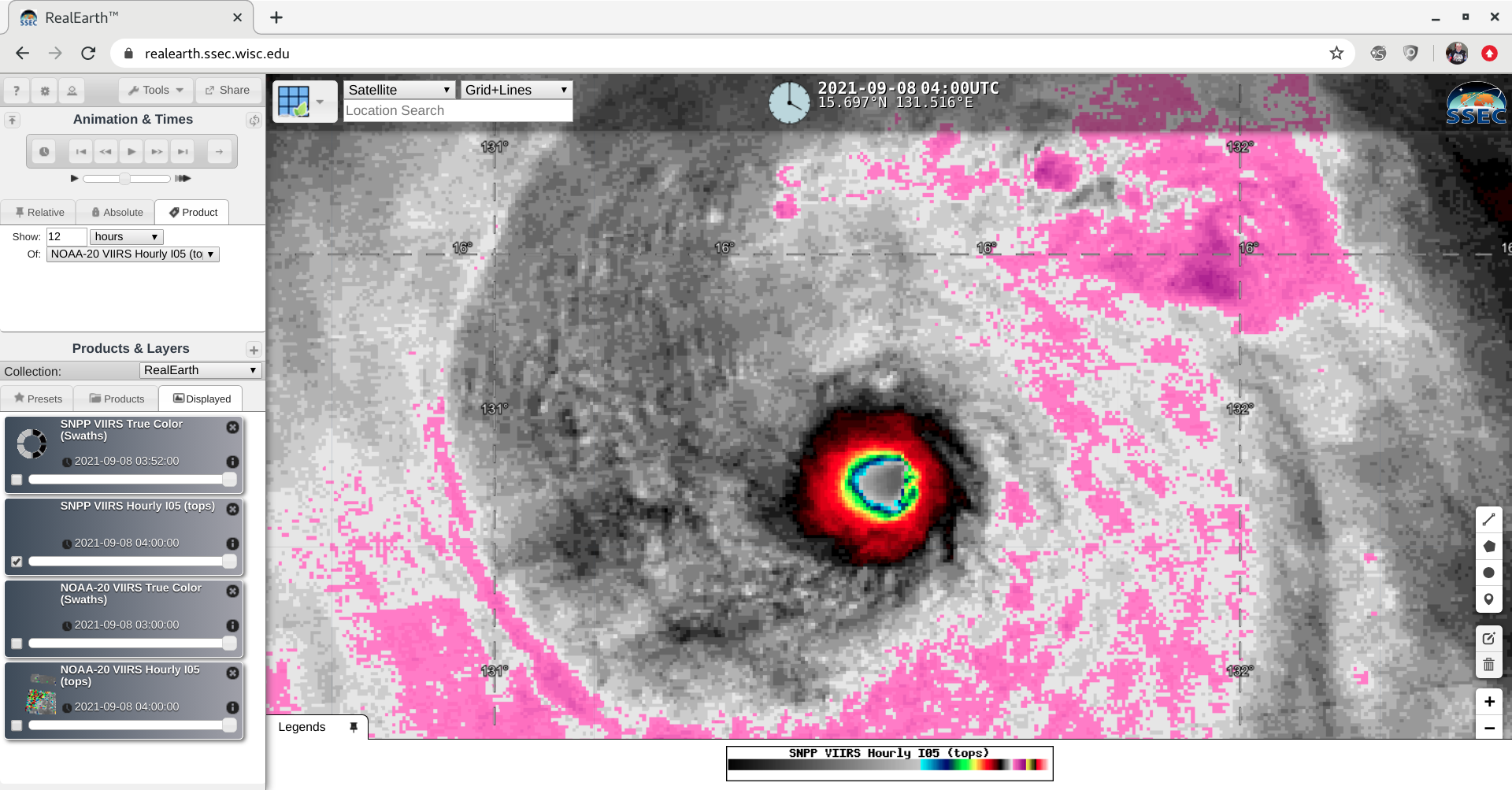
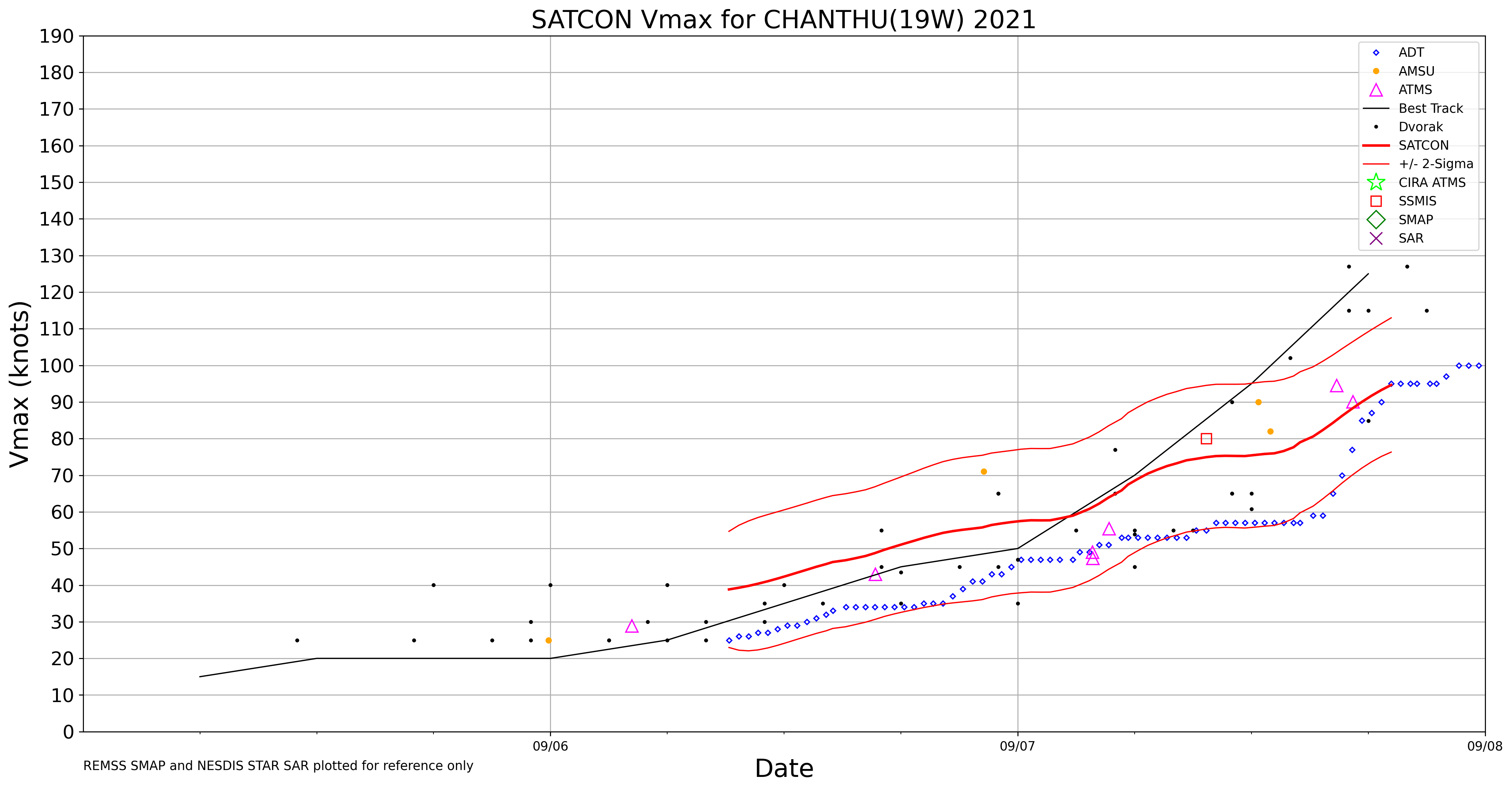
JMA Himawari-8 Infrared Window (10.4 µm) images (above) displayed Typhoon Chanthu undergoing a period of rapid intensification — with the appearance of a small-diameter “pinhole eye” within just a few hours — from a Category 2 to a Category 4 storm (ADT | SATCON) as it moved westward toward the... Read More
