Tropical Storm Kate loses convection

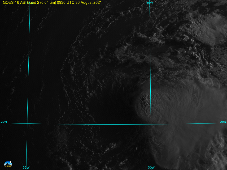
The animation above, of GOES-16 Visible (0.64 µm) imagery, shows Tropical Storm Kate at sunrise with convection near the storm center and to its east. (An overnight image from Suomi NPP’s Day Night Band, below, taken from NASA Worldview, also shows convection near the storm center.) As the day progresses, however, the obvious surface circulation moves northward and the convection near the surface collapses.

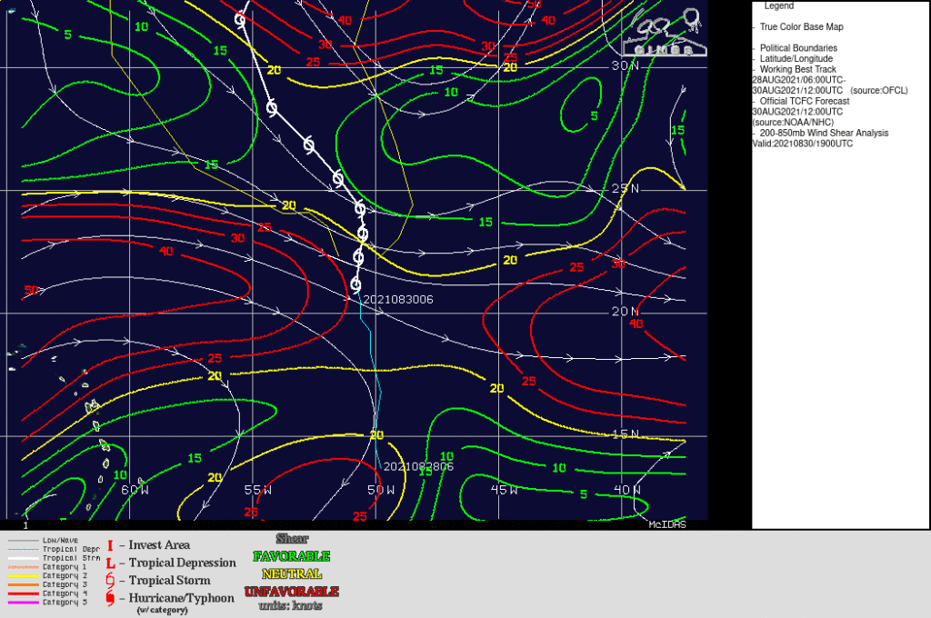
The shear analysis from the CIMSS Tropical Website, below, shows why the convection is displaced to the east of this storm. Strong westerly shear is present.


