Hurricane Nicholas makes landfall in Texas
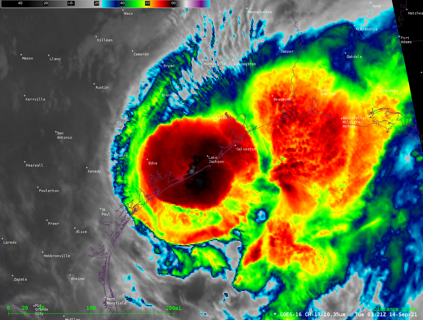
Hurricane Nicholas made landfall on the Gulf Coast shortly after 0530 UTC on 14 September. It is a challenge to determine the storm center from the animation above, although deep convection is suggestive of its location. Note the collapse of deep convection as well at the end of the animation. Radar... Read More
