Rapid intensification of Typhoon Chanthu in the West Pacific

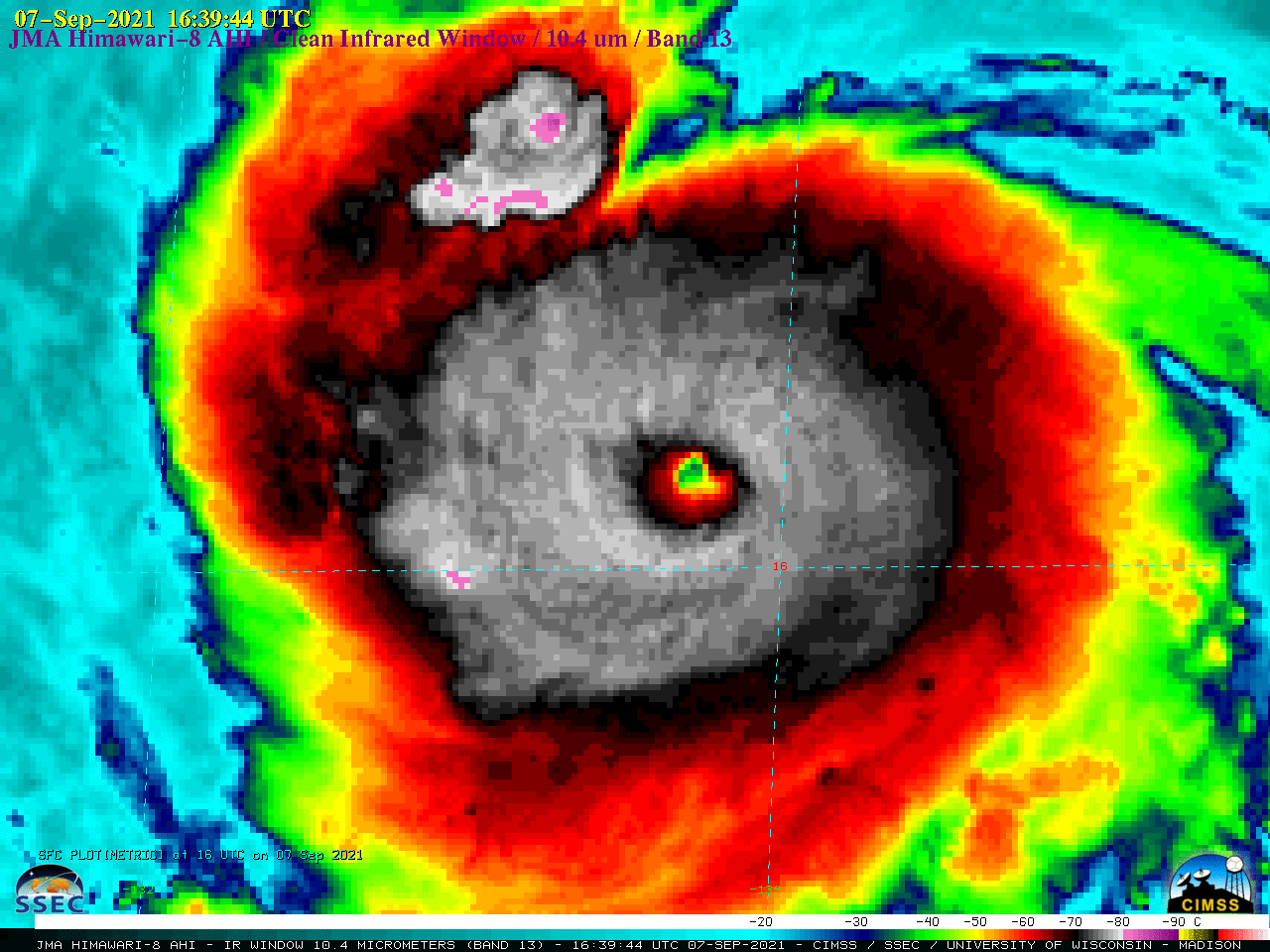
JMA Himawari-8 Infrared Window (10.4 µm) images [click to play animation | MP4]
JMA Himawari-8 Infrared Window (10.4 µm) images (above) displayed Typhoon Chanthu undergoing a period of rapid intensification — with the appearance of a small-diameter “pinhole eye” within just a few hours — from a Category 2 to a Category 4 storm (ADT | SATCON) as it moved westward toward the Philippine Sea on 07 September 2021. Chanthu was moving over very warm water (SST | OHC), and an analysis of deep-layer wind shear from the CIMSS Tropical Cyclones site (below) depicted an environment of light shear — all factors which favored rapid intensification.

JMA Himawari-8 Infrared images, with an analysis of deep-layer wind shear at 15 UTC [click to enlarge]
===== 08 September Update =====

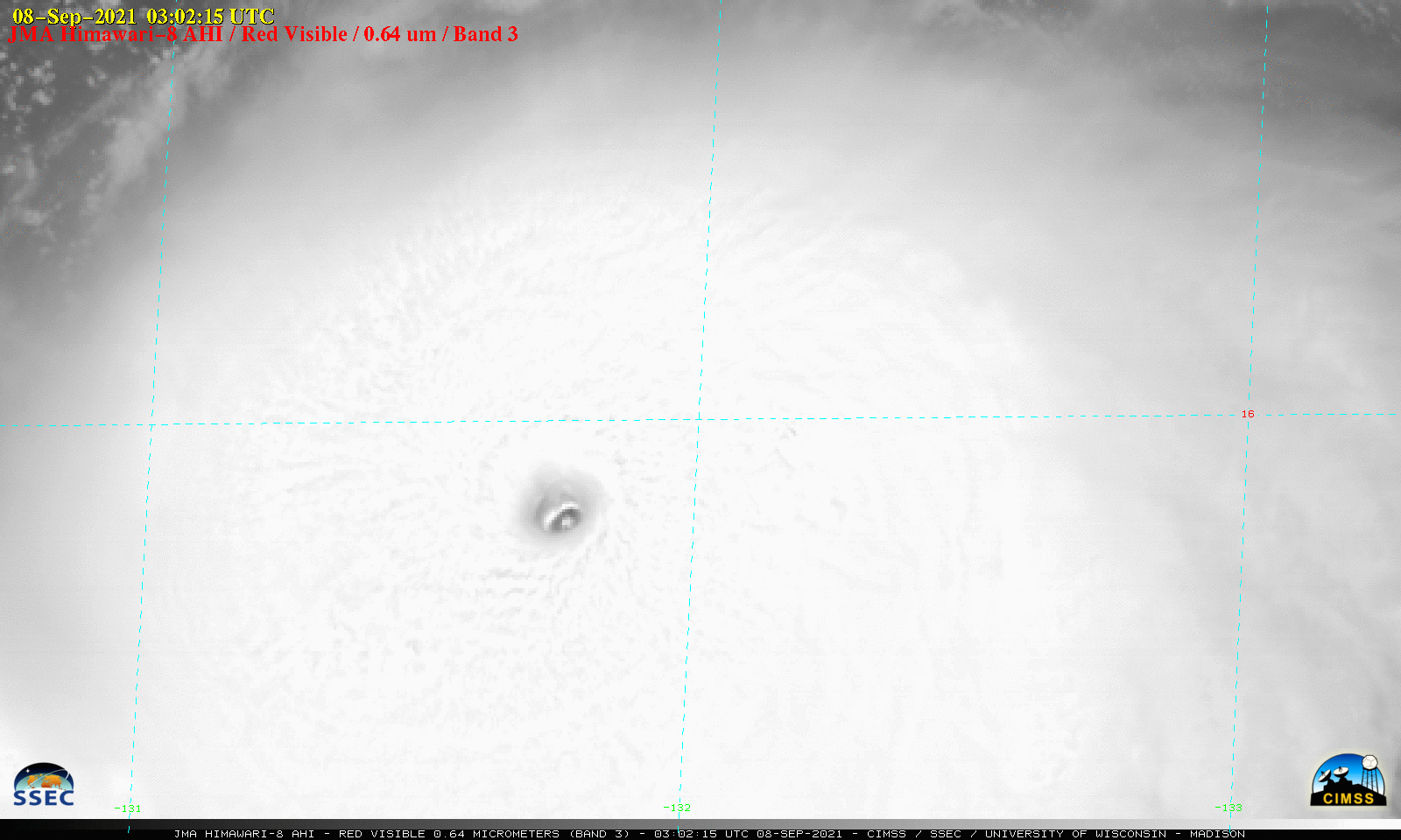
Himawari-8 “Red” Visible (0.64 µm) images [click to play animation | MP4]
During the subsequent daytime hours, Chanthu continued its trend of intensification, becoming a Category 5 tropical cyclone at 0600 UTC on 08 September. Himawari-8 Visible (0.64 µm) images (above) showed the west-southwestward motion of the pinhole eye.
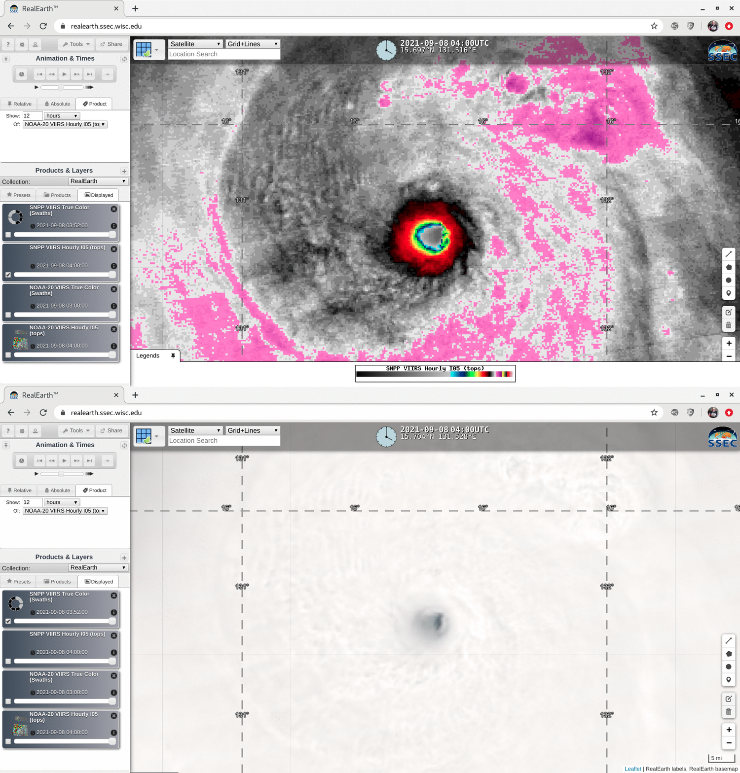
Just prior to the time that Chanthu reached Category 5 intensity, a toggle between VIIRS True Color RGB and Infrared Window (11.45 µm) images from Suomi NPP as viewed using RealEarth is shown below. The diameter of the eye appeared to be about 5 miles, which is unusually small.


