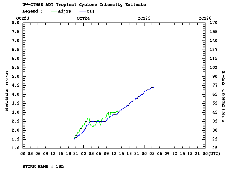
This website works best with a newer web browser such as Chrome, Firefox, Safari or Microsoft Edge. Internet Explorer is not supported by this website.

Category: Tropical cyclones

Hurricane Adrian in the East Pacific

 Hurricane Adrian developed into a Category 3 hurricane early in the day on 09 June 2011. McIDAS images of GOES-12 0.63 µm visible channel data (above) initially showed a well-defined eye before it began to get partially obscured by the high clouds of a central dense overcast (CDO).DMSP SSMIS 85... Read More

Subtropical Storm “Ariani” off the coast of Brazil

   Subtropical Storm “Ariani” developed off the southeast coast of Brazil on 15 March 2011. GOES-12 0.65 µm visible channel images (above; click image to play animation) displayed a number of overshooting tops within the large cloud shield of the disturbance. Some hints of a cyclonic (clockwise in the Southern Hemisphere)... Read More