Tropical Storm Irene
TROPICAL STORM IRENE SPECIAL DISCUSSION NUMBER 1
NWS NATIONAL HURRICANE CENTER MIAMI FL AL092011
700 PM AST SAT AUG 20 2011AN AIR FORCE RESERVE HURRICANE HUNTER AIRCRAFT INVESTIGATING THE TROPICAL WAVE EAST OF THE LESSER ANTILLES FOUND A SMALL LOW-LEVEL CIRCULATION CENTER JUST SOUTHWEST OF A LARGE CONVECTIVE BURST AND A MINIMUM PRESSURE OF ABOUT 1006 MB. THE PLANE ALSO MEASURED A MAXIMUM WIND OF 53 KT AT 1400 FT AND BELIEVABLE WINDS OF ABOUT 45 KT FROM THE SFMR. THUS ADVISORIES ARE BEING INITIATED ON TROPICAL STORM IRENE WITH AN INITIAL INTENSITY OF 45 KT.
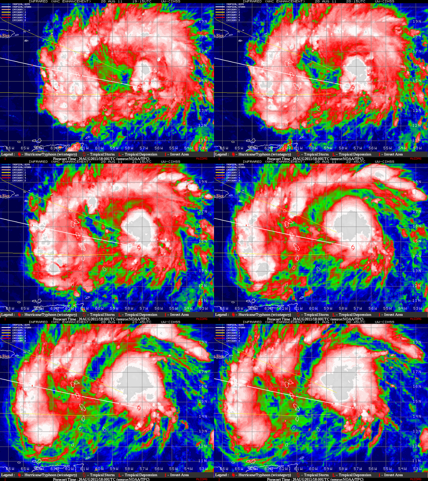
GOES-13 10.7 µm IR images from the CIMSS Tropical Cyclones site (above) showed the large convective burst, along with the location and initial NHC forecast track of the center of Irene.
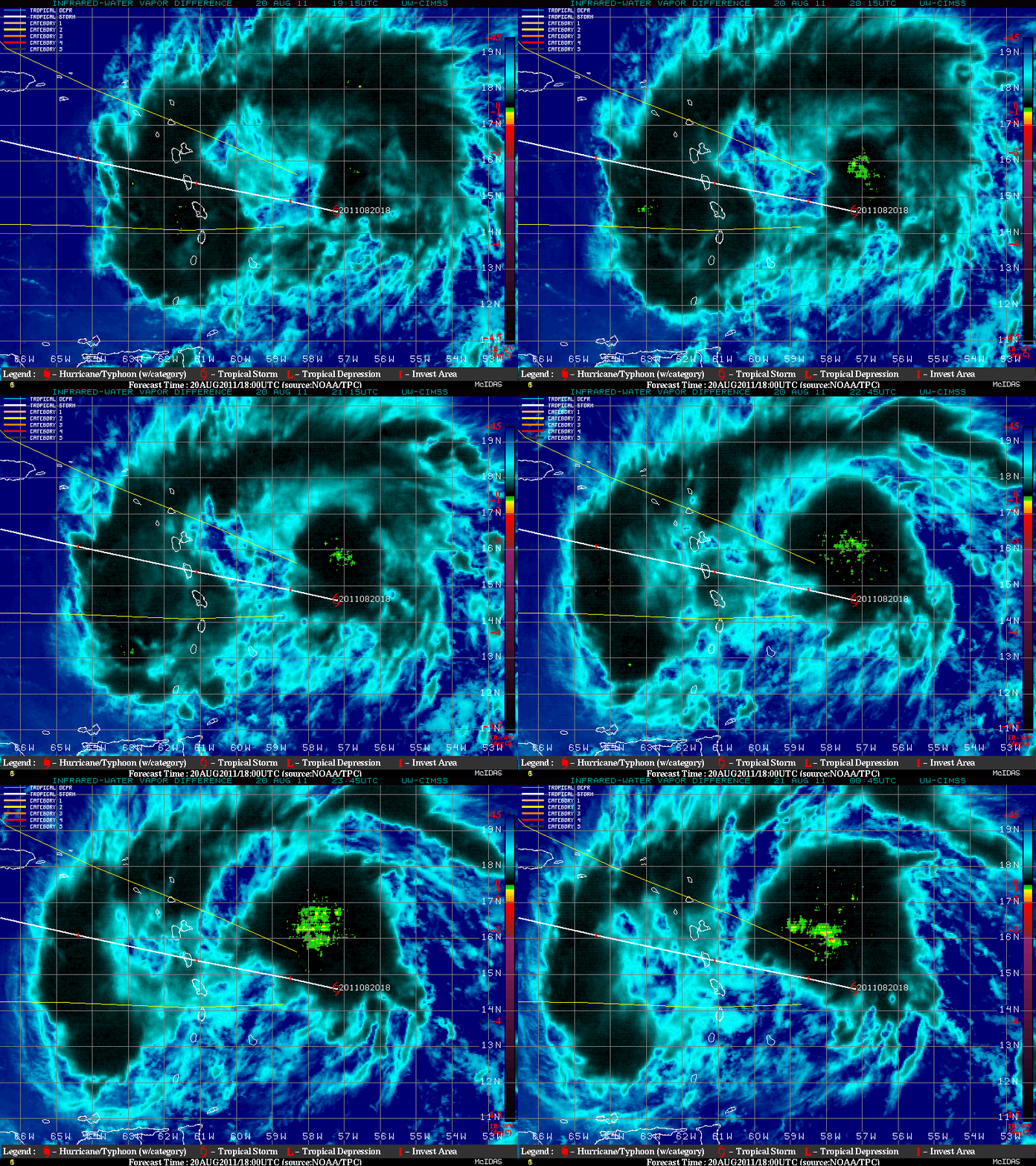
Within the large convective burst feature, GOES-13 IR / Water Vapor brightness temperature difference product images (below) displayed negative values (green to yellow to red color enhancement) indicative of intense overshooting tops — a signature that is favorable for continued intensification.
===== 21 August Update =====
The GOES-13 satellite was placed into Rapid Scan Operations (RSO) beginning at 10:15 UTC on 21 August (providing images as frequently as every 5-10 minutes), to monitor Tropical Storm Irene as it approached Puerto Rico. McIDAS images of GOES-13 0.63 µm visible channel data (below; click image to play animation) showed the development of a well-defined cyclonic circulation, as well as a few low-level outflow boundaries propagating outward along the southwestern quadrant of the storm.


