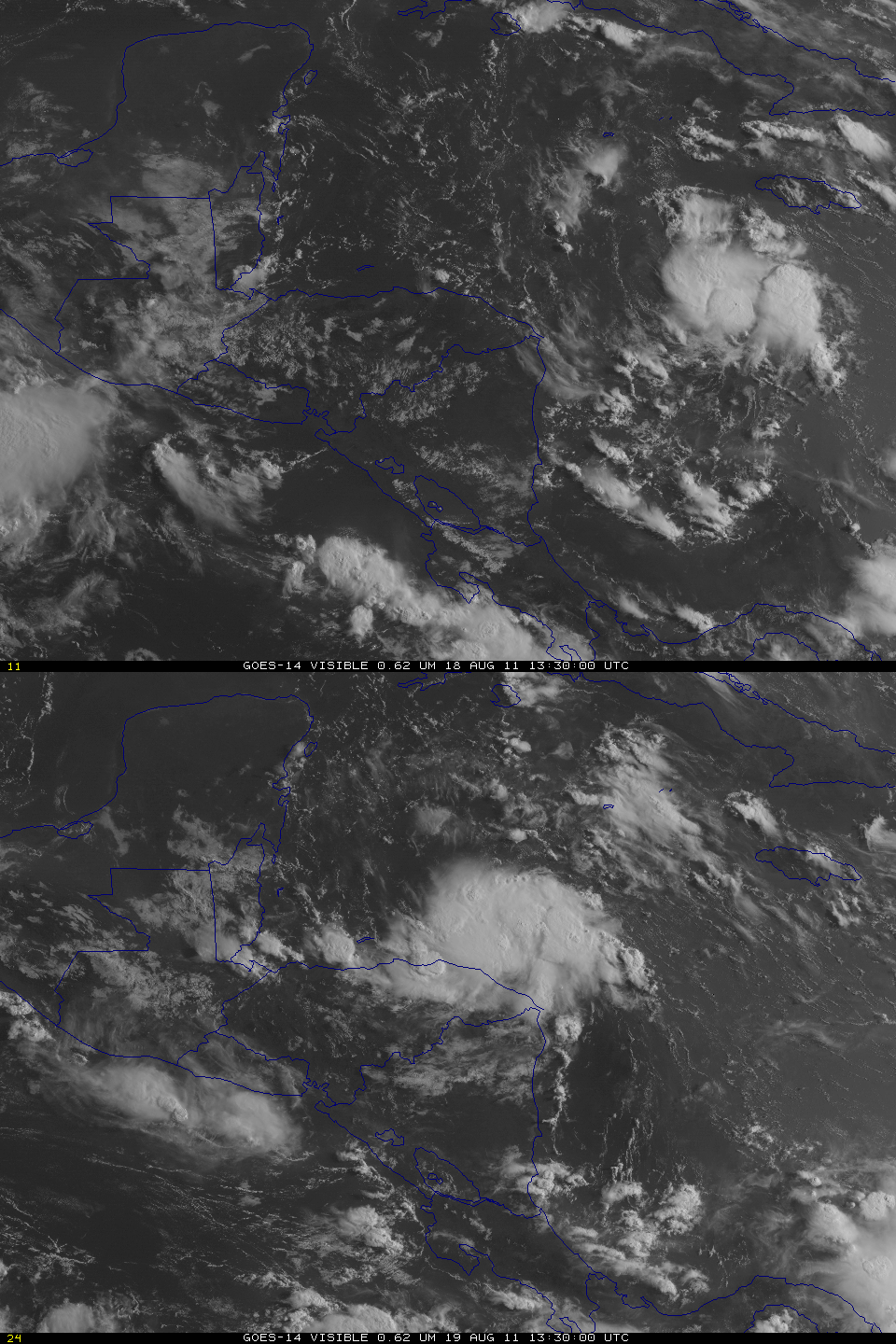
Tropical System in the northwest Caribbean
A strong tropical depression has been moving west-northwestward through the Caribbean, and is north of Honduras on August 19th. The visible image loop above, using data from GOES-14 (over the Equator at 105º West Longitude), shows the disturbance at 1330 UTC on August 18th and on August 19th. Some modest increase in organization is discernable, as well as the motion to the west-northwest.
Data from GOES-14 and GOES-13 can be used to produce a stereoscopic view of the tropical depression, above. Three dimensions become visible using this technique. This allows the strong thunderstorms near the depression center to pop up out of the screen, and it also facilitates viewing the thin cirrus at the edges of the disturbance.
Data available at the CIMSS Tropical Weather Website shows the tropical depression over very warm water and in an environment of low shear. Despite proximity to land, it is expected to strengthen to Tropical Storm status on the 19th; if it does, it will be named Harvey.
(Update: Harvey achieved tropical storm status at 1800 UTC on 19 August)


