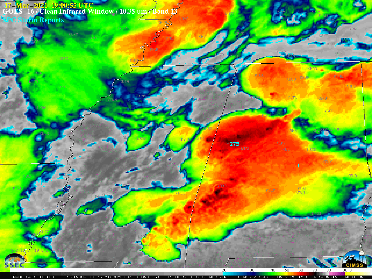
Severe weather across the Deep South and Mid-South
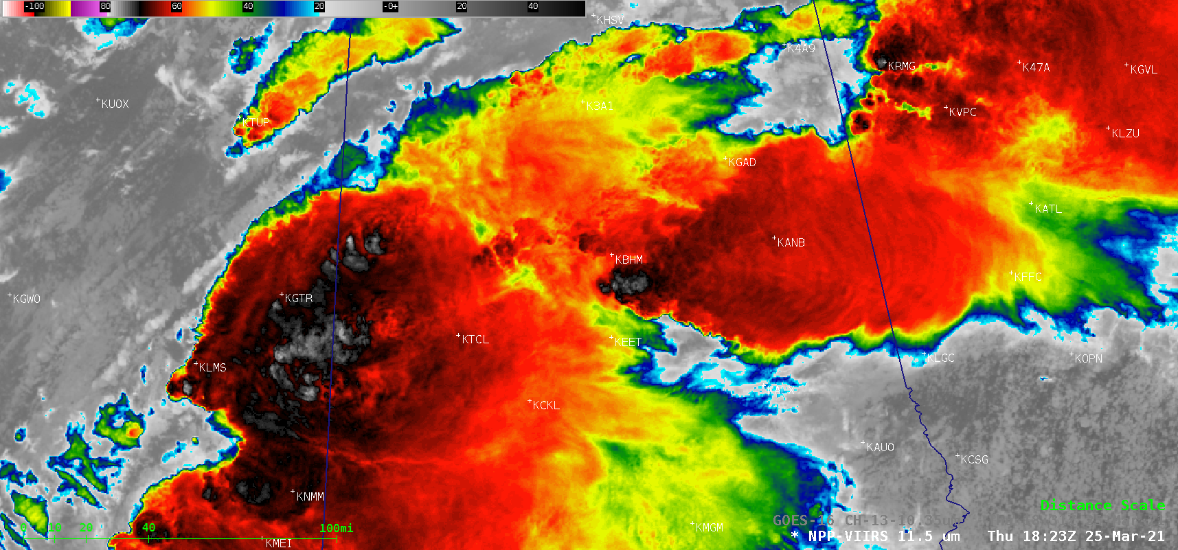
1-minute Mesoscale Domain Sector GOES-16 “Red” Visible (0.64 µm) images (above) and “Clean” Infrared Window (10.35 µm) images (below) include time-matched plots of SPC Storm Reports that were produced by a number of supercell thunderstorms that developed and moved across the Deep South and Mid-South on 25 March 2021. The highest concentration of tornadoes occurred in Alabama, including one that was responsible for multiple fatalities... Read More
