Severe weather across much of the Southeast US
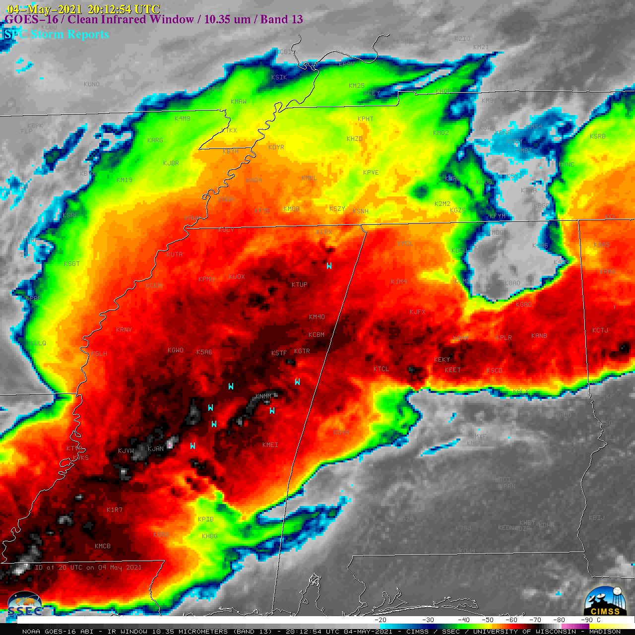
1-minute Mesoscale Domain Sector GOES-16 (GOES-East) “Red” Visible (0.64 µm) images (above) include time-matched plots of SPC Storm Reports (predominantly widespread damaging winds, with some large hail and a few tornadoes) produced by a large and long-lived Mesoscale Convective System (MCS) that moved eastward across much of Mississippi and Alabama on 04 May 2021. The strong winds — with some gusts in excess... Read More
