Severe weather across the Deep South and Mid-South
![GOES-16 “Red” Visible (0.64 µm) images, with time-matched SPC Storm Reports plotted in red [click to play animation | MP4]](https://cimss.ssec.wisc.edu/satellite-blog/images/2021/03/210325_goes16_visible_spcStormReports_Deep_South_anim.gif)
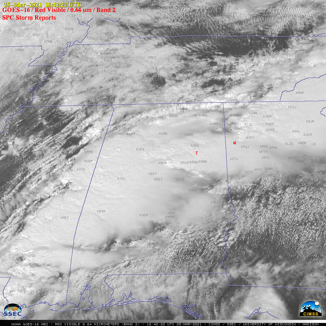
GOES-16 “Red” Visible (0.64 µm) images, with time-matched SPC Storm Reports plotted in red [click to play animation | MP4]
![GOES-16 “Clean” Infrared Window (10.35 µm) images, with time-matched SPC Storm Reports plotted in cyan [click to play animation | MP4]](https://cimss.ssec.wisc.edu/satellite-blog/images/2021/03/210325_goes16_infrared_spcStormReports_Deep_South_anim.gif)
GOES-16 “Clean” Infrared Window (10.35 µm) images, with time-matched SPC Storm Reports plotted in cyan [click to play animation | MP4]
![GOES-16 “Clean” Infrared Window (10.35 µm) and Suomi NPP VIIRS Infrared Window (11.45 µm) images at 1921 UTC [click to enlarge]](https://cimss.ssec.wisc.edu/satellite-blog/images/2021/03/210325_1831utc_suomiNPP_goes16_infrared_Deep_South_anim.gif)
GOES-16 “Clean” Infrared Window (10.35 µm) and Suomi NPP VIIRS Infrared Window (11.45 µm) images at 1831 UTC [click to enlarge]