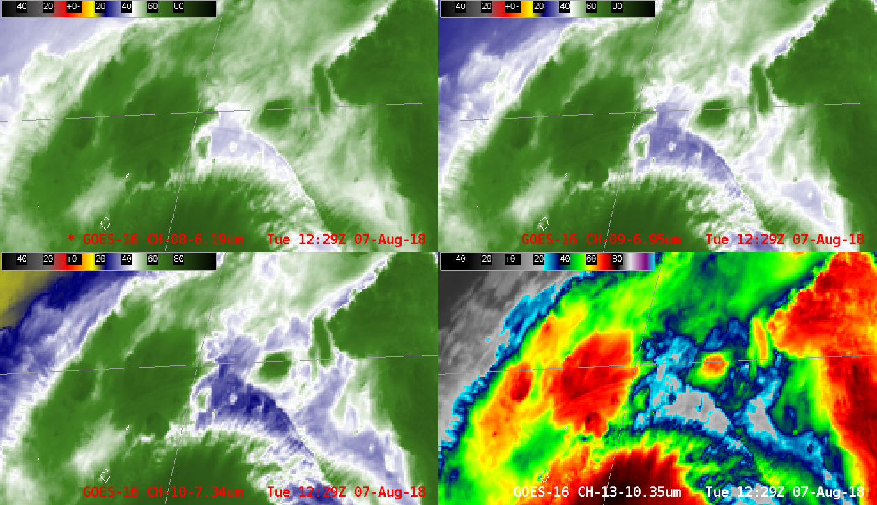
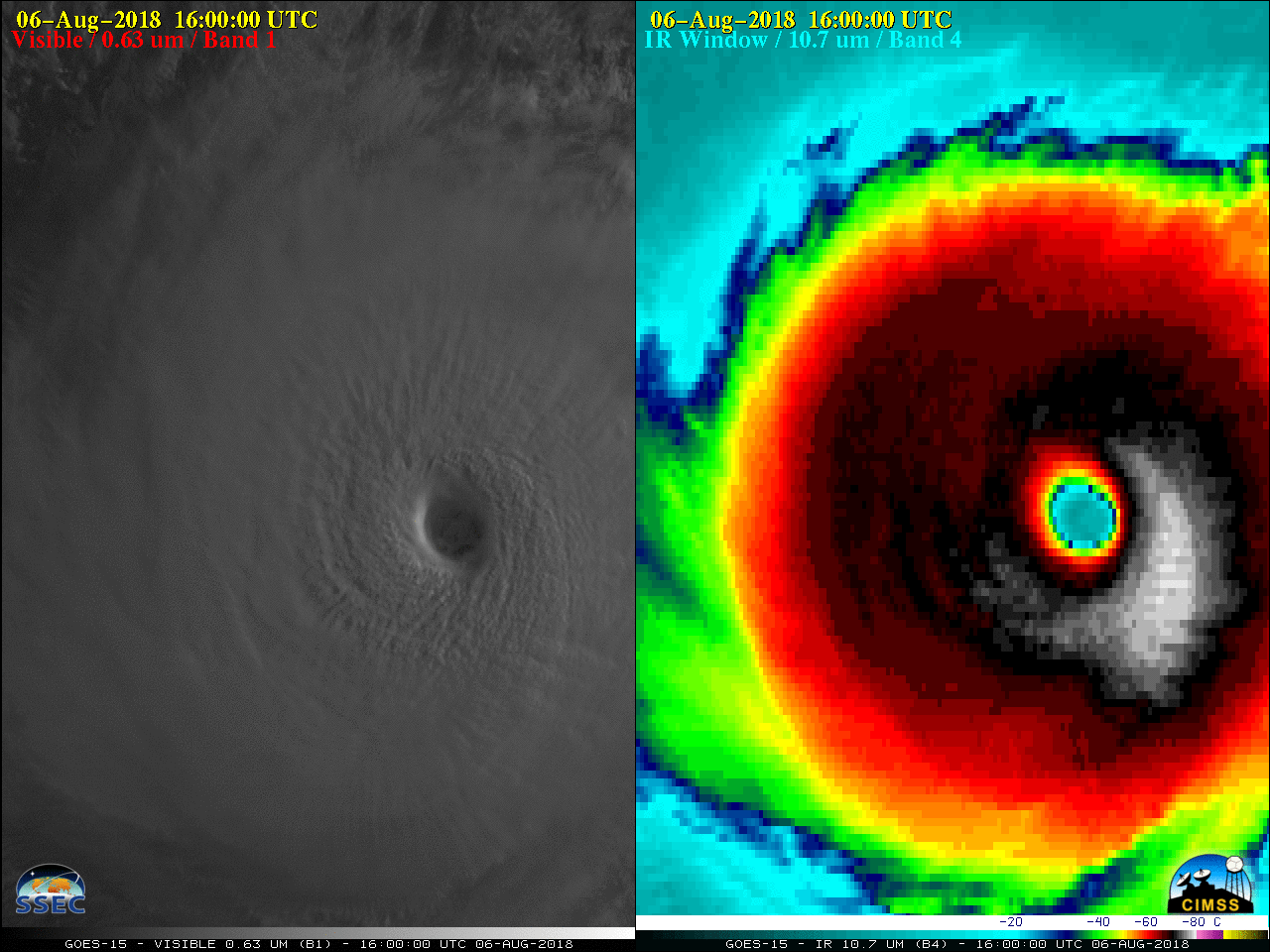
This website works best with a newer web browser such as Chrome, Firefox, Safari or Microsoft Edge. Internet Explorer is not supported by this website.

Category: Satellite winds

Hurricane Alex

Subtropical Storm Alex (NHC advisory archive) formed in the far eastern Atlantic Ocean on 13 January 2016. Animations of GOES-13 (GOES-East) 0.63 µm Visible (above) and 10.7 µm Infrared images (below) showed the initial evolution and northeastward motion of the storm. Alex is only the 4th known January tropical or subtropical storm... Read More

Rope Cloud over the Gulf of Mexico

Visible Imagery over the Gulf of Mexico on 28 December 2015 revealed the presence of a Rope Cloud. Rope Clouds are handy features in satellite imagery because they reveal the location of the surface cold front, and the animation above shows wind shifts from southerly to westerly as the Rope... Read More

Hurricane Kate

GOES-13 Visible Imagery, above, shows Tropical Storm Kate northeast of the Bahamas late in the day on 9 November. The storm is over a region of warm sea surface temperatures, below (imagery from the CIMSS Tropical Weather Site), in an environment of low shear. RapidScat winds show winds between 35 and 40 knots... Read More