Remnants of Hurricane Beryl off the East Coast of the US

GOES-16 “Red” Visible (0.64 µm) images [click to play animation]
Overlays of low-level (produced using Visible Band 2) and upper-level (produced using Water Vapor Band 8) Derived Motion Winds (below) highlighted the primary low-level circulation, as well as the trough aloft whose axis was located just to the west.
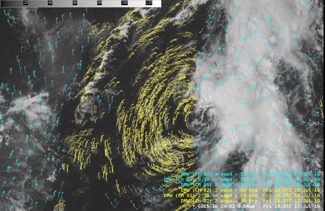
GOES-16 “Red” Visible (0.64 µm) images, with low-level (Visible Band 2) Derived Motion Winds plotted in yellow and upper-level (Water Vapor Band 8) Derived Motion Winds plotted in cyan [click to play animation]
![GOES-16 Visible (0.64 µm) image, with contours of Deep-Layer Wind Shear [click to enlarge]](https://cimss.ssec.wisc.edu/satellite-blog/wp-content/uploads/sites/5/2018/07/180713_19utc_vis_shear_ex_Beryl.jpeg)
GOES-16 Visible (0.64 µm) image, with contours of Deep-Layer Wind Shear [click to enlarge]