Tropical Storm Beryl forms in the Atlantic Ocean
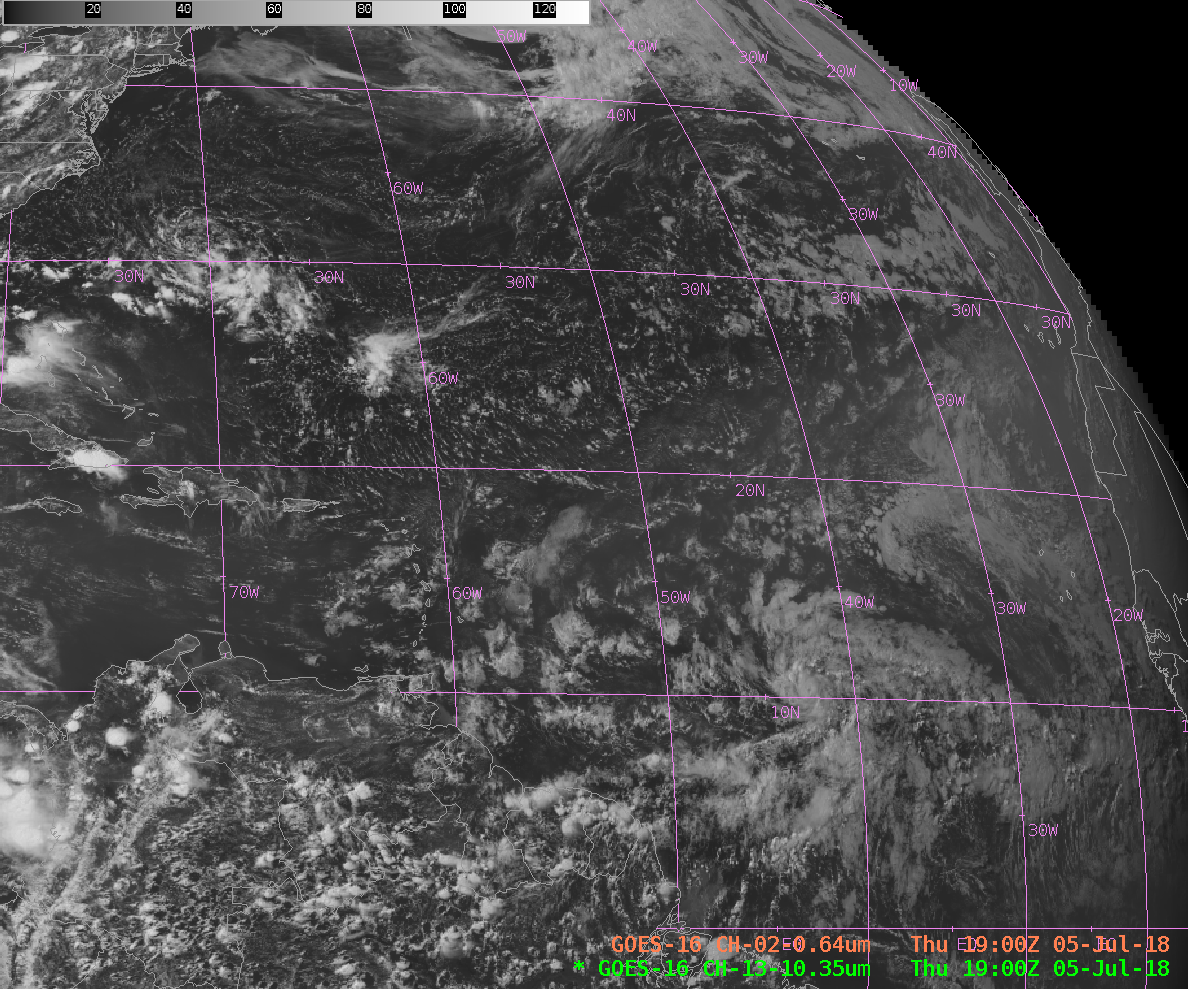
GOES-16 Band 2 (“Red Visible”, 0.64 µm) Imagery over the Atlantic Ocean, 0915-2130 UTC on 5 July 2018 (Click to animate)
The season’s second named tropical cyclone in the Atlantic Basin has formed. GOES-16 visible imagery, above (click to play an animated gif), shows Tropical Storm Beryl moving westward just north of 10 º N Latitude between 40 º and 50 º W Longitude. The infrared imagery (10.3 µm), the Clean Window, below shows a compact storm with cold cloud tops and a central dense overcast.
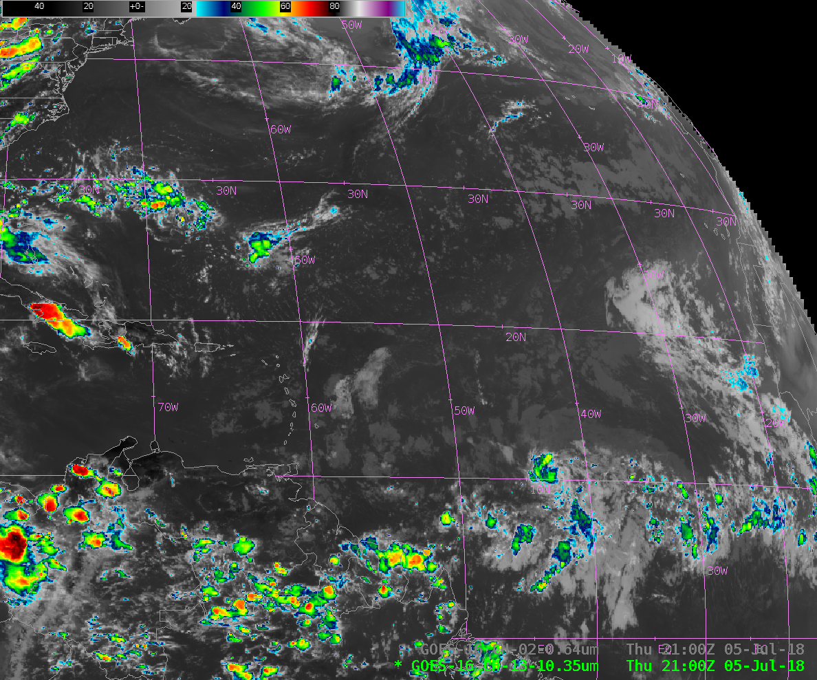
GOES-16 Band 13 (“Clean Window”, 10.3 µm) Infrared Imagery over the Atlantic Ocean, 0915-2130 UTC on 5 July 2018 (Click to animate)
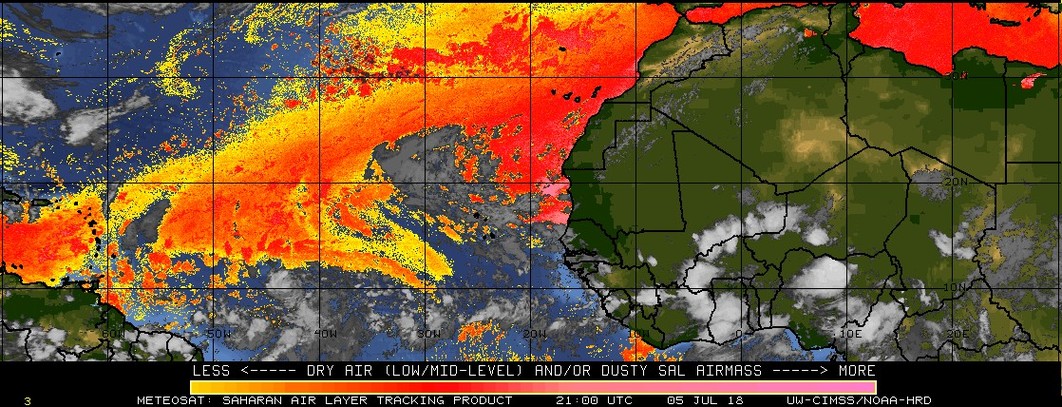
Much of the tropical Atlantic north of 10 N Latitude shows little convection. This is because of a Saharan Air Layer, shown below (in red) from a screen capture from the CIMSS Tropical Website (Click here for the latest SAL analysis). An important component of the SAL analysis is the Split Window Difference field (10.3 µm – 12.3 µm) that can diagnose both moisture and dust. The SAL analysis shows considerable dry Saharan air over the Atlantic; Beryl has formed along its southern edge. Compare the SAL analysis to the Split Window Difference field, below, that shows dry air in blue. Similar features are present in both. The GOES-16 Low-Level Water Vapor Infrared Imagery (7.34 µm), here, shows similar features as well. There are multiple ways to diagnose dry air with GOES-16.
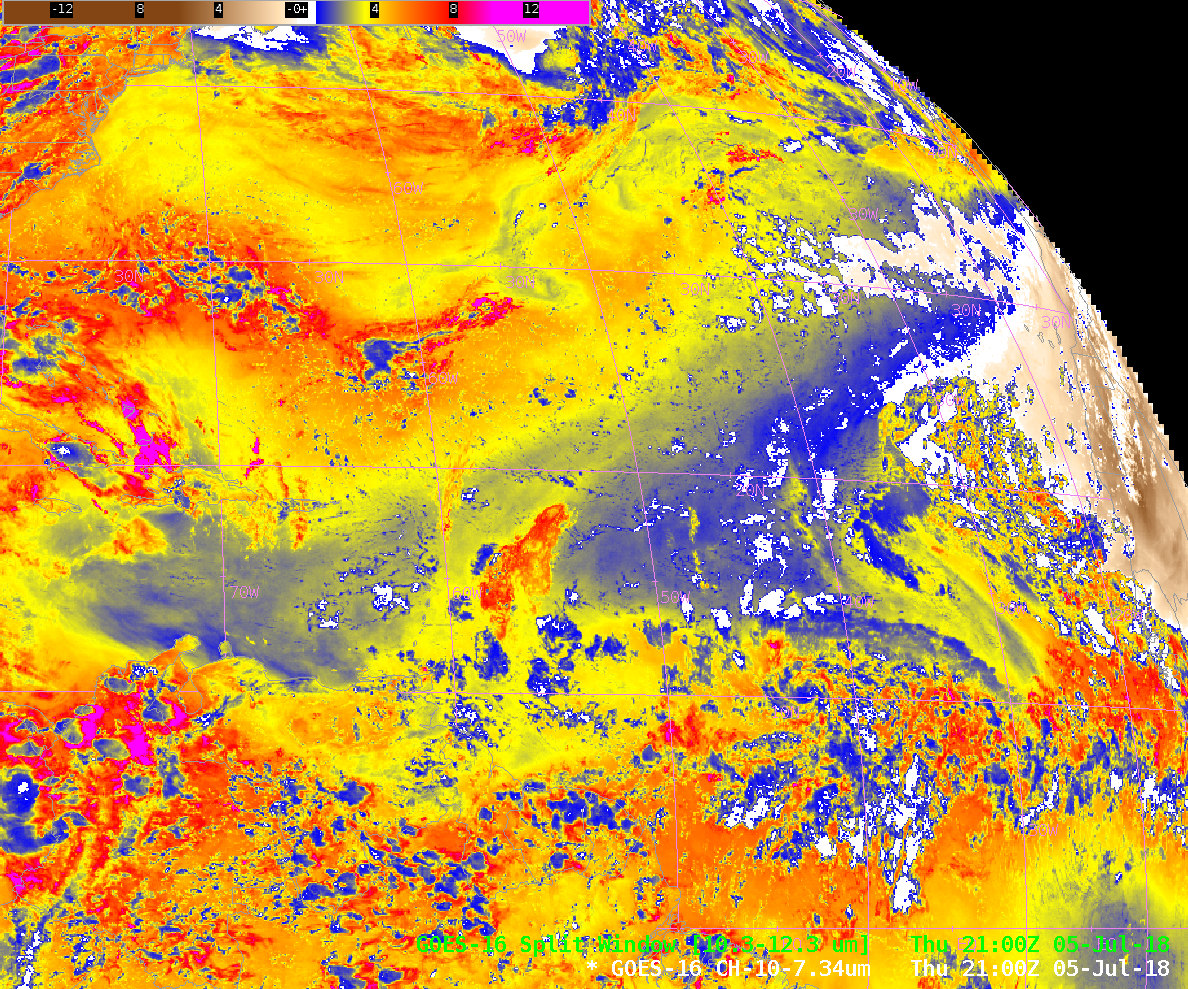
GOES-16 Split Window Difference field (10.3 -12.3 µm) Imagery over the Atlantic Ocean, 2100 UTC on 5 July 2018 (Click to enlarge)
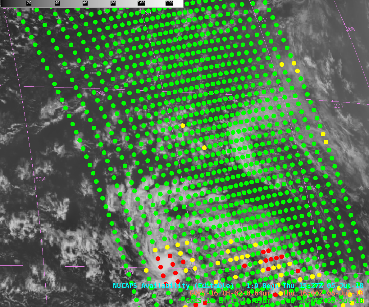
NUCAPS Soundings from Suomi NPP can be used to diagnose the thermodynamics of the atmosphere surrounding Beryl. The image below shows NUCAPS Soundings locations between 1500 and 1600 UTC on 5 July 2018, and the points are color-coded to describe the data (as discussed here). A Sounding near 16.3 N, 43.1 W (north of Beryl) shows dryness at mid-levels; total precipitable water is only 1.27″. A Sounding closer to the storm, at 10.3 N, 43.5 W (west of Beryl) is much wetter: total precipitable water is 2.12″. NUCAPS Soundings are available online (over the Continental US only) here.
Very small (in size) Beryl is forecast to strengthen in the short term. See the National Hurricane Center website and the CIMSS Tropical Website for more information.
==== Update 6 July 2018 ====Beryl has strengthened and is a hurricane, as of 0900 UTC on 6 July, the first hurricane of the 2018 Atlantic Hurricane season. The sandwich product animation below, courtesy Rick Kohrs and Joleen Feltz, CIMSS, that combines visible (0.64 µm) and clean window infrared (10.3 µm) imagery shows the appearance and subsequent disappearance of a very small eye.


