Cloud-top “warm trench” infrared signature over Colorado
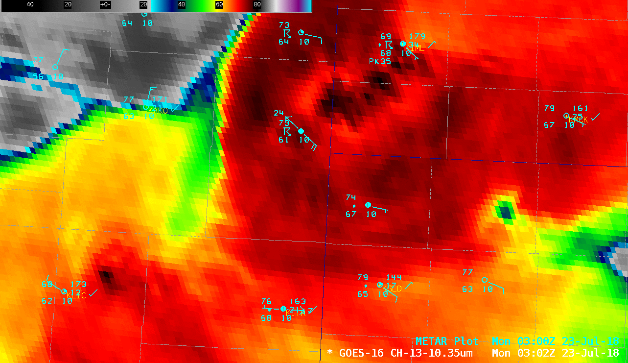
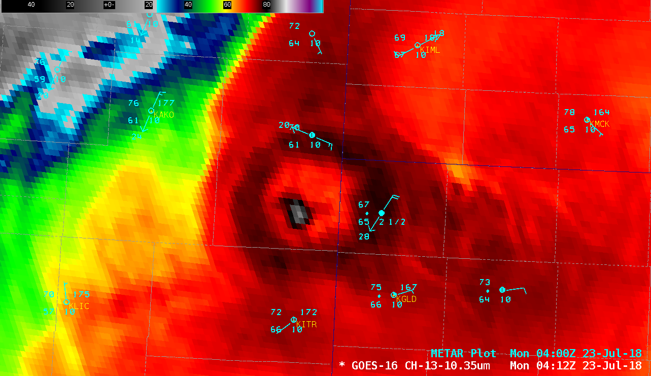
GOES-16 “Clean” Infrared Window (10.3 µm) images, with plots of surface reports [click to play animation | MP4]
A 250-meter resolution Terra MODIS Infrared Window (11.0 µm) imageat 0402 UTC (below) with a slightly different color enhancement showed similar delta-T values (-81ºC/-67ºC) with the overshooting top / warm trench. The diameter of the warm trench was approximately 30-40 miles.
![Terra MODIS Infrared Window (11.0 µm) image, with plots of surface reports [click to enlarge]](https://cimss.ssec.wisc.edu/satellite-blog/wp-content/uploads/sites/5/2018/07/MODIS_IR_20180723_0402.png)
Terra MODIS Infrared Window (11.0 µm) image, with plots of surface reports [click to enlarge]
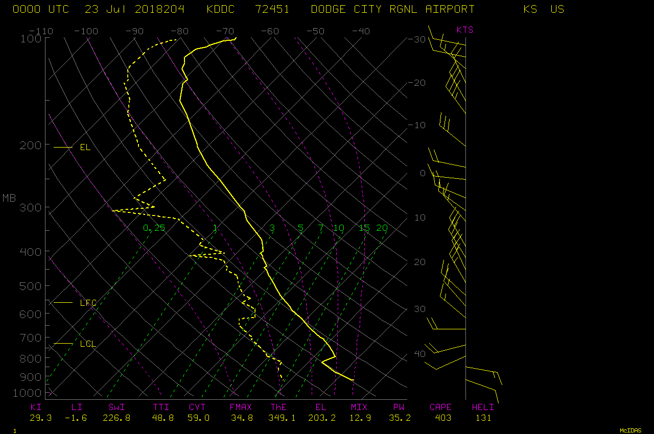
![Plot of 00 UTC rawinsonde data from North Platte, Nebraska [click to enlarge]](https://cimss.ssec.wisc.edu/satellite-blog/wp-content/uploads/sites/5/2018/07/180723_00UTC_KLBF_RAOB.GIF)
Plot of 00 UTC rawinsonde data from North Platte, Nebraska [click to enlarge]
![GOES-16 Cloud Top Height derived product at 0412 UTC [click to enlarge]](https://cimss.ssec.wisc.edu/satellite-blog/wp-content/uploads/sites/5/2018/07/CO_cth-20180723_041229.png)
GOES-16 Cloud Top Height derived product at 0412 UTC [click to enlarge]
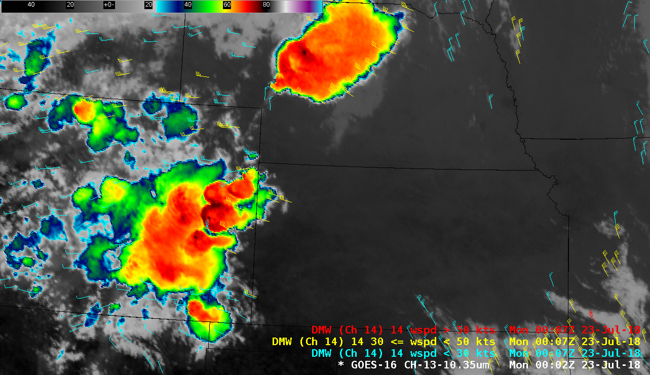
GOES-16 “Clean” Infrared Window (10.3 µm) images, with 11.2 µm infrared Derived Motion Winds [click to play animation | MP4]
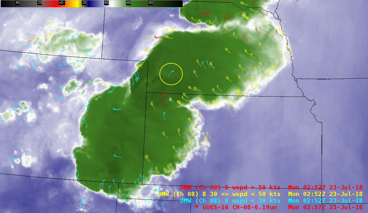
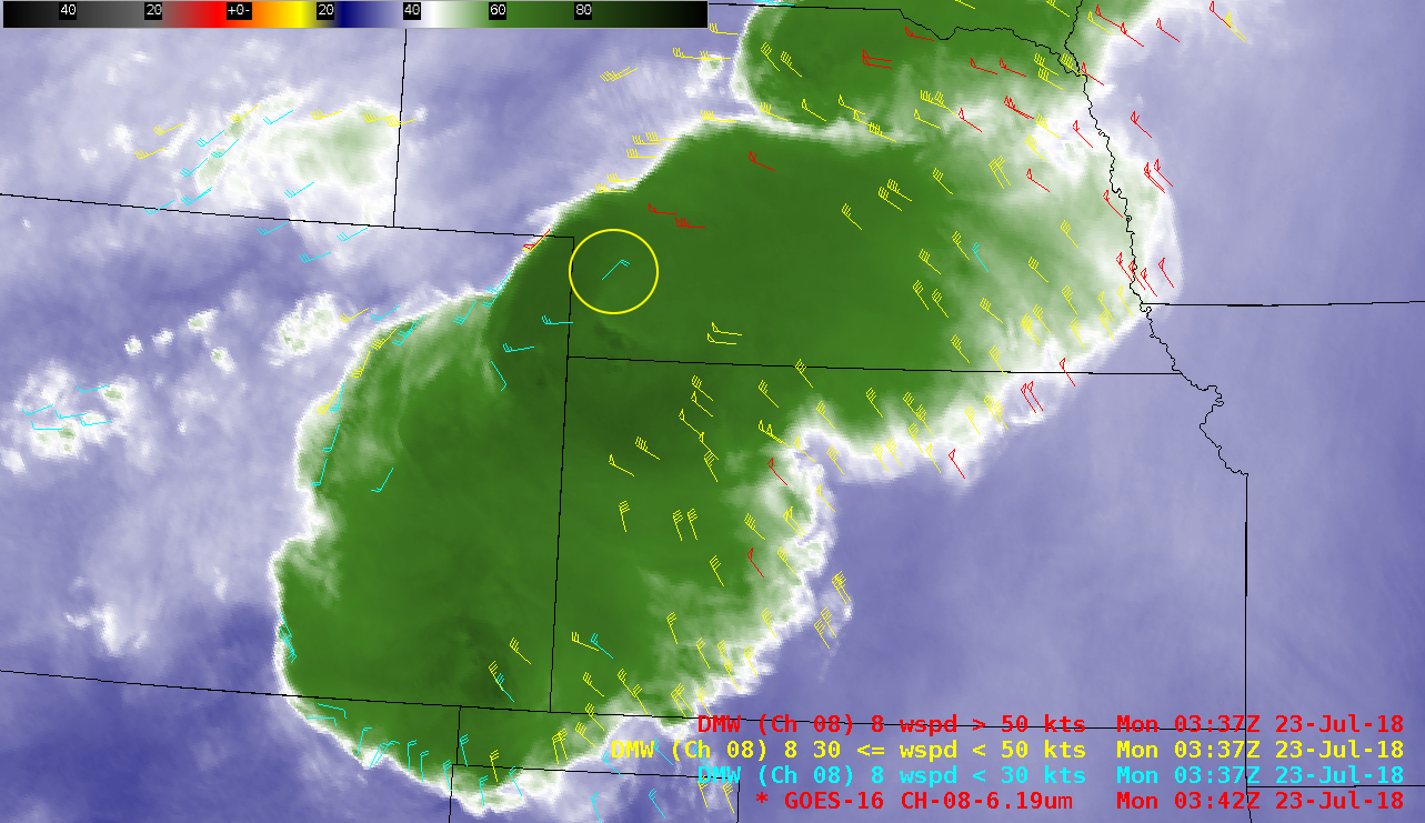
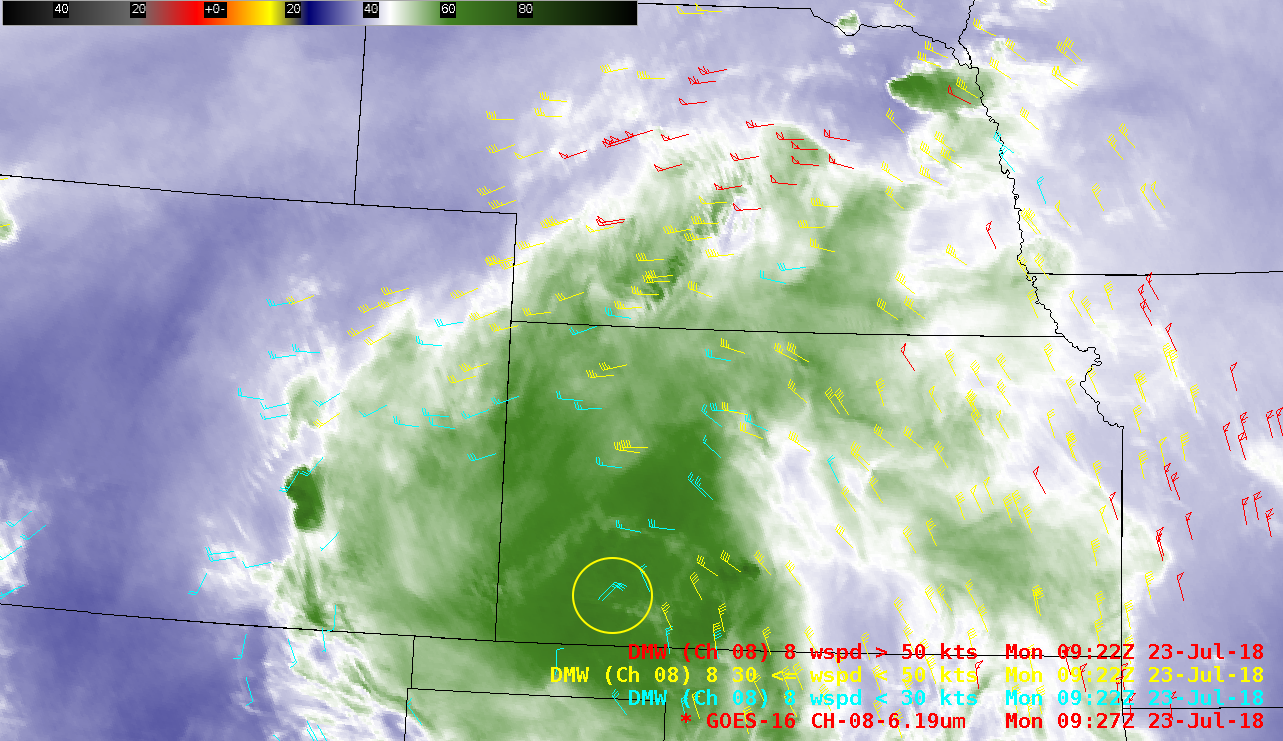
![GOES-16 Upper-level Water Vapor (6.2 µm) images, with 6.2 µm water vapor Derived Motion Winds [click to play animation | MP4]](https://cimss.ssec.wisc.edu/satellite-blog/wp-content/uploads/sites/5/2018/07/180723_goes16_waterVapor_derivedMotionWinds_CO_warm_trench_awips_anim.gif)
GOES-16 Upper-level Water Vapor (6.2 µm) images, with 6.2 µm water vapor Derived Motion Winds [click to play animation | MP4]