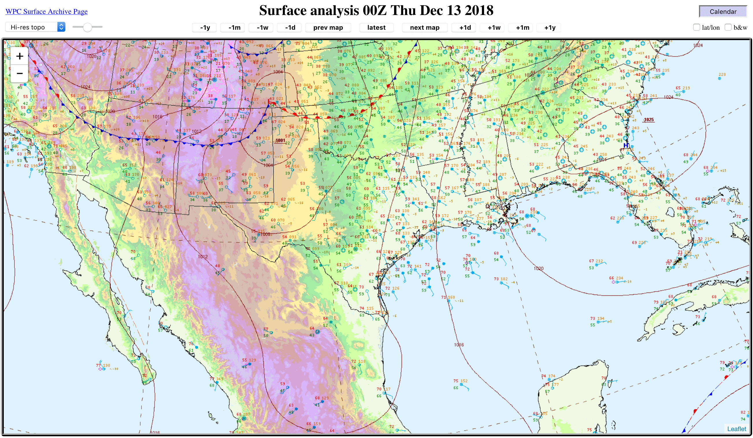
Southern US storm, and a Tehuano wind event
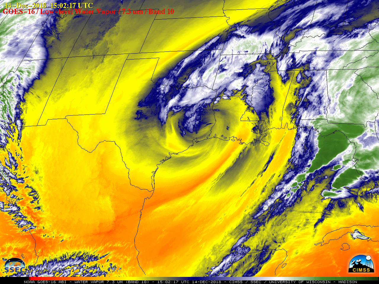
A large midlatitude cyclone moved from the southern High Plains to the Lower Mississippi Valley during the 13 December – 15 December 2018 period (surface analyses) — GOES-16 (GOES-East) Low-level Water Vapor (7.3 µm) images (above) showed the evolution of this system.The corresponding GOES-16 Water Vapor images with plots of hourly surface wind gusts are... Read More
