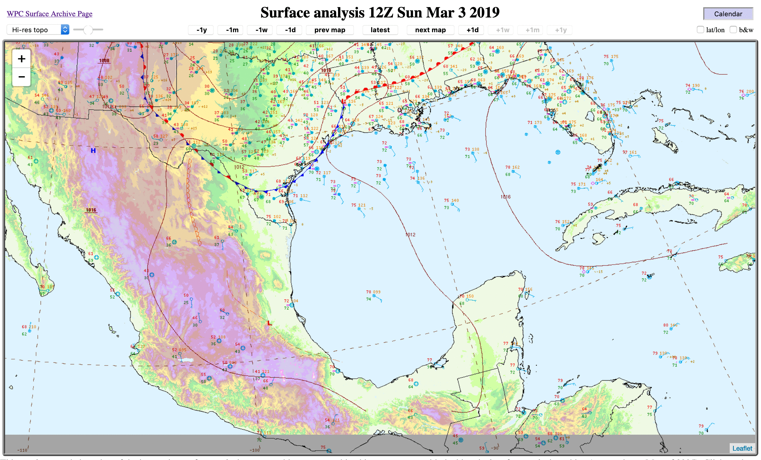
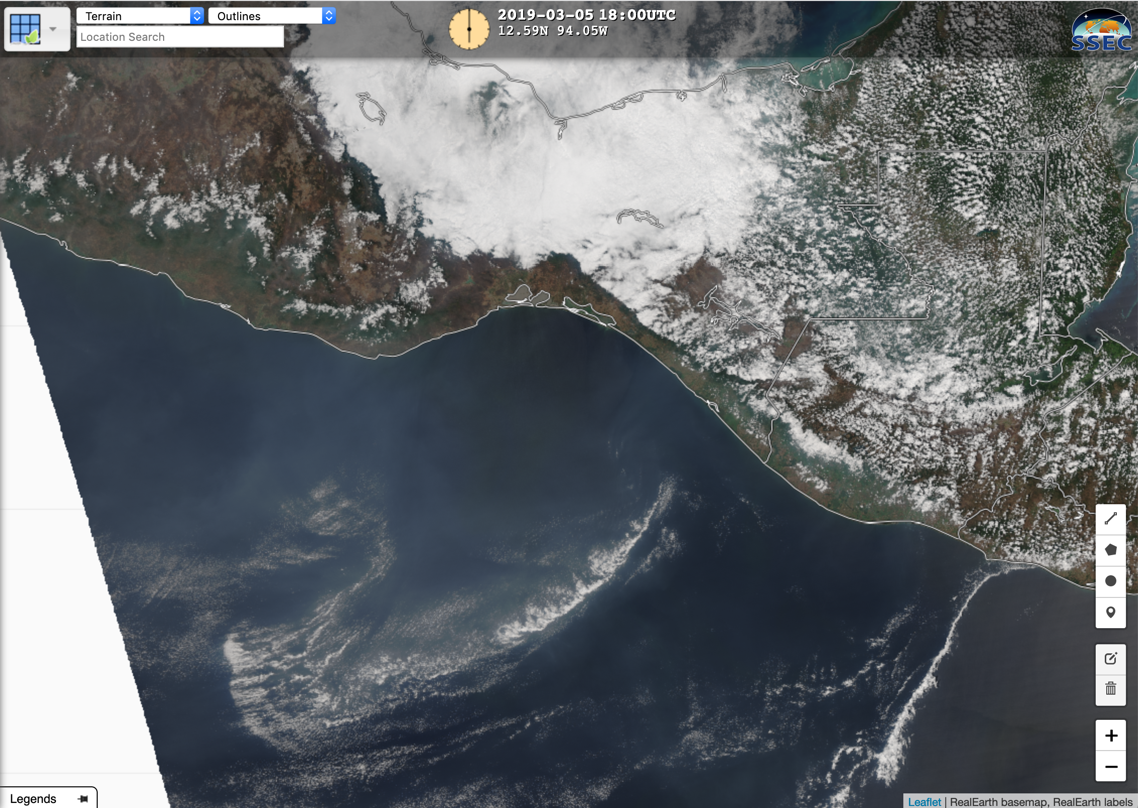
This website works best with a newer web browser such as Chrome, Firefox, Safari or Microsoft Edge. Internet Explorer is not supported by this website.

Category: Satellite winds

Explosive cyclogenesis off the East Coast of the United States

A strong extratropical cyclone that deposited snow in the deep south developed explosively during the early morning hours of 4 January 2018. The GOES-16 Clean Window (10.3 µm) animation, above, from 0102 – 1337 UTC on 4 January, brackets the explosive development: from 993 hPa at 0000 UTC to 968 mb at 0900 UTC, a strengthening that easily meets the “Bomb” criteria set forth by Sanders and Gyakum (1980).... Read More

Northeast US heavy rain and high wind event

* GOES-16 data posted on this page are preliminary, non-operational and are undergoing testing *GOES-16 Mid-level Water Vapor (6.9 µm) images with hourly surface weather symbols plotted in red (above) showed the large-scale evolution of a storm system that deepened rapidly as it moved across the Northeast US during the... Read More