West Pacific Typhoon Yutu
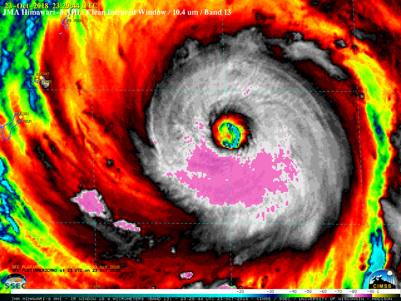
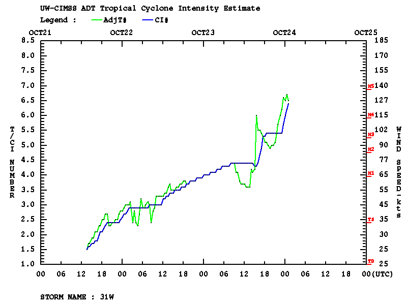
Rapid-scan (2.5-minute interval) Himawari-8 “Clean” Infrared Window (10.4 µm) images (above) showed the formation of a well-defined eye as Typhoon Yutu rapidly intensified from a Category 2 to a Category 4 storm (ADT | SATCON) east of Guam on 23 October 2018. Cloud-top infrared brightness temperatures were -90ºC or colder... Read More
