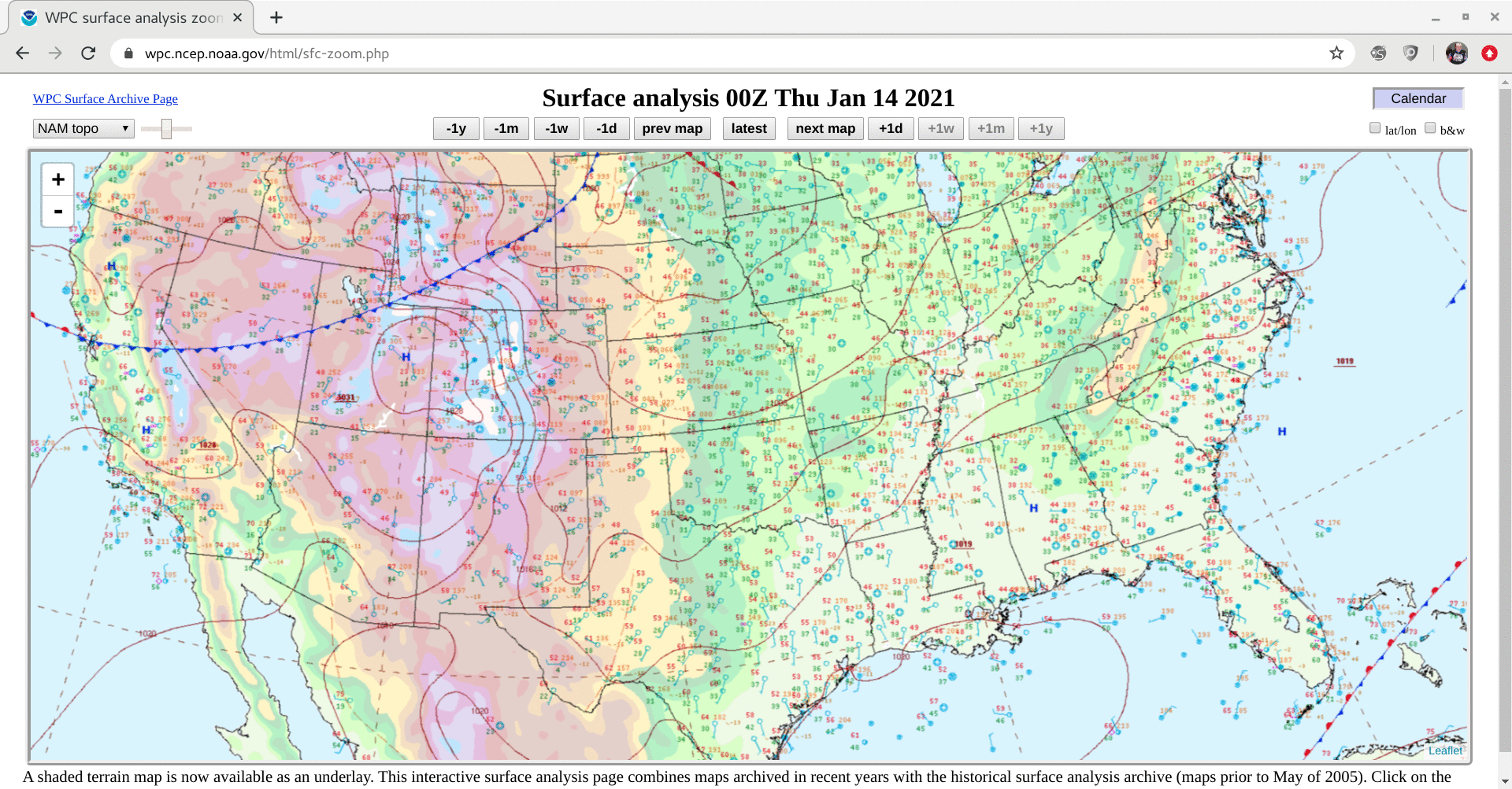
A leeside cold frontal gravity wave in the Plains, and a strong polar jet stream over the Rockies
![GOES-16 Upper-level Water Vapor (6.2 µm) images, with plots of hourly surface wind barbs and gusts [click to play animation | MP4]](https://cimss.ssec.wisc.edu/satellite-blog/images/2021/01/210114_goes16_waterVapor8_surfaceWinds_Plains_anim.gif)
GOES-16 Upper-level Water Vapor (6.2 µm) images, with plots of hourly surface wind barbs and gusts [click to play animation | MP4]
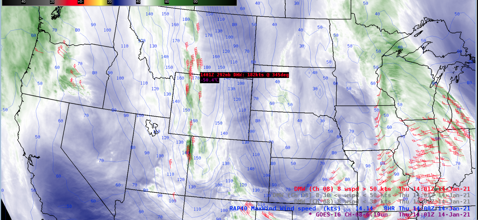
In addition, an anomalously-strong (170-180 knot) meridional branch of the upper-tropospheric polar jet stream was progressing southward over the Rocky Mountains — and GOES-16 Water Vapor images with plots of Derived Motion Winds and contours of RAP40 model maximum wind speeds (below) revealed that the highest satellite-tracked Derived Motion Wind (DMW) speed was 182 knots over southern Montana at 1401 UTC. Some of the DMW speeds were nearly 10 knots faster than the RAP40 model maximum wind (for example, this 170-knot DMW over Wyoming at 1616 UTC).
![GOES-16 Upper-level Water Vapor (6.2 µm) images, with plots of 6.2 µm Derived Motion Winds and contours of RAP40 model maximum wind speeds [click to play animation | MP4]](https://cimss.ssec.wisc.edu/satellite-blog/images/2021/01/210114_goes16_waterVapor_derivedMotionWinds_Rockies_jet_anim.gif)
GOES-16 Upper-level Water Vapor (6.2 µm) images, with plots of 6.2 µm Derived Motion Winds and contours of RAP40 model maximum wind speeds [click to play animation | MP4]