Tropical Invest 90E becomes Tropical Storm Andres
![GOES-17 “Red” Visible (0.64 µm) and "Clean" Infrared Window images [click to play animation | MP4]](https://cimss.ssec.wisc.edu/satellite-blog/images/2021/05/210508_goes17_visible_infrared_Invest_90E_anim.gif)
GOES-17 “Red” Visible (0.64 µm) and “Clean” Infrared Window (10.35 µm) images [click to play animation | MP4]
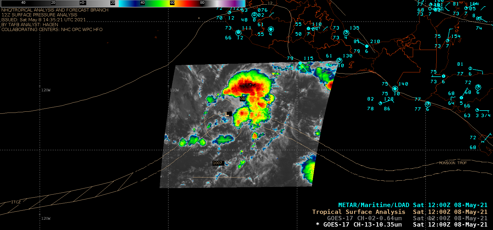
GOES-17 “Clean” Infrared Window (10.35 µm) image (Mesoscale Sector), with an overlay of the 12 UTC surface analysis [click to enlarge]
![Ocean Heat Content and Sea Surface Temperature [click to enlarge]](https://cimss.ssec.wisc.edu/satellite-blog/images/2021/05/210508_oceanHeatContent_seaSurfaceTemperature_Invest90E_anim.gif)
Ocean Heat Content and Sea Surface Temperature [click to enlarge]
===== 09 May Update =====
![GOES-17 “Red” Visible (0.64 µm) and "Clean" Infrared Window (10.35 µm) images [click to play animation | MP4]](https://cimss.ssec.wisc.edu/satellite-blog/images/2021/05/210509_goes17_infrared_visible_Tropical_Storm_Andres_anim.gif)
GOES-17 “Red” Visible (0.64 µm) and “Clean” Infrared Window (10.35 µm) images [click to play animation | MP4]
A GOES-17 Infrared / Water Vapor Difference product (reference) from the CIMSS Tropical Cyclones site (below) highlighted areas of deep convection where overshooting tops were likely penetrating the tropopause (yellow to red enhancement).
![GOES-17 Infrared - Water Vapor Difference product [click to enlarge]](https://cimss.ssec.wisc.edu/satellite-blog/images/2021/05/210509_goes17_irwvdiff_TS_Andres_anim.gif)
GOES-17 Infrared – Water Vapor Difference product [click to enlarge]
![GOES-17 Infrared images, with an overlay of deep-layer wind shear [click to enlarge]](https://cimss.ssec.wisc.edu/satellite-blog/images/2021/05/210509_goes17_infrared_shear_TS_Andres_anim.gif)
GOES-17 Infrared images, with an overlay of deep-layer wind shear [click to enlarge]
===== 10 May Update =====
![GOES-17 “Red” Visible (0.64 µm) and "Clean" Infrared Window (10.35 µm) images [click to play animation | MP4]](https://cimss.ssec.wisc.edu/satellite-blog/images/2021/05/210510_goes17_infrared_visible_Tropical_Storm_Andres_anim.gif)
GOES-17 “Red” Visible (0.64 µm) and “Clean” Infrared Window (10.35 µm) images [click to play animation | MP4]