Cyclone Freddy makes landfall in Madagascar
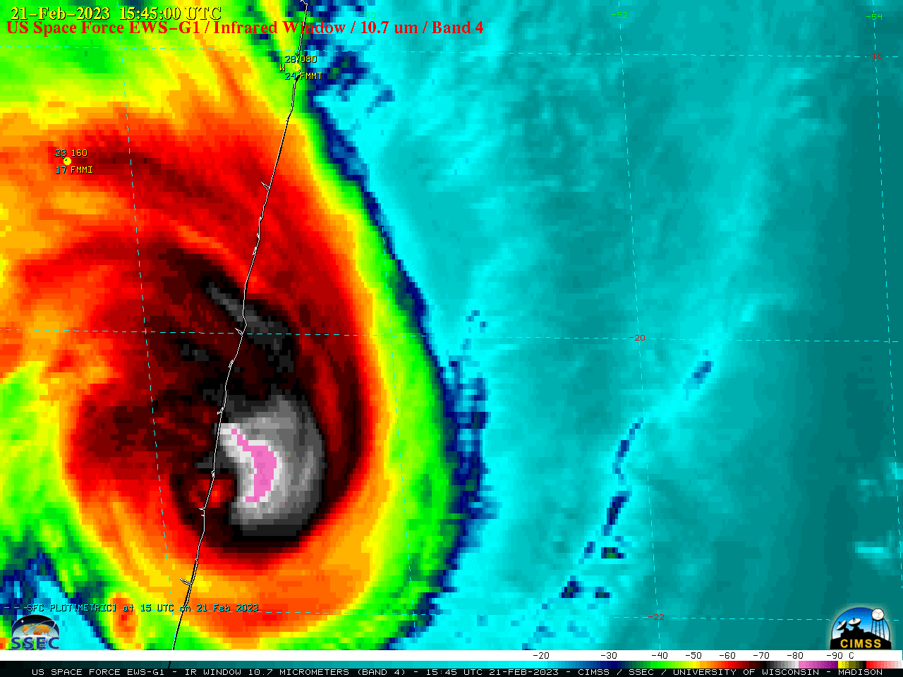
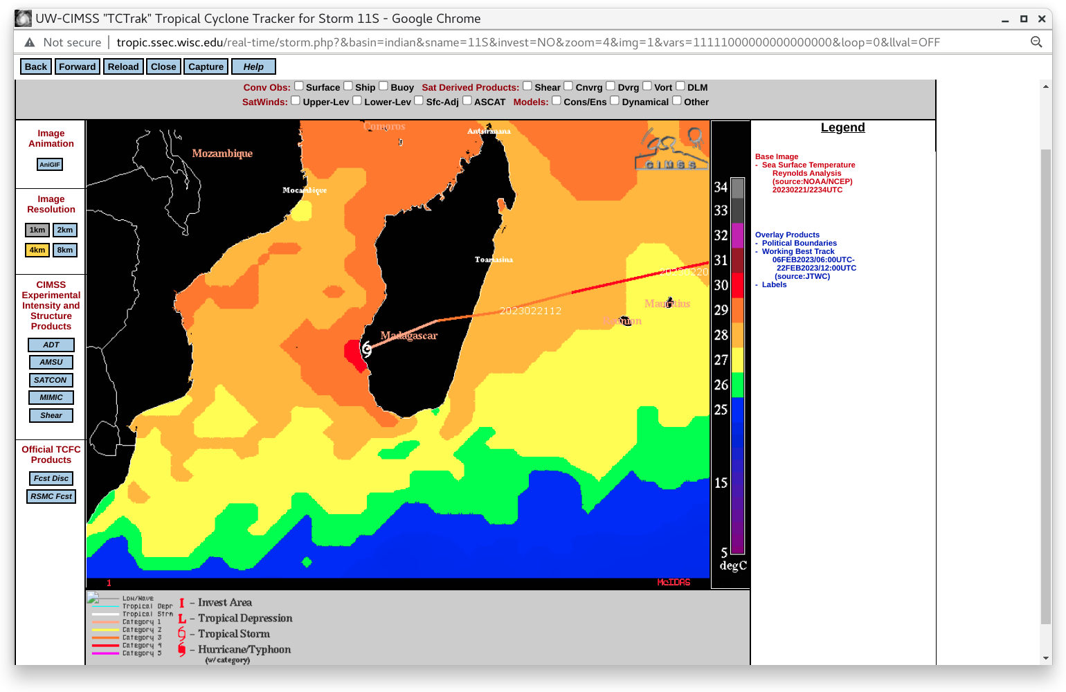
US Space Force EWS-G1 (formerly GOES-13) Infrared Window (10.7 µm) images (above) showed Category 3 Cyclone Freddy making landfall along the east coast of Madagascar on 21 February 2023.According to products from the CIMSS Tropical Cyclones site, during the 12-15 hours leading up to landfall Freddy was traversing warm water with Sea Surface Temperature... Read More
