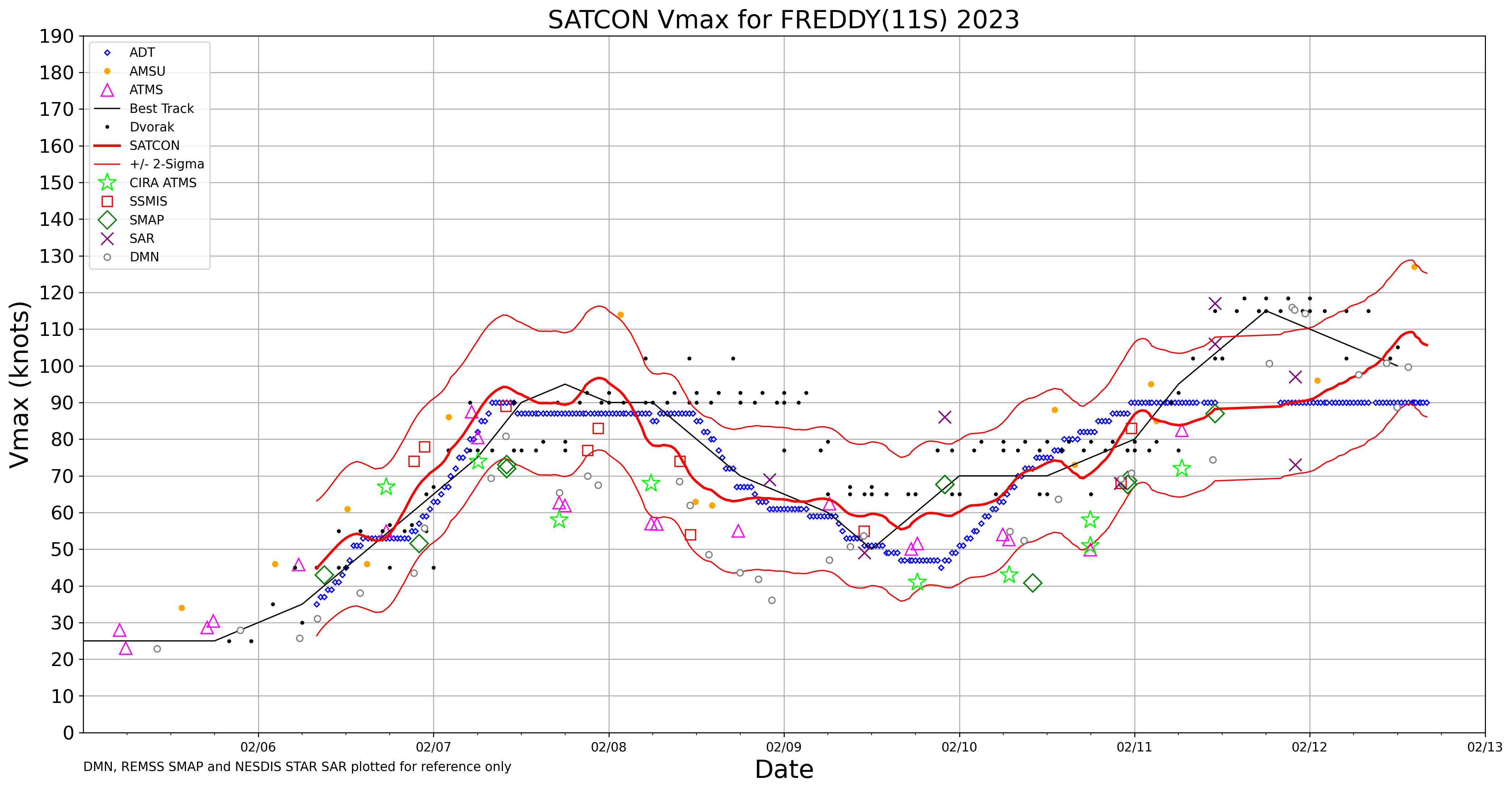
Cyclone Freddy reaches Category 4 intensity
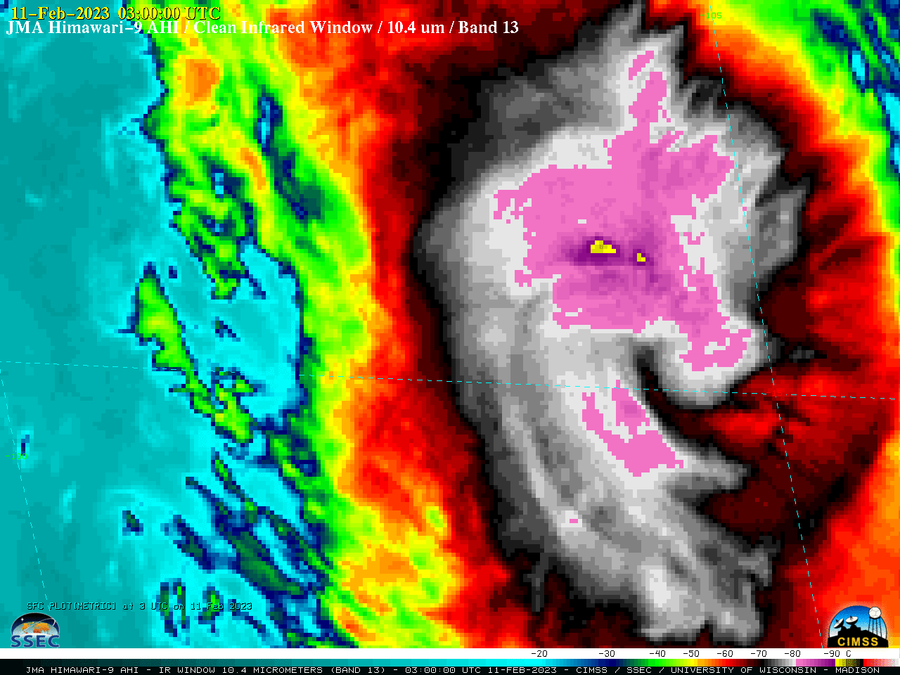
JMA Himawari-9 Infrared Window (10.4 µm) images [click to play animated GIF | MP4]
A NOAA-20 VIIRS Day/Night Band (0.7 µm) image valid at 1825 UTC on 11 February (below) showed the eye of Freddy.
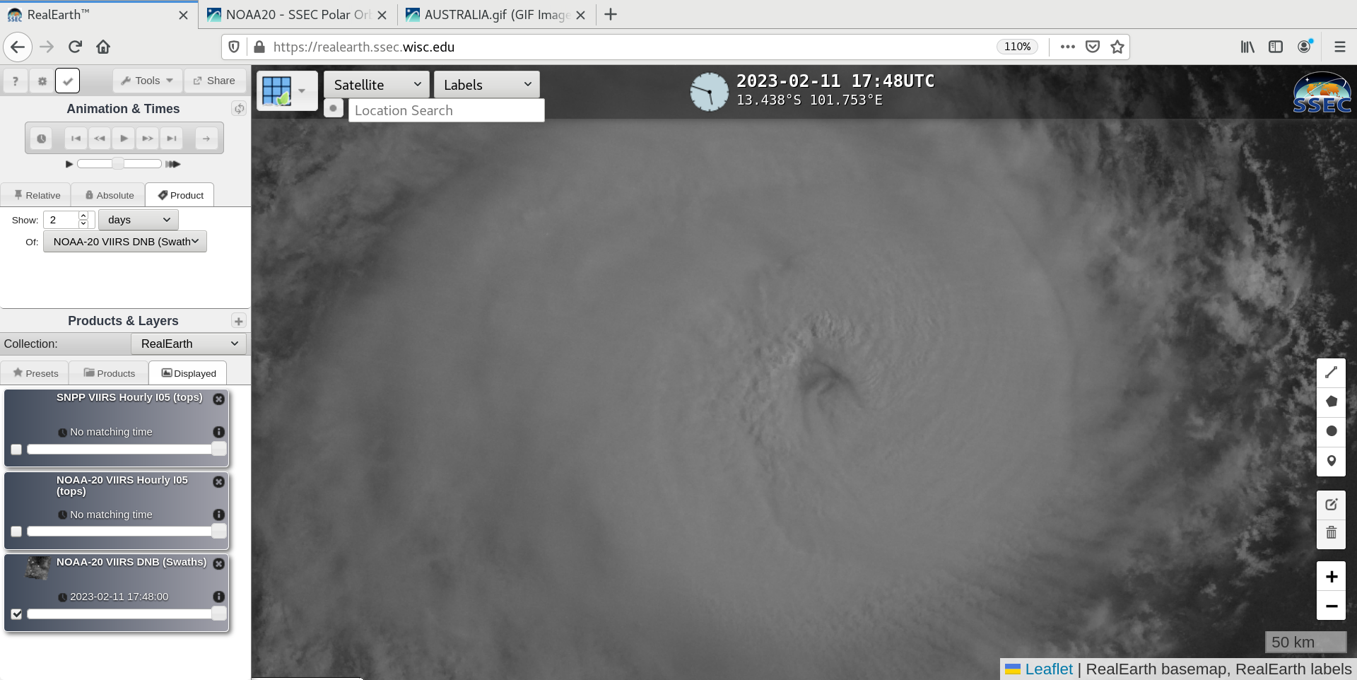
NOAA-20 VIIRS Day/Night Band (0.7 µm) image, valid at 1825 UTC on 11 February [click to enlarge]
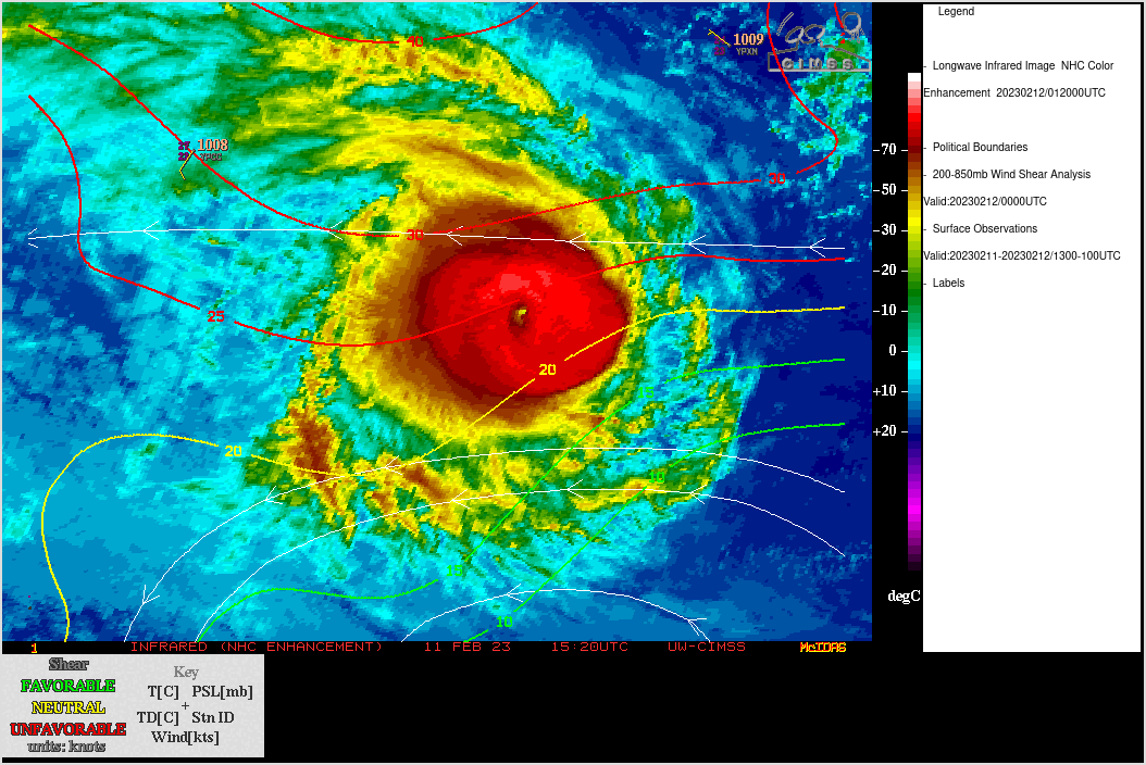
JMA Himawari-9 Infrared Window (11.2 µm) images, with contours and streamlines of 850-200 hPa wind shear
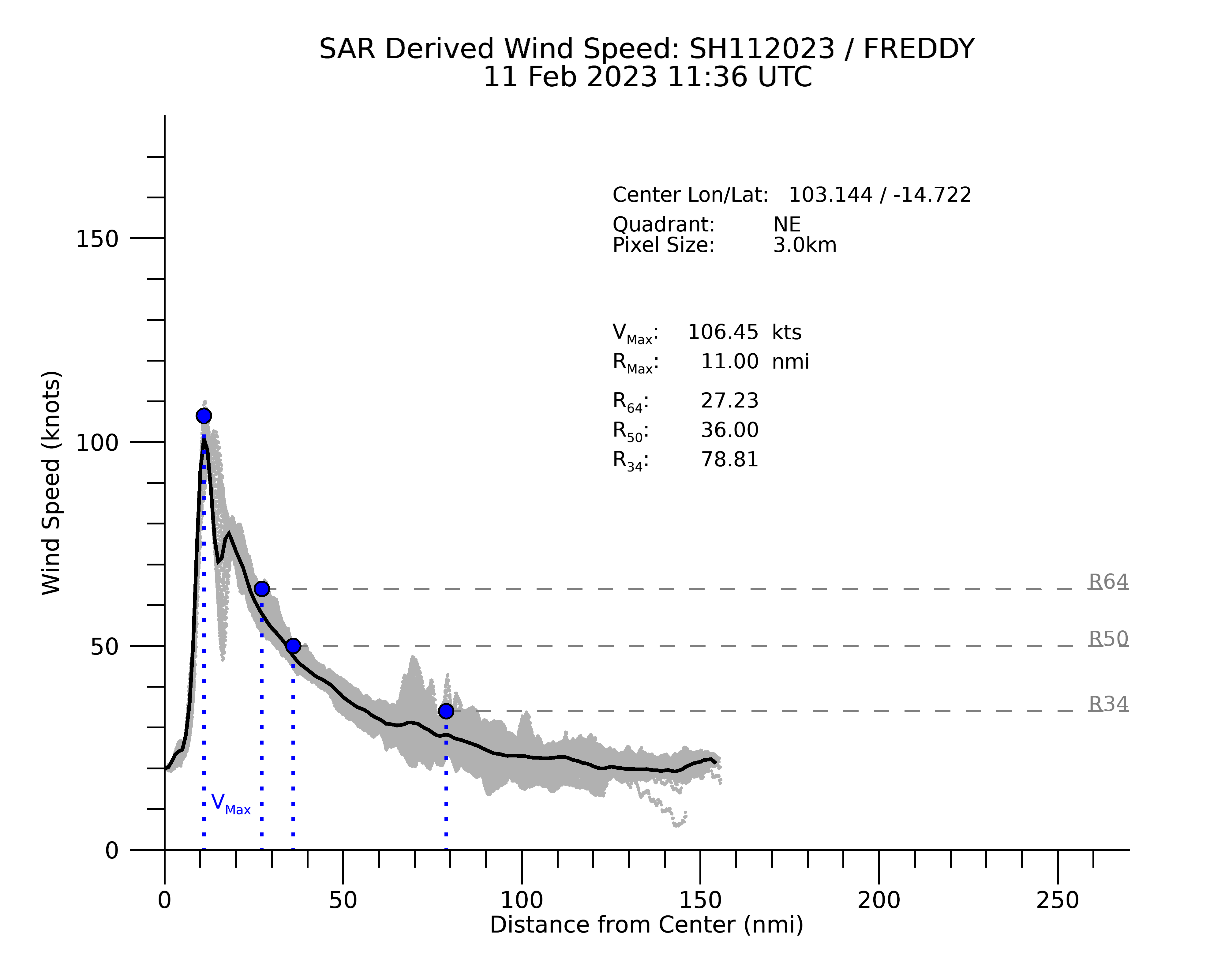
RCM/Radarsat-2 SAR winds at 1136 UTC on 11 February (source) are shown below — a maximum wind speed of 106 knots was indicated within the northeast quadrant.
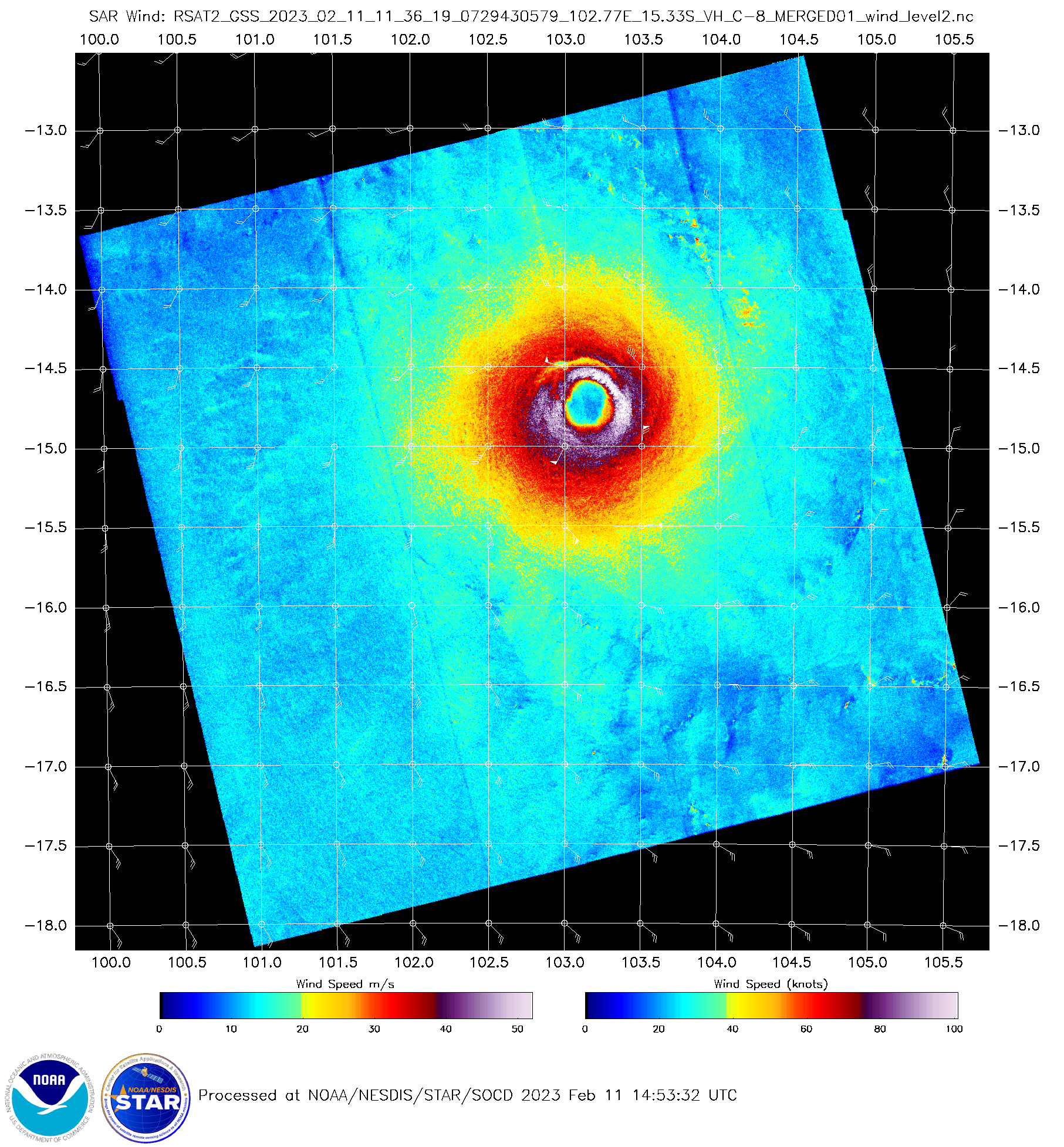
Radarsat-2 winds at 1136 UTC [click to enlarge]