SAR data over Tropical Cyclone Freddy in the Indian Ocean

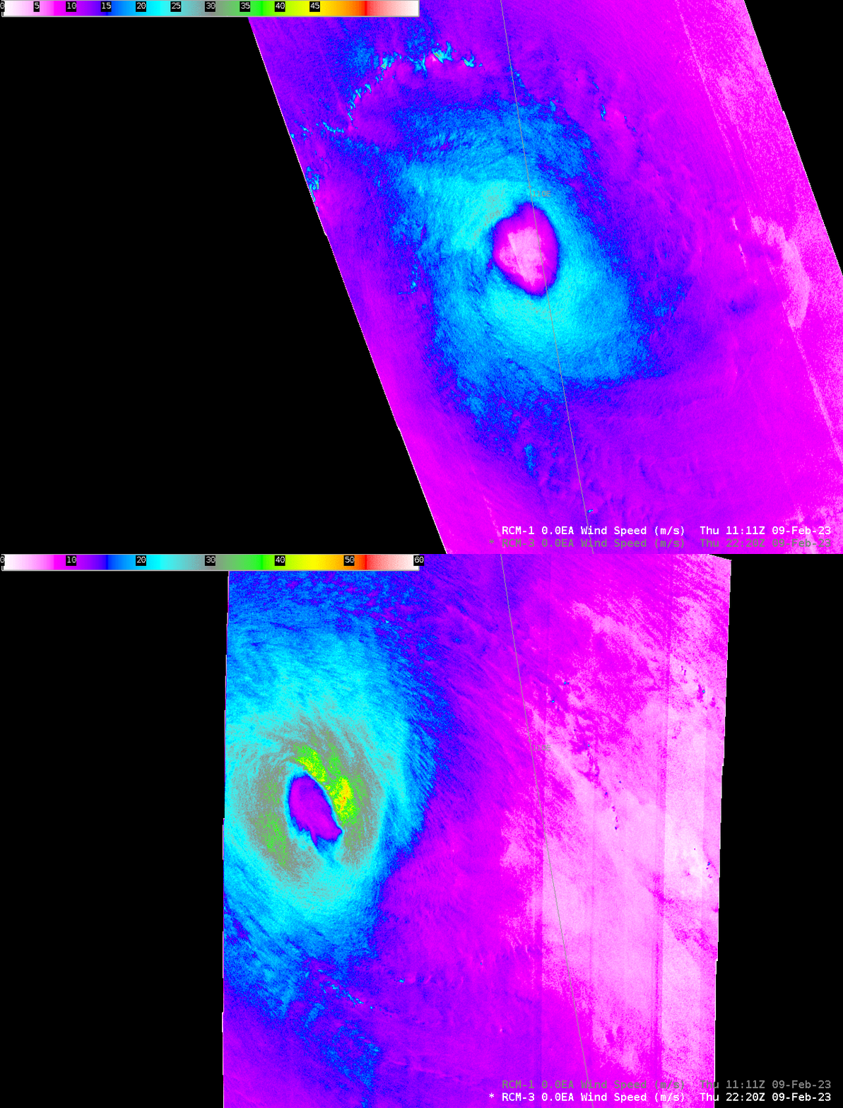
RADARSAT Constellation Mission Satellite 1 (RCM-1) overflew tropical cyclone Freddy in the eastern Indian Ocean on 9 February, and Synthetic Aperture Radar (SAR) winds from the satellite captured a well-developed eye with (instantaneous) surface winds that peaked around 25 m/s. More information on SAR winds with Freddy is available here. The toggle above shows the storm center displaced significantly to the east of the coldest cloud tops. Freddy was experiencing shear (see the 1800 UTC shear analysis below taken from the CIMSS Tropical Website) that may have helped to cause this displacement, but parallax error in the Himawari-9 imagery likely also has an affect. (This website shows the parallax error for Himawari-9 imagery).
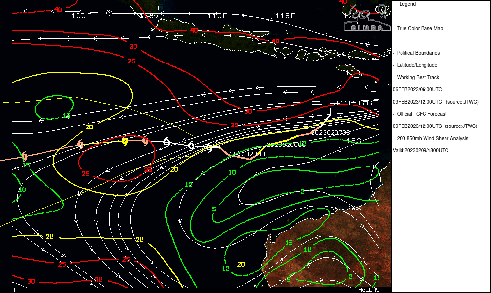
More information on Freddy is available from the Joint Typhoon Warning Center.
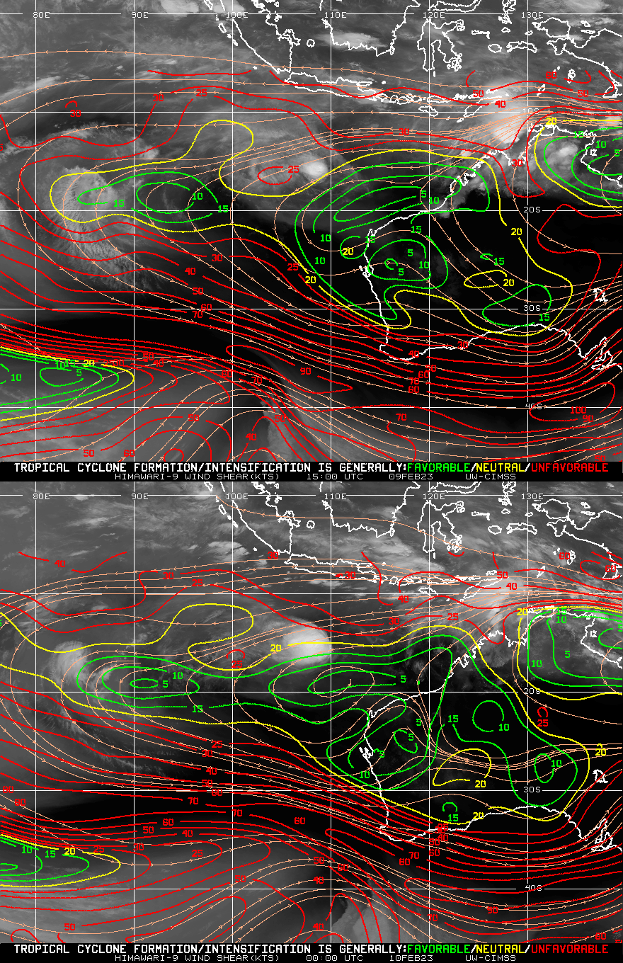
A second overpass (RCM-3) later at 2200 UTC 9 February showed significantly stronger winds — 50 m/s! — that were more centered underneath the Central Dense Overcast, suggesting weaker shear. Indeed, the Shear Analysis (at bottom, showing shear at 1500 UTC 9 February and 0000 UTC 10 February) showed weakening shear over the storm.
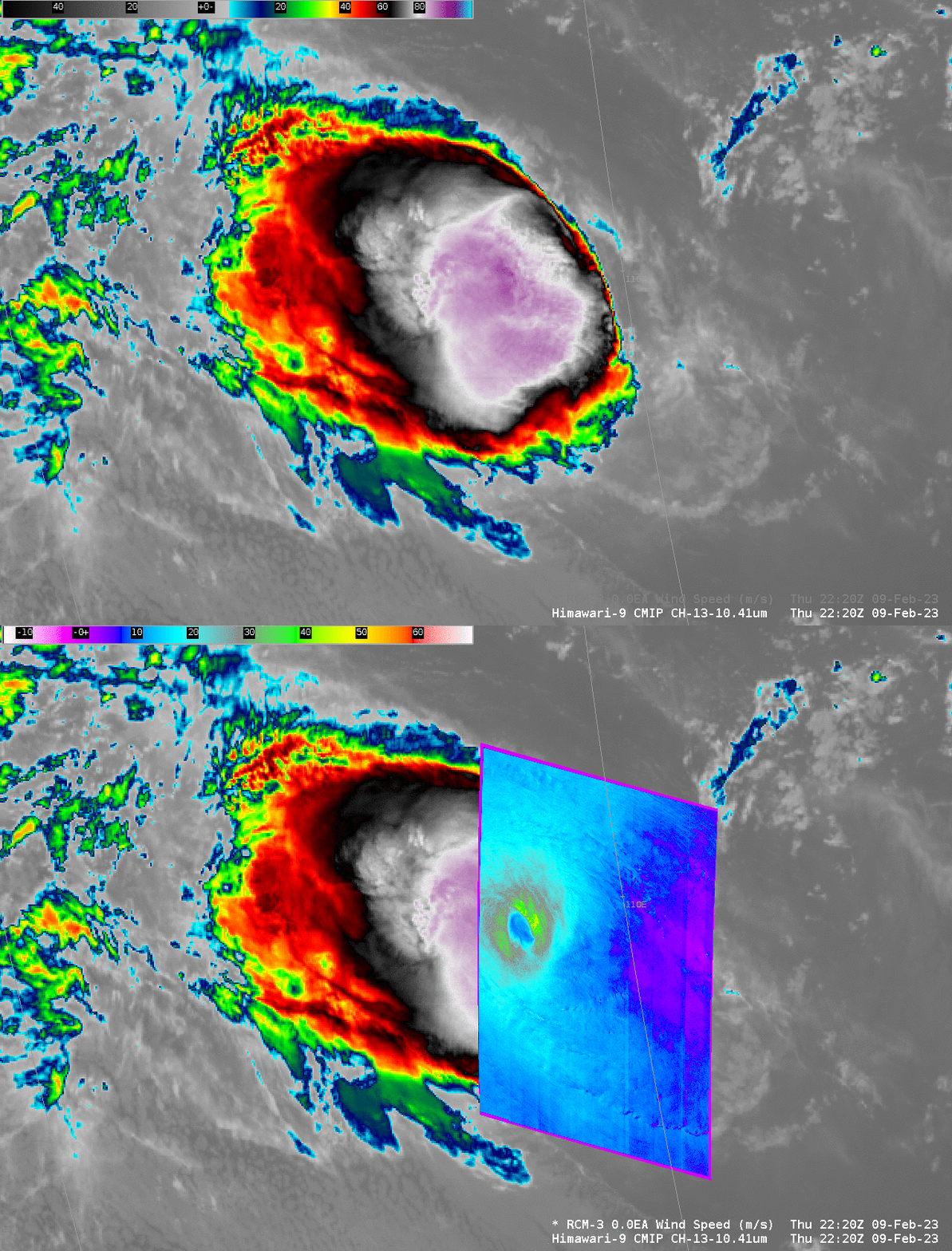
The toggle below compares the derived winds from RCM1 at 1111 UTC and from RCM3 at 2220 UTC with the same color enhancement, and over the same domain. Significant strengthening is shown!
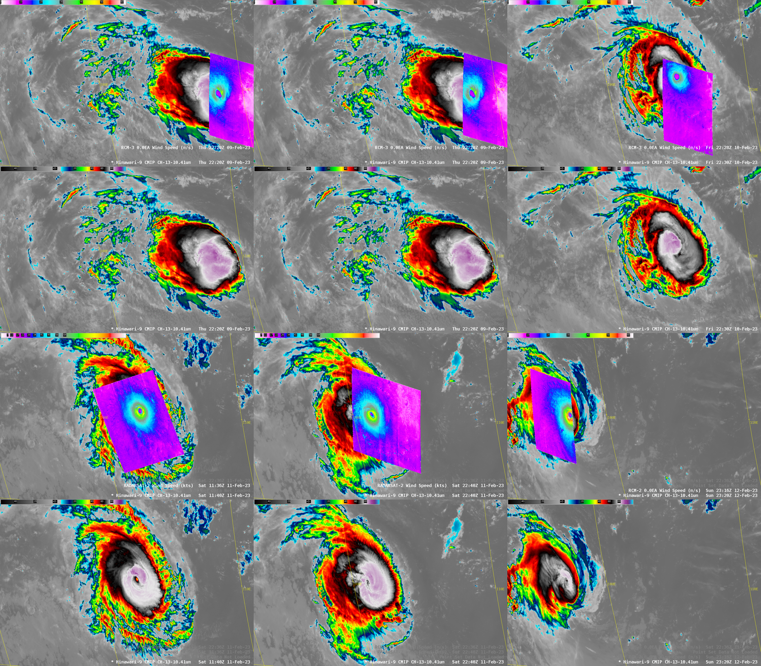
SAR observations continued as Freddy intensified to a Category 4 storm (blog post). The animation below shows five images between 9 and 12 February 2023.
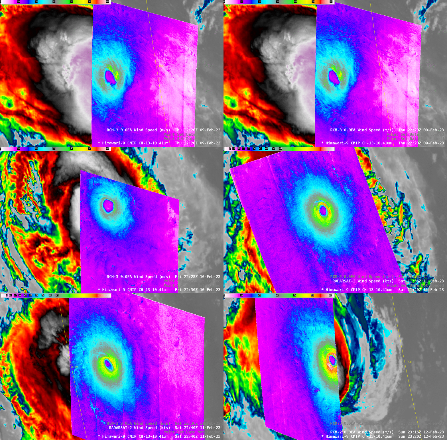
The imagery below shows the 5 scenes from above, but zoomed in so that maximum wind speeds can be identified. Note that some of the windspeeds are in knots, and some are in m/s. The color enhancement has been altered so that the windspeed to color association is similar. SAR Winds and diagnoses for Freddy are available here.
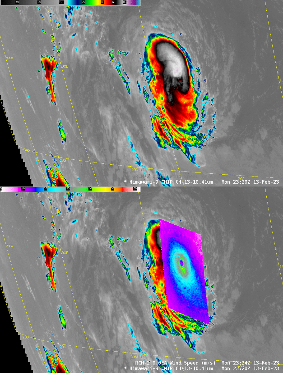
Late on 13 February, RCM2 overflew Freddy and produced the wind scene shown below in a toggle with Himawari-9 Clean window imagery. Note that the limb of the Himawari scene is showing up in this image. Parallax errors in the Himawari-9 imagery (compared to the surface-based SAR imagery) will increase as the storm moves closer to Africa. A zoomed-in view of the SAR winds is available here.
Another overpass occurred at 1224 UTC on 14 February. Two toggles are shown below; the effects of the parallax shift in the Himawari-9 imagery become more and more apparent!

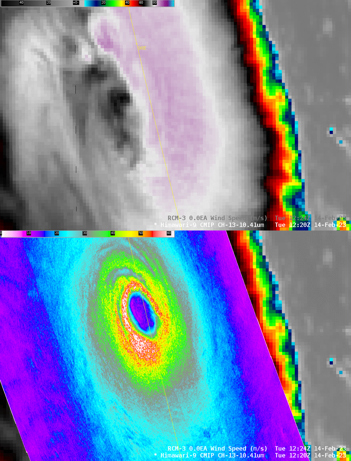
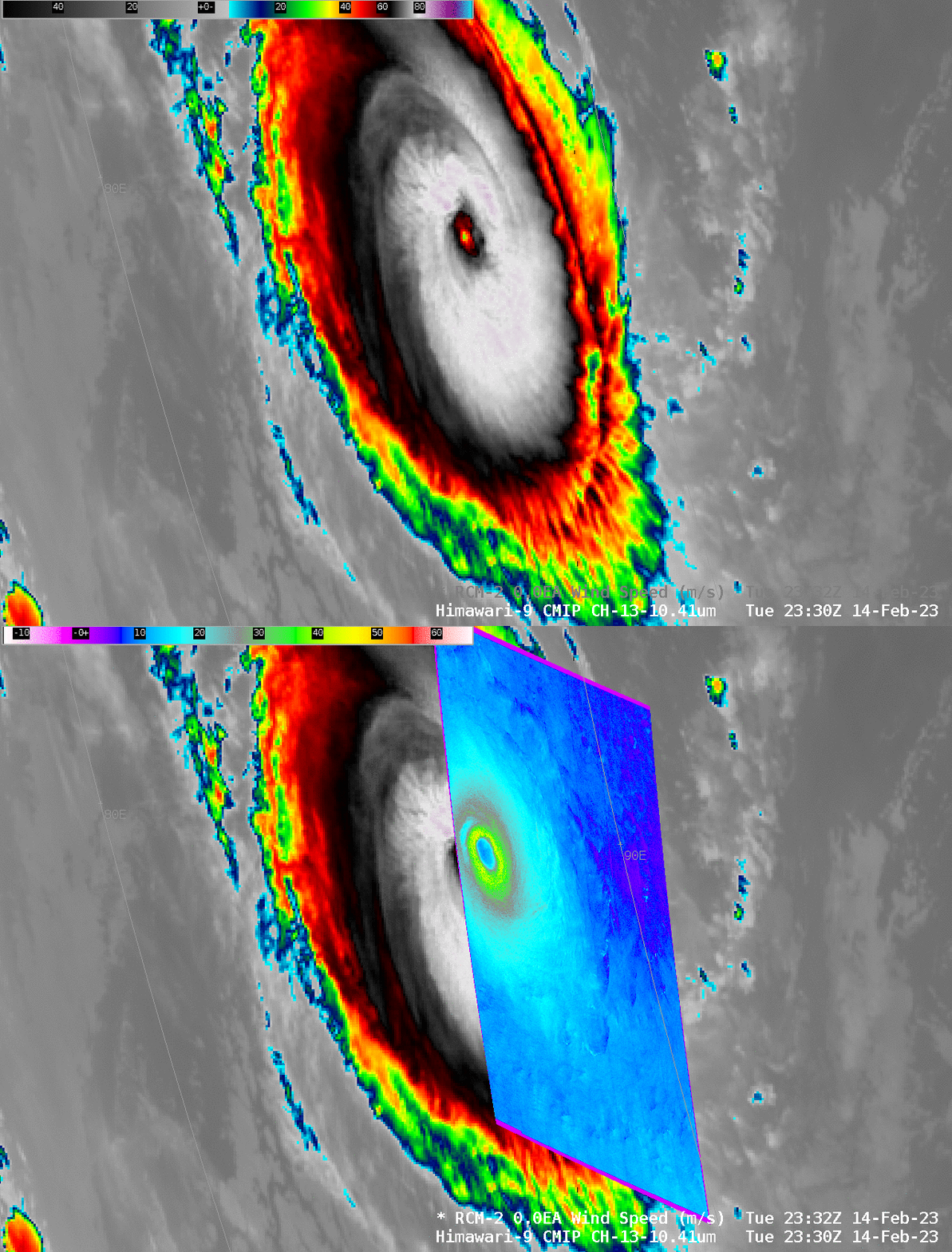
RCM2 SAR winds from 2330 UTC on 14 February are shown below, and the parallax shift is readily apparent. Click here to view a zoomed-in SAR analysis over the eye.
