Typhoon Soulik in the northwest Pacific Ocean
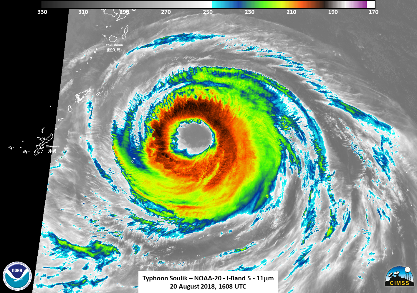
Typhoon Soulik, south of Japan and moving westward, has acquired a very large eye — almost 100 miles across! Himawari-8 imagery, above (courtesy JMA), shows the evolution and enlargement of the eye between 0900 and 1400 UTC on 20 August 2018.GCOM, Suomi NPP and NOAA-20 all passed over Soulik between... Read More
