Typhoon Soulik in the northwest Pacific Ocean
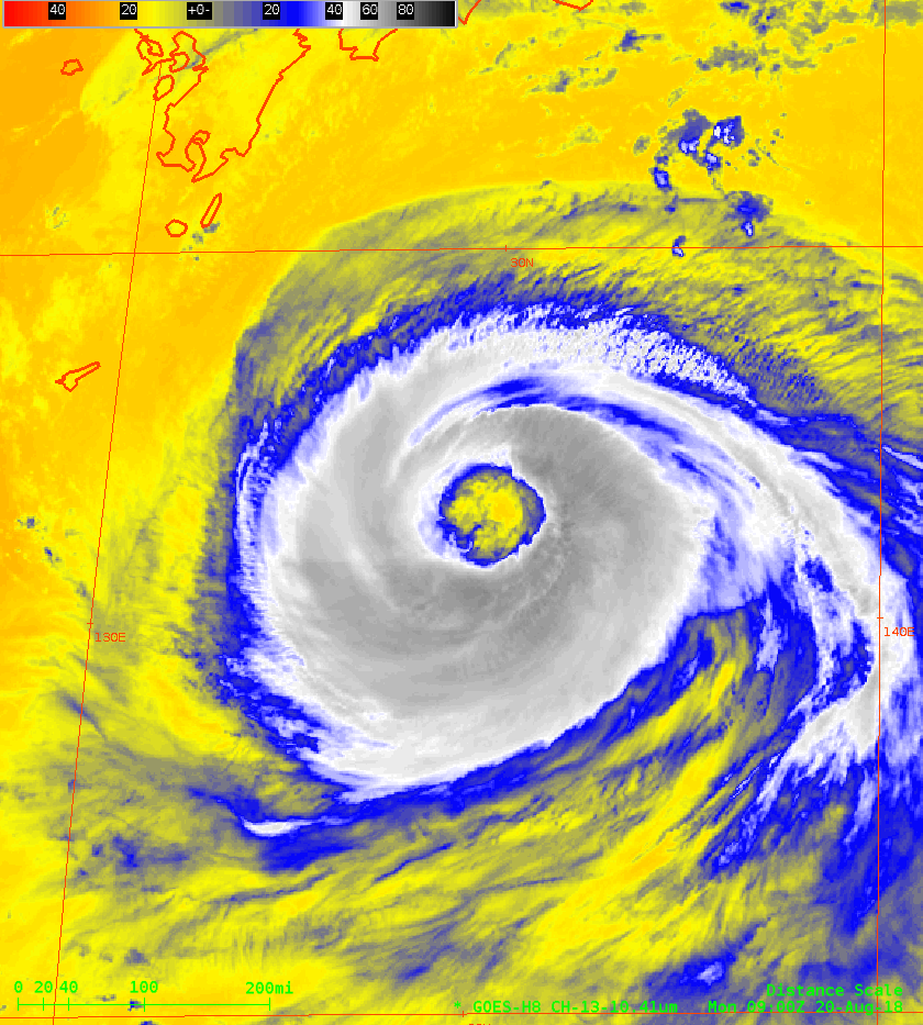
Himawari-8 AHI Band 13 Clean Window (10.4 µm) imagery, 0900-1400 UTC on 18 August 2018 (Click to animate)
Typhoon Soulik, south of Japan and moving westward, has acquired a very large eye — almost 100 miles across! Himawari-8 imagery, above (courtesy JMA), shows the evolution and enlargement of the eye between 0900 and 1400 UTC on 20 August 2018.
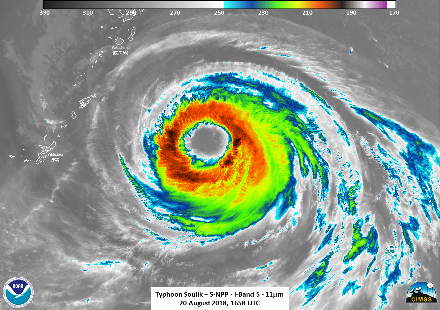
GCOM, Suomi NPP and NOAA-20 all passed over Soulik between 1600 and 1715 UTC on 18 August. The Infrared Toggle, below, from NOAA-20 (1608 UTC) and Suomi NPP (1658 UTC) also shows a large eye.
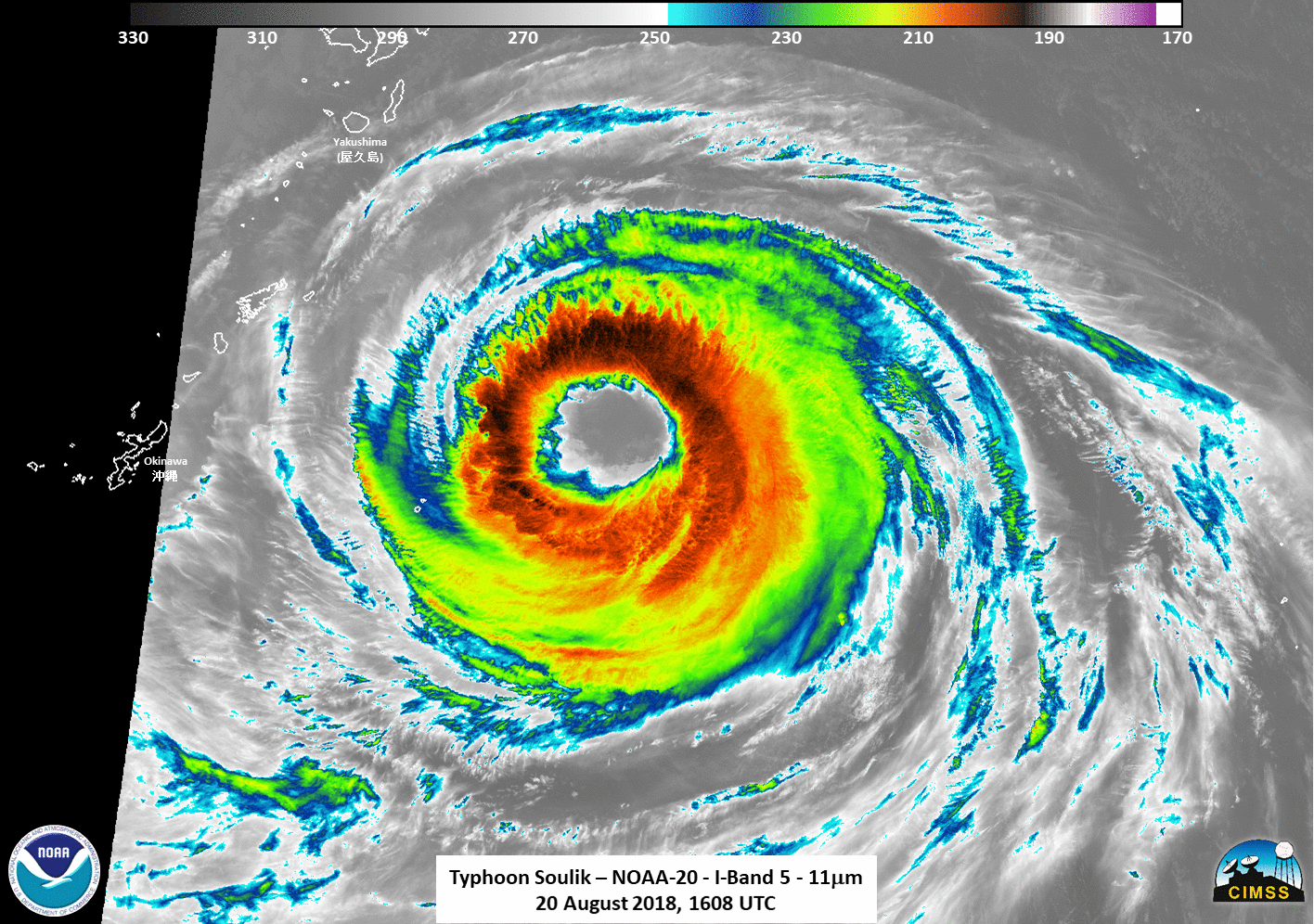
NOAA-20 (1608 UTC) and Suomi NPP (1658 UTC) 11.45 µm Infrared Imagery of Soulik on 18 August 2018 (Click to enlarge)
Day Night Band Imagery from Suomi NPP, below, also shows a large eye. There was little lunar illumination occurring at the time because the moon was below the horizon.
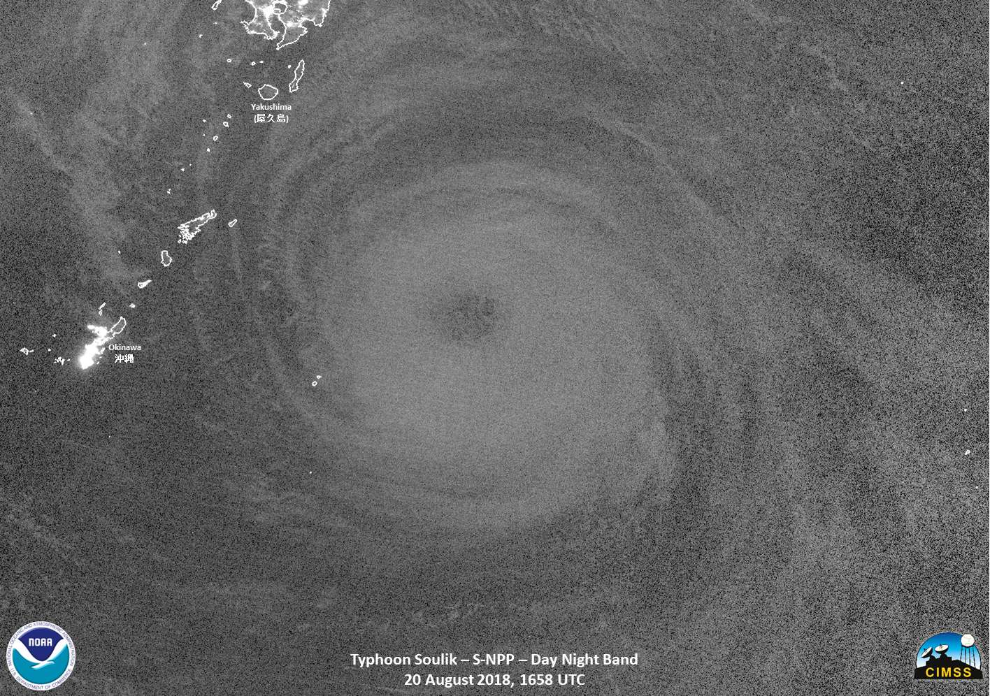
Suomi NPP Day Night Band Visible (0.70 µm) Imagery over Soulik, 1658 UTC on 18 August 2018 (Click to enlarge)
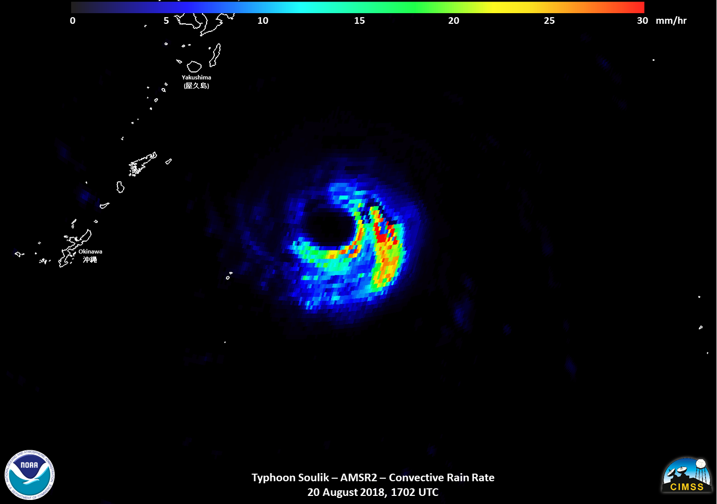
GCOM overflew Soulik at 1702 UTC, and the AMSR-2 instrument on board gave estimates of rain rate, both convective and a the surface. Those are toggled below.
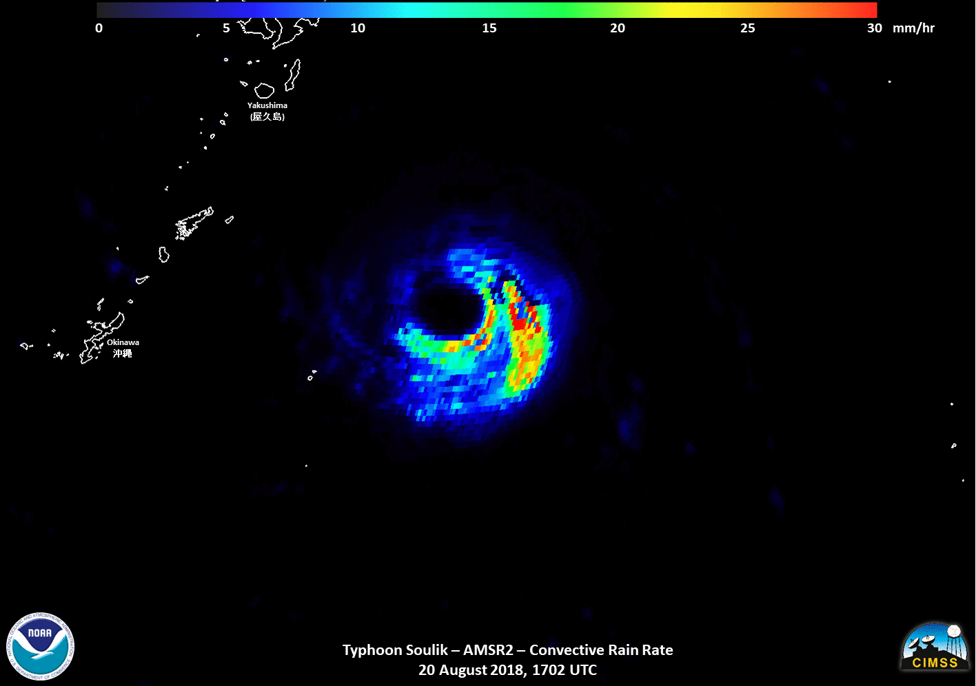
GCOM AMSR-2 Microwave estimates of Precipitation over Soulik, 1702 UTC on 18 August 2018 (Click to enlarge)
(Suomi NPP, NOAA-20 and GCOM imagery courtesy William Straka, CIMSS)
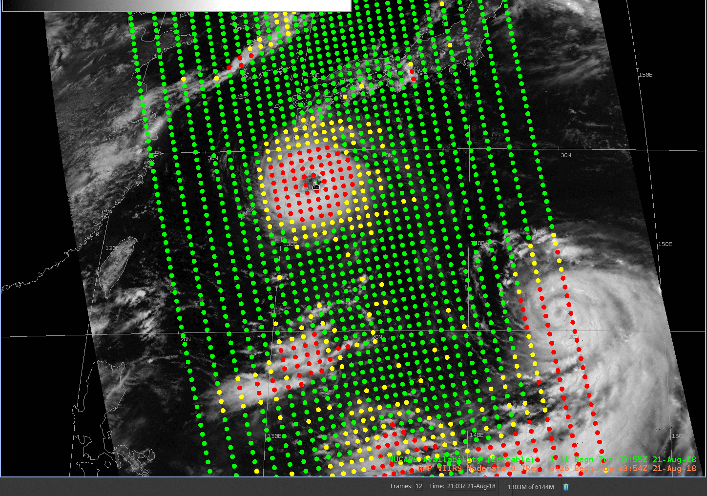
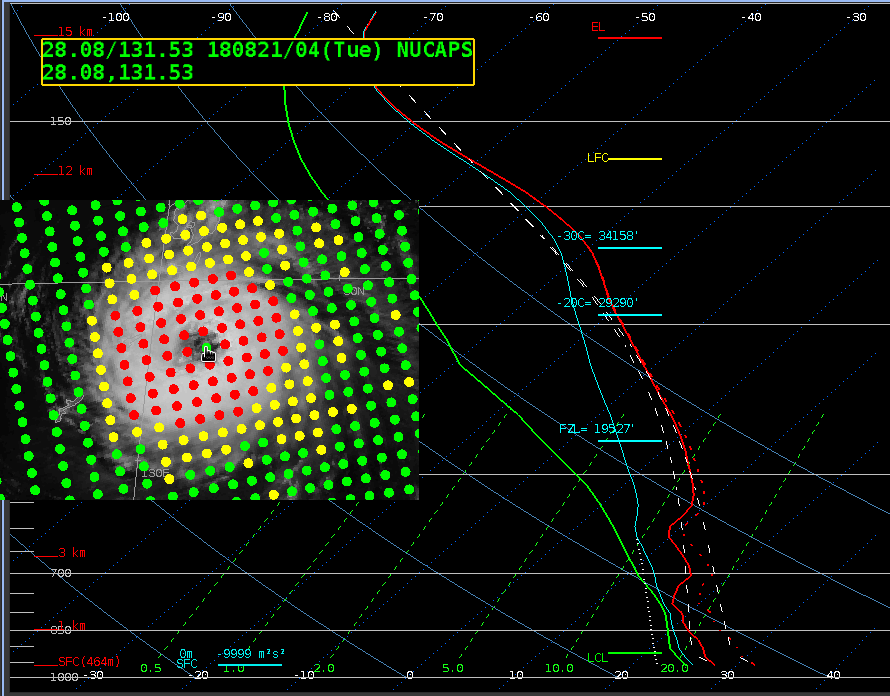
Soulik’s eye was wide enough that a NUCAPS soundings retrieval (Click here for more information on NUCAPS soundings) could be made from data collected during a Suomi-NPP overpass at 0350 UTC on 21 August 2018. Note the green sounding location within Soulik’s eye — Green dots denote regions where the infrared retrieval was successful. The sounding at that point is shown below. (NUCAPS imagery courtesy Landon Aydlett, WFO Guam).
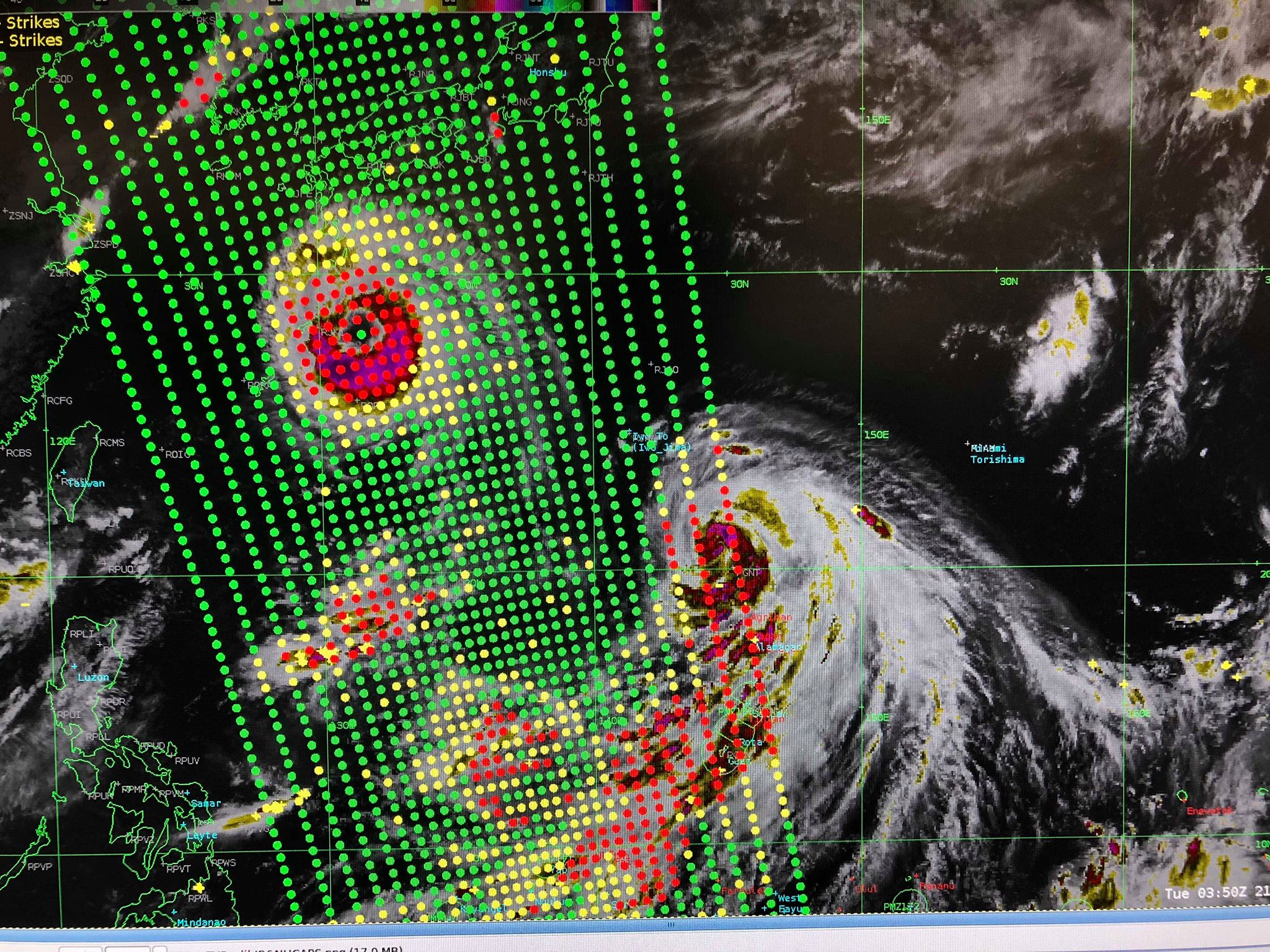
Suomi NPP NUCAPS sounding locations at 0350 UTC on 21 August 2018 on top of AHI 10.4 µm Clean Window imagery (Click to enlarge)
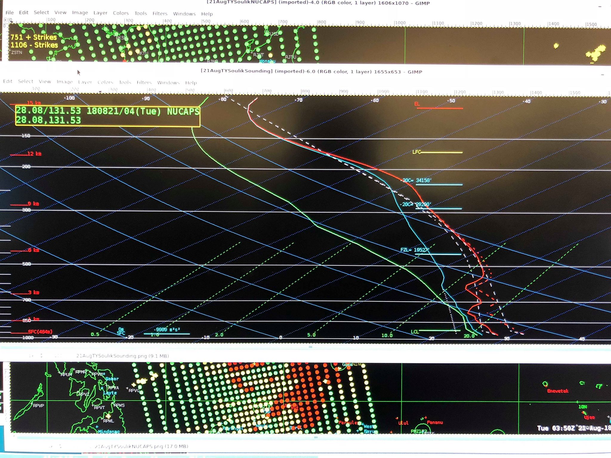
Suomi NPP NUCAPS Sounding within the eye of Soulik at 0350 UTC on 21 August 2018 (Click to enlarge)
You can use NUCAPS Soundings to diagnose the difference between the environment in the storm eye, and in the surrounding environment. The animation below shows locations of 5 soundings, one in the Eye, and one north, east, south and west of the CDO. The five selected soundings are shown at the bottom, with insets showing which sounding is which. The sounding in the eye shows remarkable warmth, as expected: at 555 hPa, for example, eye temperatures are around 8º C; values at the 4 outside points range from 0.4º to 2.9º C. Sounding parameters as viewed in AWIPS can be seen here.
Suomi NPP NUCAPS Sounding Points overlain on a Day Night Band Image, ~0350 UTC on 21 August 2018 (Click to enlarge). Sounding locations are indicated.
NUCAPS Soundings in and around Typhoon Soulik at the locations indicated, ~0350 UTC on 21 August 2018 (Click to enlarge)
Soulik’s path is projected to remain south of Japan and approach the Korean Peninsula by mid-week. For more information on Soulik, consult the CIMSS/SSEC Tropical Weather Website, or the Joint Typhoon Warning Center.