SAR winds with convection over Lake Superior
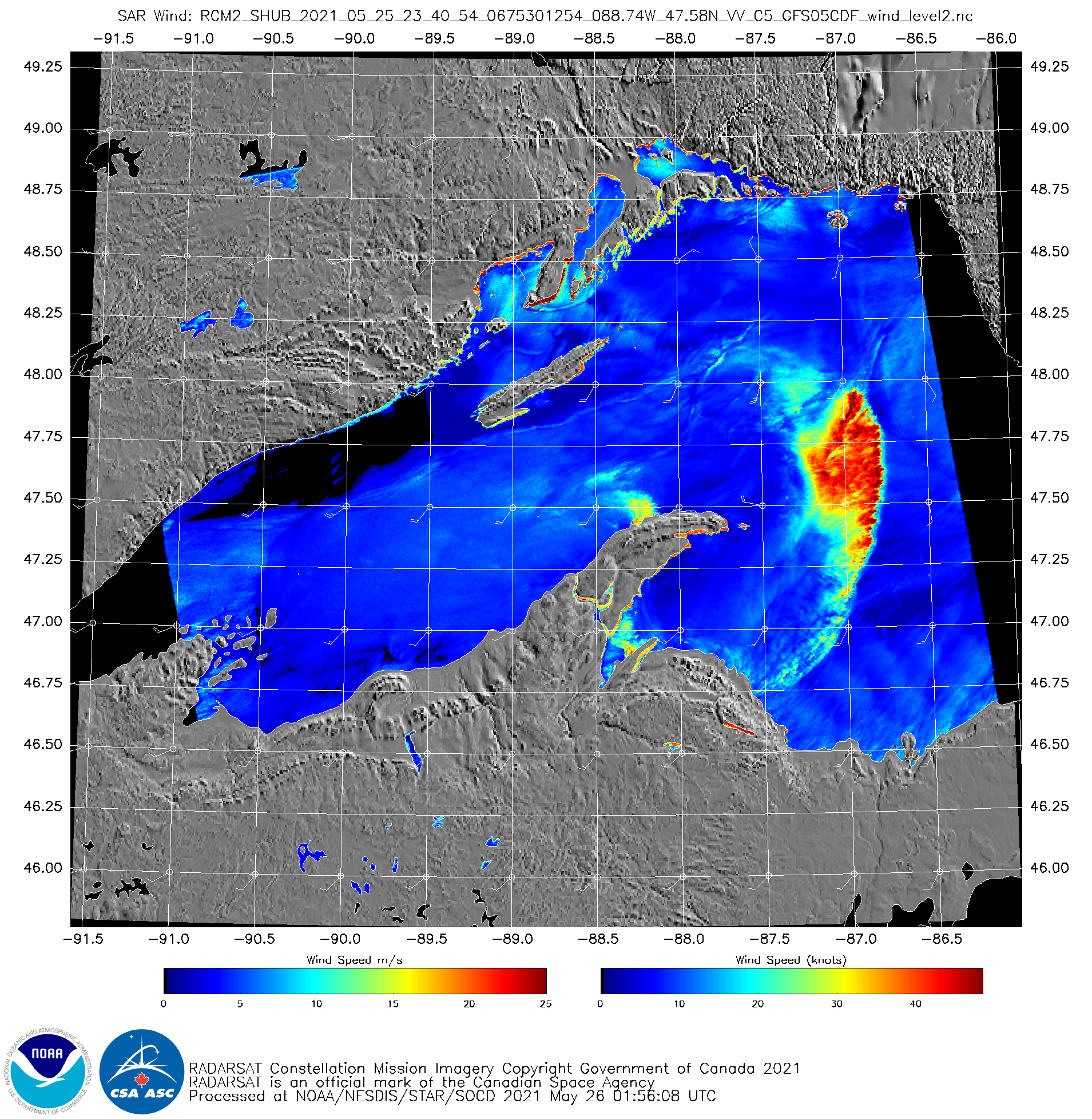
GOES-16 visible imagery, above, shows a line of convection moving over Lake Superior late in the day on 25 May 2021. Merged MRMS Radar Reflectivity at 2340 UTC, below, (from this website) shows radar echoes approaching 45 dBz (at a fair distance from the radars being used to produce the imagery). What... Read More
