Interpreting SAR data over the Bering Sea
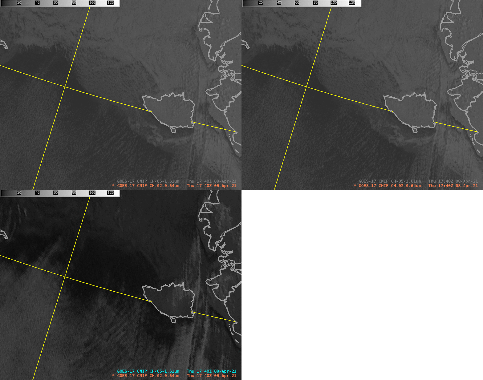
The toggle above shows GOES-17 ABI Band 2 (“Red Visible” at 0.64 µm) and Band 5 (“Snow/Ice” at 1.61 µm) imagery at 1740 UTC on 8 April 2021. 60ºN and 170ºW lat/lon lines are included in yellow, as well as Nunivak Island. There is evidence of sea ice extending from south of Nunivak northwestward; visible 0.64 µm imagery shows much greater reflectance compared to 1.61 µm snow/ice imagery. It’s much harder to view the ice edge in the snow/ice channel because reflectances in that channel for ice and water are similar.
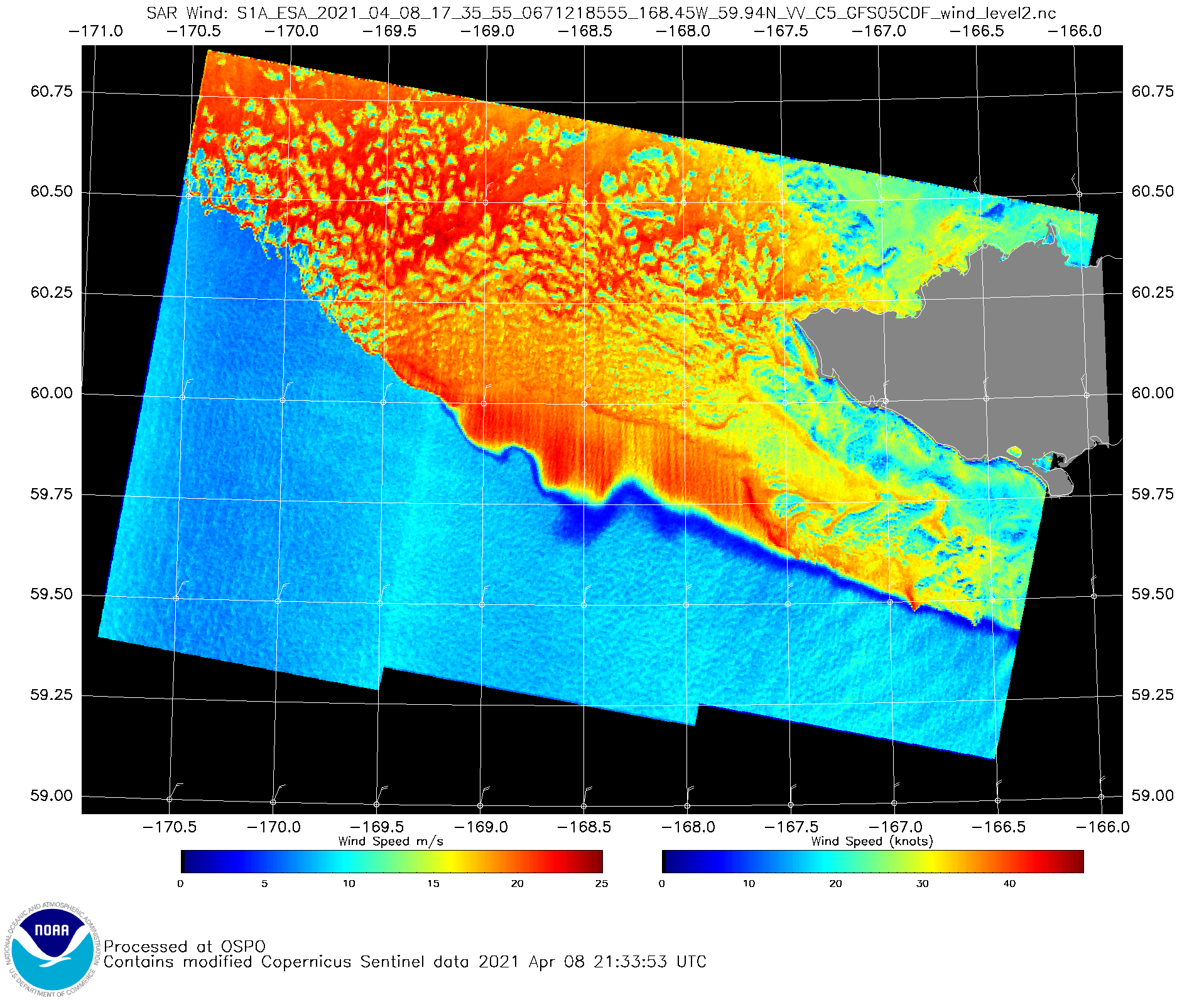
Compare the toggle above to the Sentinel-1A Synthetic Aperture Radar (SAR) image at 1735 UTC on 8 April 2021, shown below. The stark wind difference (red vs. blue) in the SAR wind image below is in reality a change in ocean state, with ice over the red region and open water over the blue. (Here is the Sea Ice analysis for 8 April from the Alaska Sea Ice Program (ASIP)). Interpretation of SAR winds requires a knowledge of the presence of ice.


