SAR winds with convection over Lake Superior
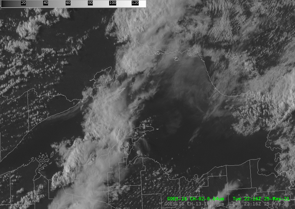
GOES-16 Band 2 (0.64 µm, “Red Visible”) imagery, 2216 UTC on 25 May – 0126 UTC on 26 May 2021 (Click to animate)
GOES-16 visible imagery, above, shows a line of convection moving over Lake Superior late in the day on 25 May 2021. Merged MRMS Radar Reflectivity at 2340 UTC, below, (from this website) shows radar echoes approaching 45 dBz (at a fair distance from the radars being used to produce the imagery). What kind of surface winds are likely associated with this system in the middle of Lake?

Merged MRMS Reflectivity, 2340 UTC on 25 May 2021 (click to enlarge)
Synthetic Aperture Radar data from the Canadian satellite RADARSat Constellation Mission-3 (RCM3), below, (from this website), shows winds in excess of 50 knots. The winds show a bowing structure as well. RCM data are very useful in lake/oceanic regions where surface data are sparse.
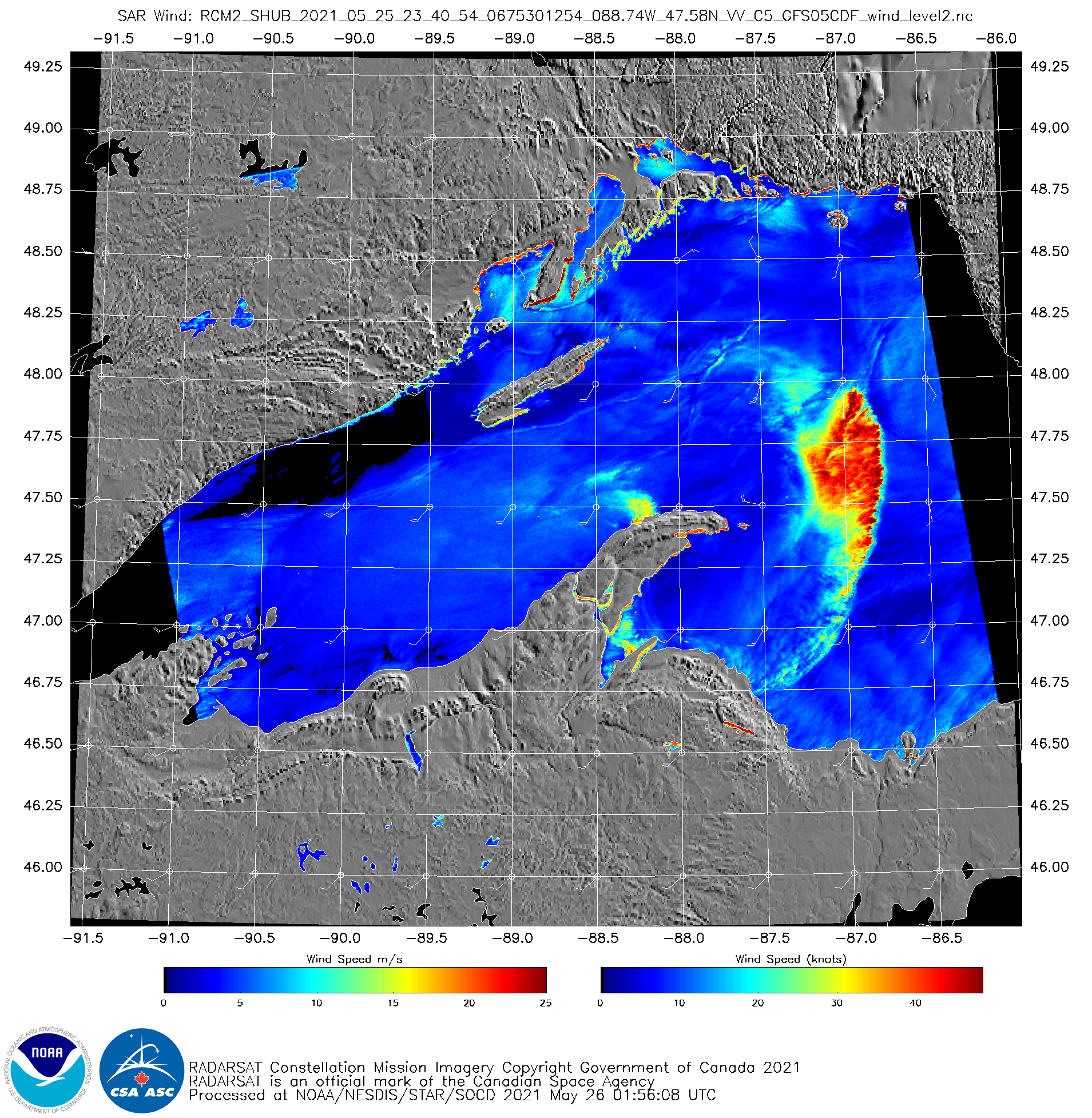
RCM3 SAR Winds over Lake Superior, 2339 UTC on 25 May 2021 (Click to enlarge)