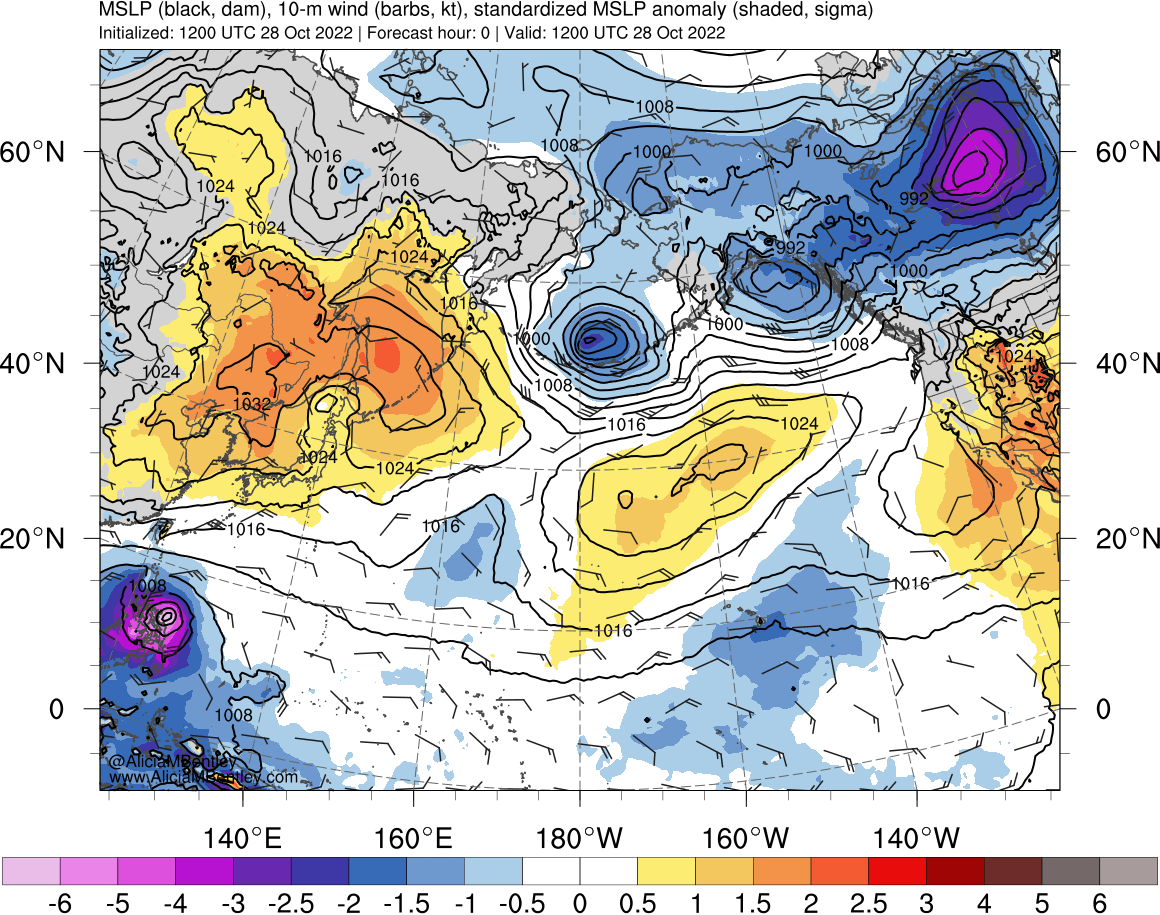
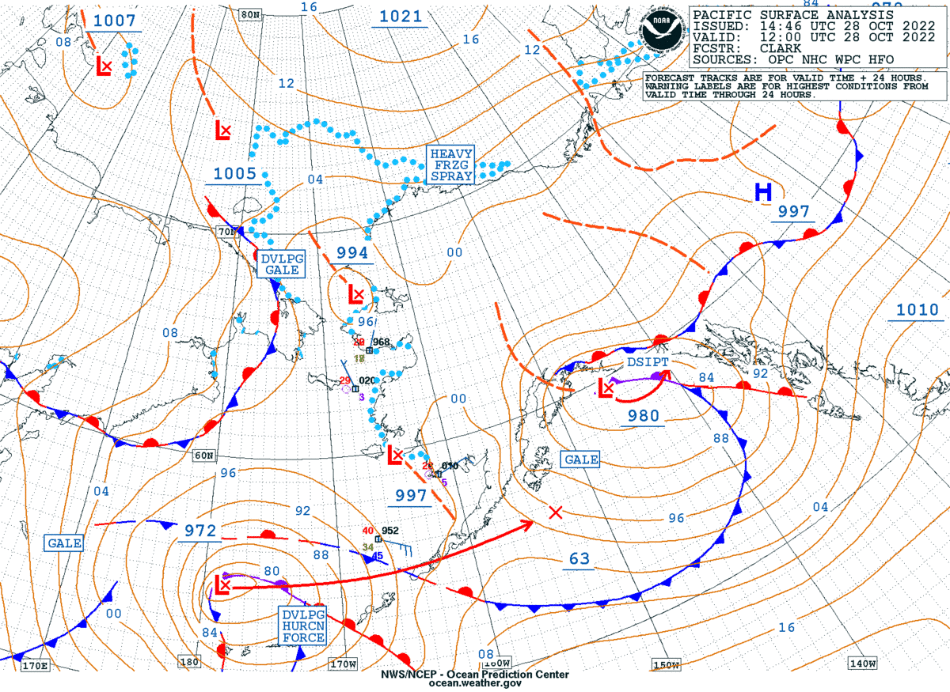
Hurricane Force low in the southern Bering Sea
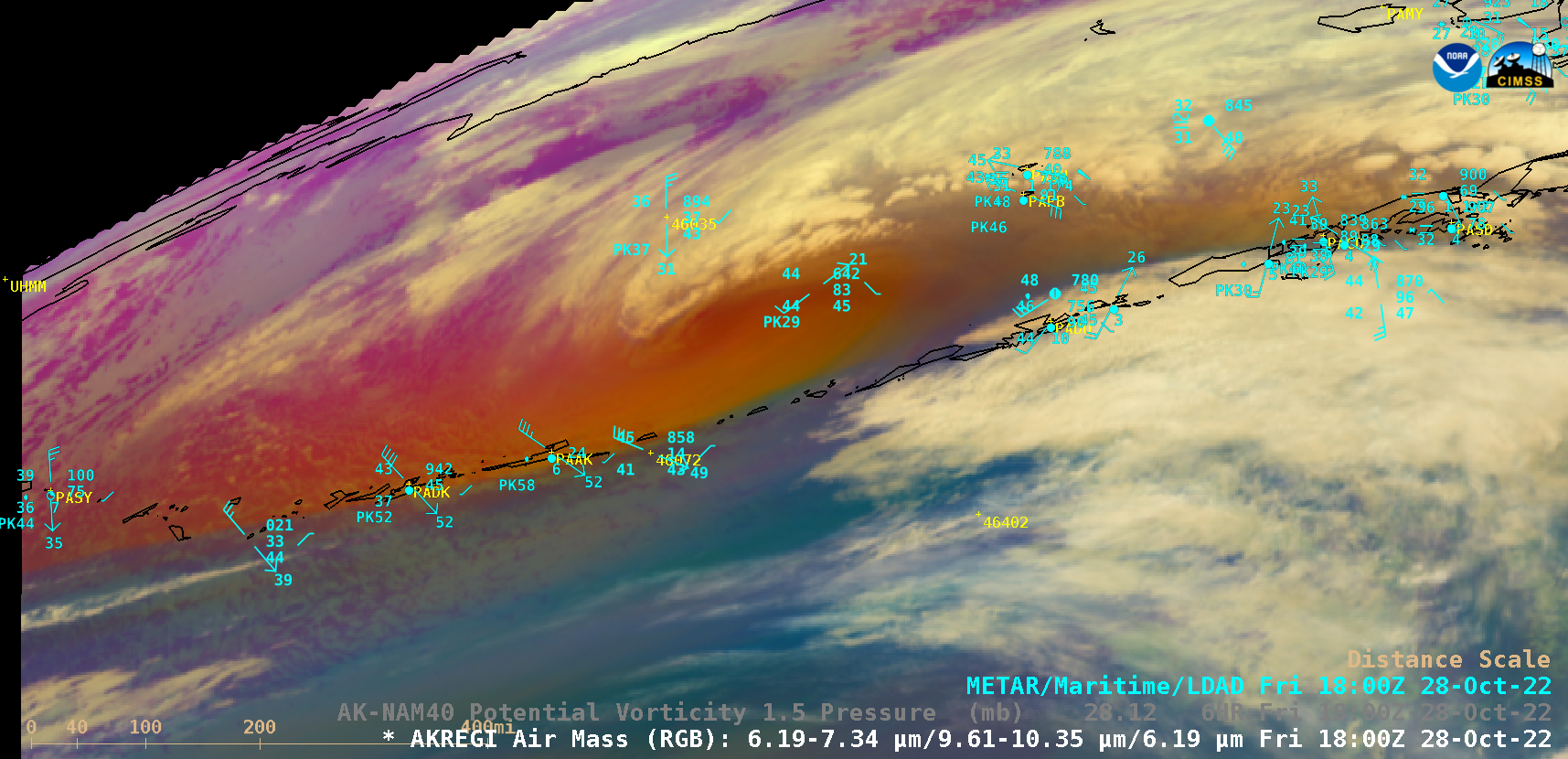
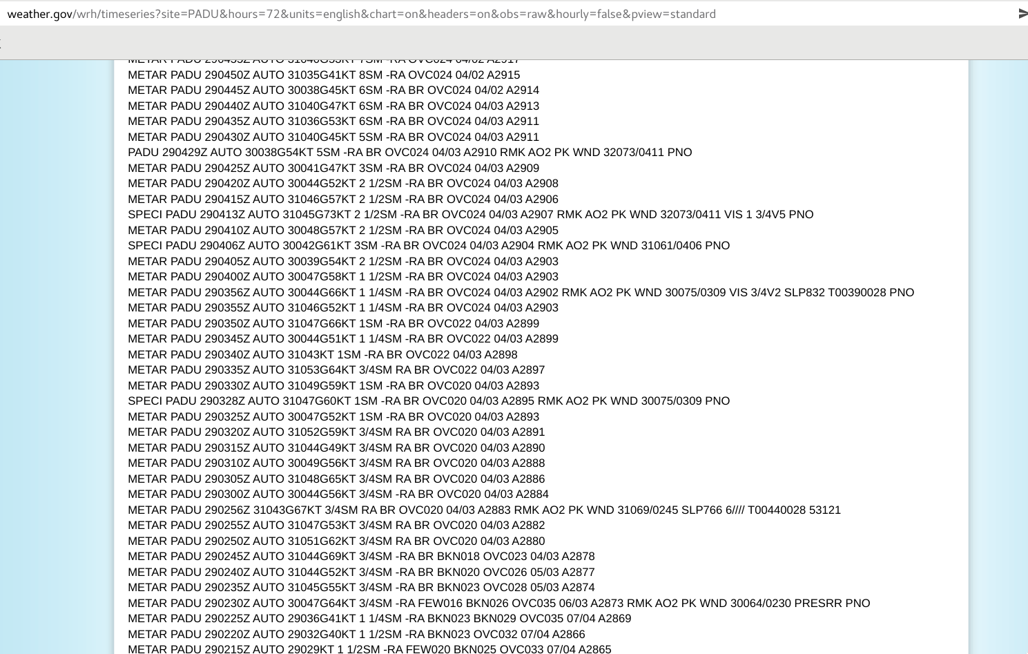
An anomalously-deep Hurricane Force low (surface analyses) moved eastward across the southern Bering Sea and eastern Aleutian Islands on 28 October 2022. GOES-18 (GOES-West) Air Mass RGB images (above) included plots of hourly surface reports — which showed some of the strong winds produced by this storm. Peak wind gusts included 75 knots / 86 mph... Read More
