Pyrocumulonimbus clouds in Oregon, Idaho and California
An extended period of hot temperatures across much of the western US — where drought conditions were widespread — helped set the stage for large wildfires which produced several pyrocumulonimbus (pyroCb) clouds in parts of Oregon, Idaho and California during the 07-10 September 2022 period.
===== 07 September =====
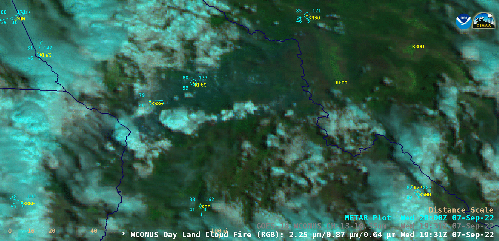
GOES-18 Day Land Cloud Fire RGB images [click to play animated GIF | MP4]
1-minute GOES-18 True Color RGB images visualized using CSPP GeoSphere (below) showed the smoke-laden cloud tops (shades of tan) associated with some of the pyroCb pulses from the eastern Oregon and central Idaho wildfires.
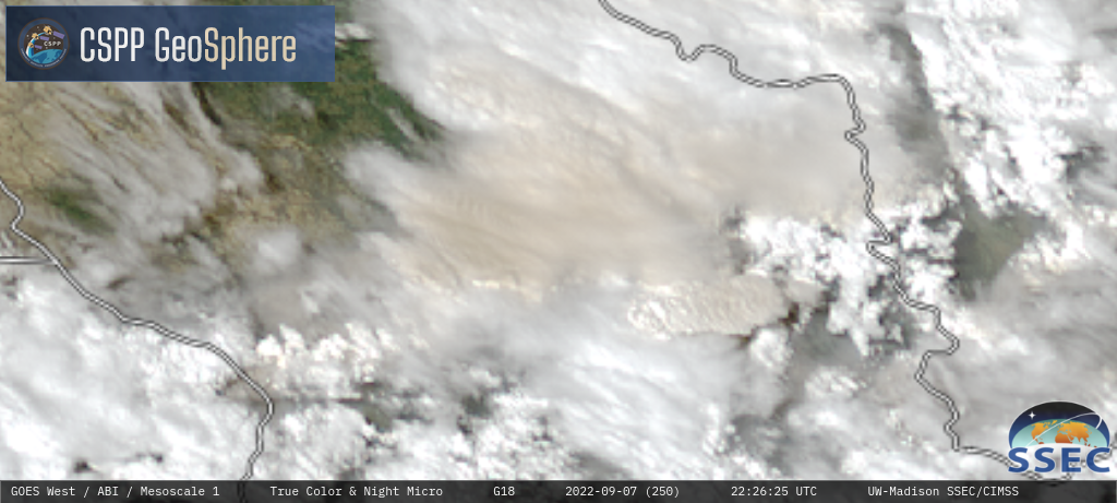
GOES-18 True Color RGB images [click to play MP4 animation]

GOES-18 Day Land Cloud Fire RGB (top left), Shortwave Infrared (3.9 µm, top right), Infrared Window (10.35 µm, bottom left) and Cloud Top Temperature (bottom right) [click to play animated GIF | MP4]
===== 08 September =====
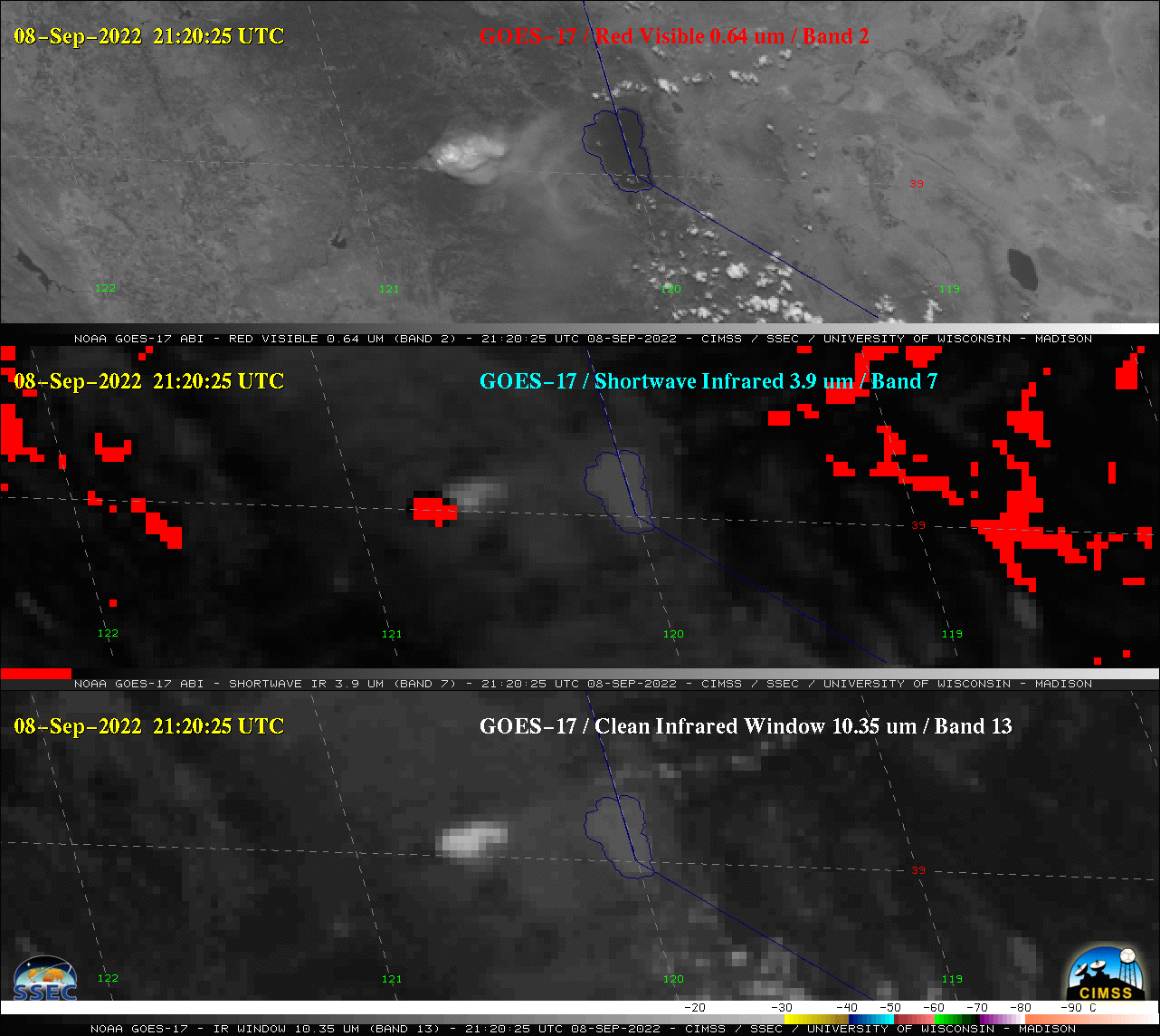
GOES-17 “Red” Visible (0.64 µm, top), Shortwave Infrared (3.9 µm, middle) and “Clean” Infrared Window (10.35 µm, bottom) [click to play animated GIF | MP4]
1-minute GOES-17 True Color RGB images (below) displayed the smoke-laden (shades of tan) cloud top of this “marginal pyroCb”.
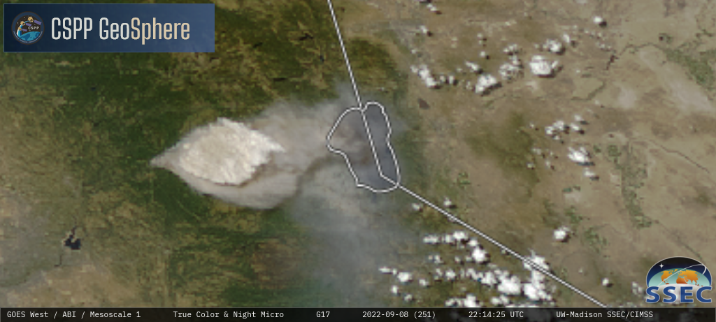
GOES-17 True Color RGB images [click to play MP4 animation]
===== 10 September =====
As discussed in this blog post, the Cedar Creek Fire in Oregon had been producing a large smoke plume during the day on 09 September — and this trend continued into the overnight hours, as shown by a Suomi-NPP VIIRS Day/Night Band (0.7 µm) image valid at 1020 UTC on 10 September (below). Ample illumination by a Full Moon provided an excellent example of the “visible image at night” capability of the Day/Night Band (DNB).
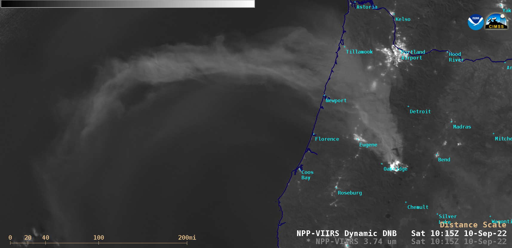
Suomi-NPP VIIRS Day/Night Band (0.7 µm) image, valid at 1020 UTC on 10 September [click to enlarge]
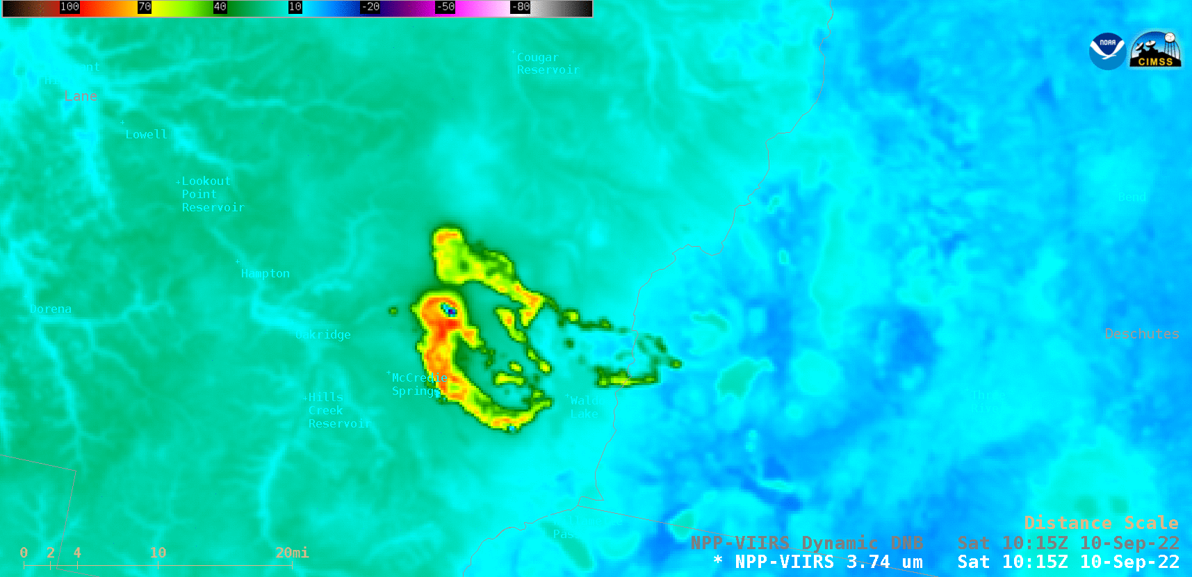
Suomi-NPP VIIRS Day/Night Band (0.7 µm) and Shortwave Infrared (11.45 µm) images, valid at 1020 UTC on 10 September [click to enlarge]
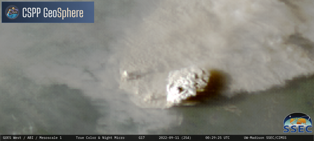
During the subsequent daytime hours, a sequence of 1-minute GOES-17 Day Land Cloud Fire RGB, Shortwave Infrared (3.9 µm), “Clean” Infrared Window (10.35 µm) and Cloud Top Temperature product (below) showed that the Cedar Creek Fire produced a pyroCb cloud late in the day on 10 September 2022. During that particular time period, the maximum surface 3.9 µm infrared brightness temperature of the fire signature reached 138.71oC (the saturation temperature of GOES-17 ABI Band 7 detectors). The coldest cloud-top 10.35 µm infrared brightness temperature was -45oC, while the coldest Cloud Top Temperature derived product value was -49oC.

Sequence of GOES-17 Day Land Cloud Fire RGB, Shortwave Infrared (3.9 µm), “Clean” Infrared Window (10.35 µm) and Cloud Top Temperature product [click to play animated GIF | MP4]
GOES-17 True Color RGB images [click to play MP4 animation]
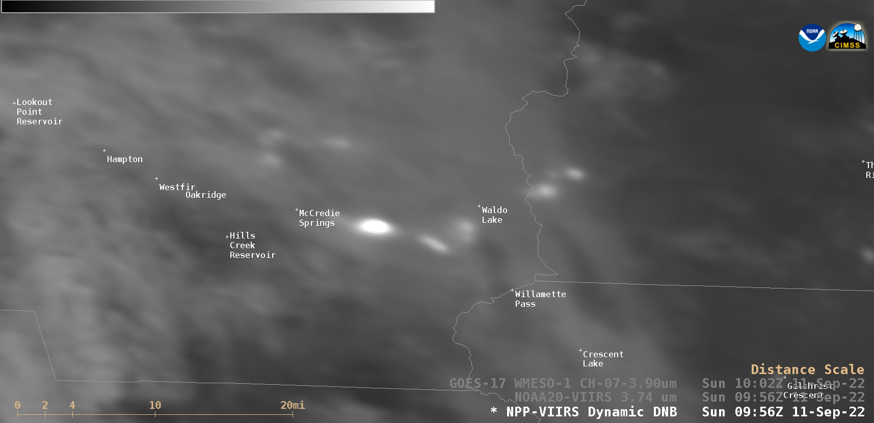
Suomi-NPP VIIRS Day/Night Band (0.7 µm) and Shortwave Infrared (11.45 µm) images, valid at 1002 UTC on 11 September [click to enlarge]