Paper mill fire in New Jersey
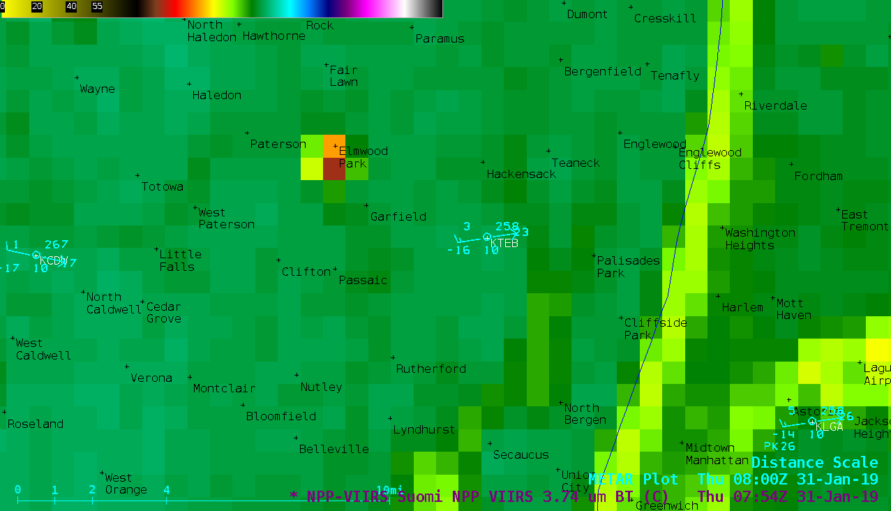
1-minute Mesoscale Domain Sector GOES-16 (GOES-East) Near-Infrared “Snow/Ice” (1.61 µm), Near-Infrared “Cloud Particle Size” (2.24 µm) and Shortwave Infrared (3.9 µm) images (above) displayed thermal signatures from a large fire at the Marcal Paper Mill in Elmwood Park, New Jersey during the evening hours of 30 January 2019. The fire reportedly began around 2215 UTC or 5:15... Read More
