This website works best with a newer web browser such as Chrome, Firefox, Safari or Microsoft Edge. Internet Explorer is not supported by this website.

Category: Lightning

Record 1-hour rainfall accumulation at Sarasota, Florida

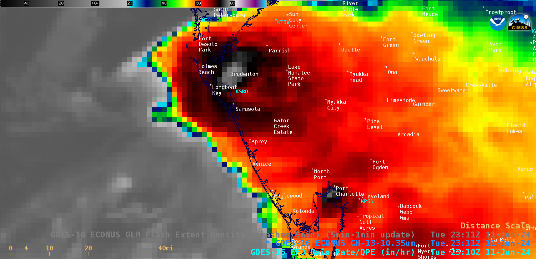
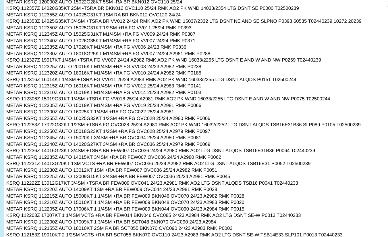
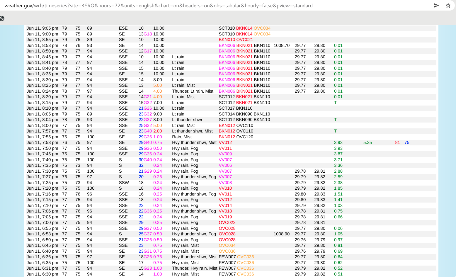
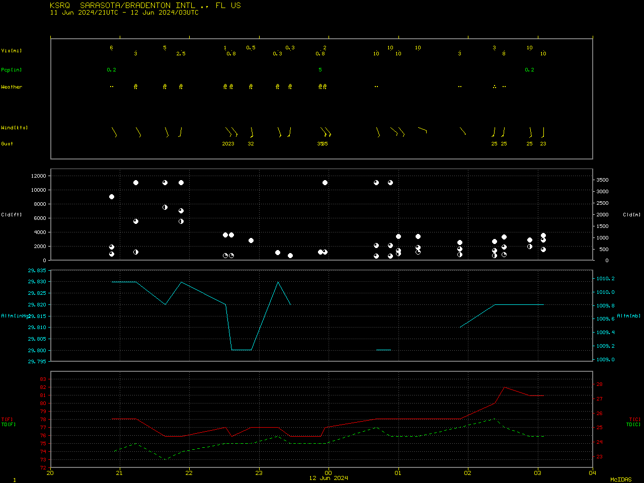
5-minute CONUS Sector GOES-16 (GOES-East) “Clean” Infrared Window (10.3 µm) images (above) displayed areas of convection that moved inland along the west coast of Florida on 11 June 2024. Sarasota/Bradenton International Airport received very heavy rainfall (3.93 inches) during the 1-hour period ending at 2353 UTC or 7:53 PM local time (METARs | decoded surface reports | plot of surface report data) —... Read More

30-second images of thunderstorms that produced tornadoes and damaging winds (with some fatalities) in the Houston, Texas area

Overlapping 1-minute Mesoscale Domain Sectors provided 30-second interval GOES-16 (GOES-East) “Red” Visible (0.64 µm) and “Clean” Infrared Window (10.3 µm) images (above) — which showed thunderstorms that produced two EF1-rated tornadoes as well as damaging winds (resulting in some fatalities) across the Houston area (SPC Storm Reports) on 16 May 2024. Widespread structural damage occurred in downtown Houston — and there were also... Read More

Deadly tornado in Middle Tennessee

1-minute Mesoscale Domain Sector GOES-16 (GOES-East) “Red” Visible (0.64 µm) and “Clean” Infrared Window (10.3 µm) images (above) included plots of Severe Thunderstorm Warning and Tornado Warning polygons — which showed the supercell thunderstorm that produced EF3 damage and was responsible for 1 fatality in the Columbia area (just southwest of Nashville) on 08 May 2024 (SPC Storm Reports). Pulses of thunderstorm... Read More

Severe thunderstorms across Nebraska and Iowa

1-minute Mesoscale Domain Sector GOES-16 (GOES-East) Visible/Infrared Sandwich RGB images (above) showed thunderstorms that produced tornadoes, large hail and damaging winds (SPC Storm Reports) across eastern Nebraska and western Iowa on 26 April 2024.1-minute GOES-16 Visible/Infrared Sandwich RGB images with an overlay of GLM Flash Extent Density (below) showed the lightning activity associated with this convection — which included some notable lightning jumps as tornadic thunderstorms moved through the... Read More