Severe thunderstorms across Nebraska and Iowa

1-minute GOES-16 Visible/Infrared Sandwich RGB images with time-matched Local Storm Reports plotted in yellow, from 1700-2320 UTC on 26 April [click to play animated GIF | MP4]
1-minute GOES-16 Visible/Infrared Sandwich RGB images with an overlay of GLM Flash Extent Density (below) showed the lightning activity associated with this convection — which included some notable lightning jumps as tornadic thunderstorms moved through the Omaha area (producing the EF3-rated Elkhorn tornado) beginning about 2040 UTC.

1-minute GOES-16 Visible/Infrared Sandwich RGB images with an overlay of GLM Flash Extent Density and time-matched Local Storm Reports plotted in yellow, from 1700-2320 UTC on 26 April [click to play animated GIF | MP4]

1-minute GOES-16 “Clean” Infrared Window (10.3 µm) images with time-matched Local Storm Reports plotted in white, from 1630 UTC on 26 April to 0202 UTC on 27 April [click to play animated GIF | MP4]
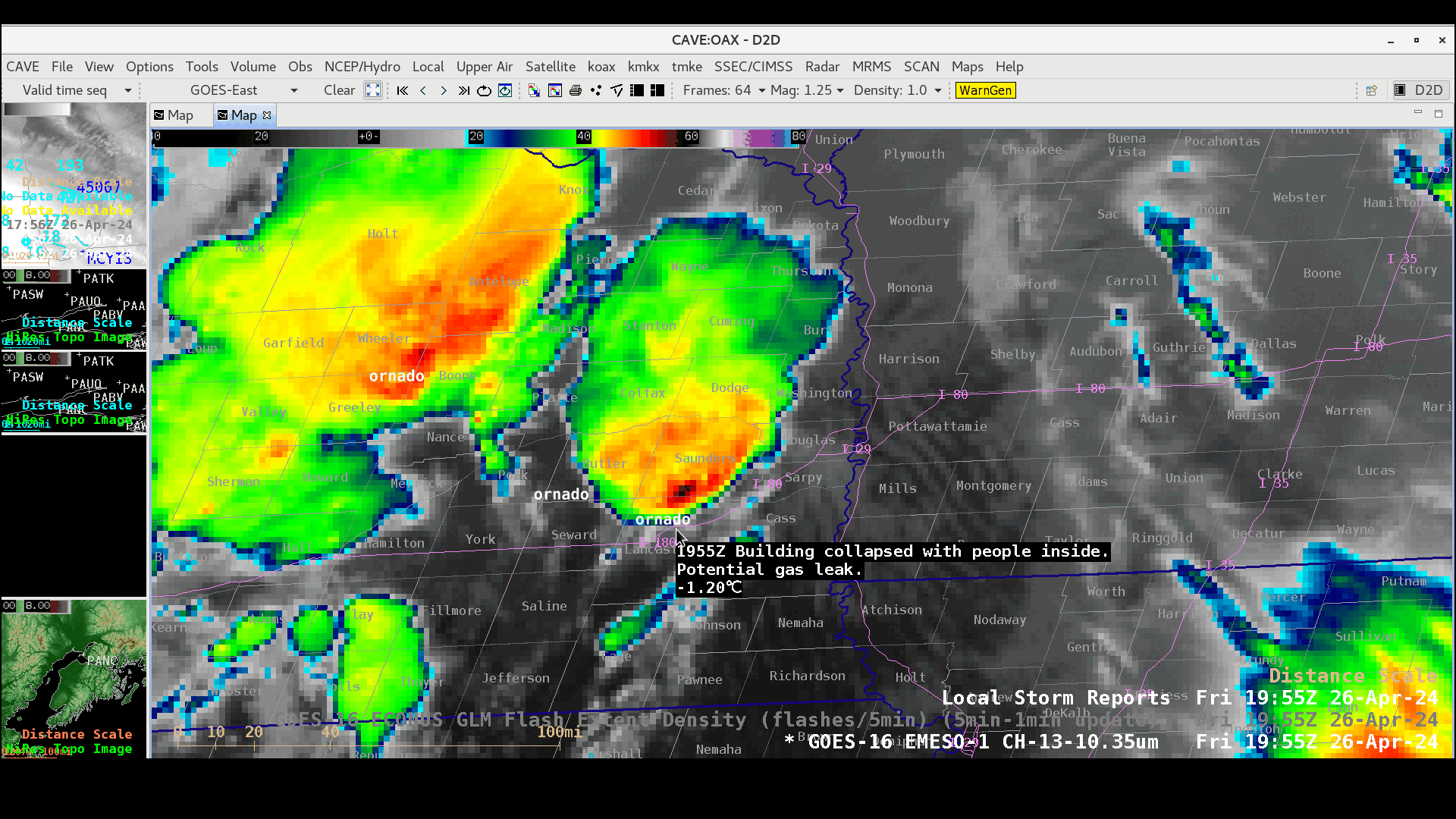
Cursor sample of select Tornado Local Storm Reports across eastern Nebraska and western Iowa, from 1955-2305 UTC on 26 April [click to play animated GIF]
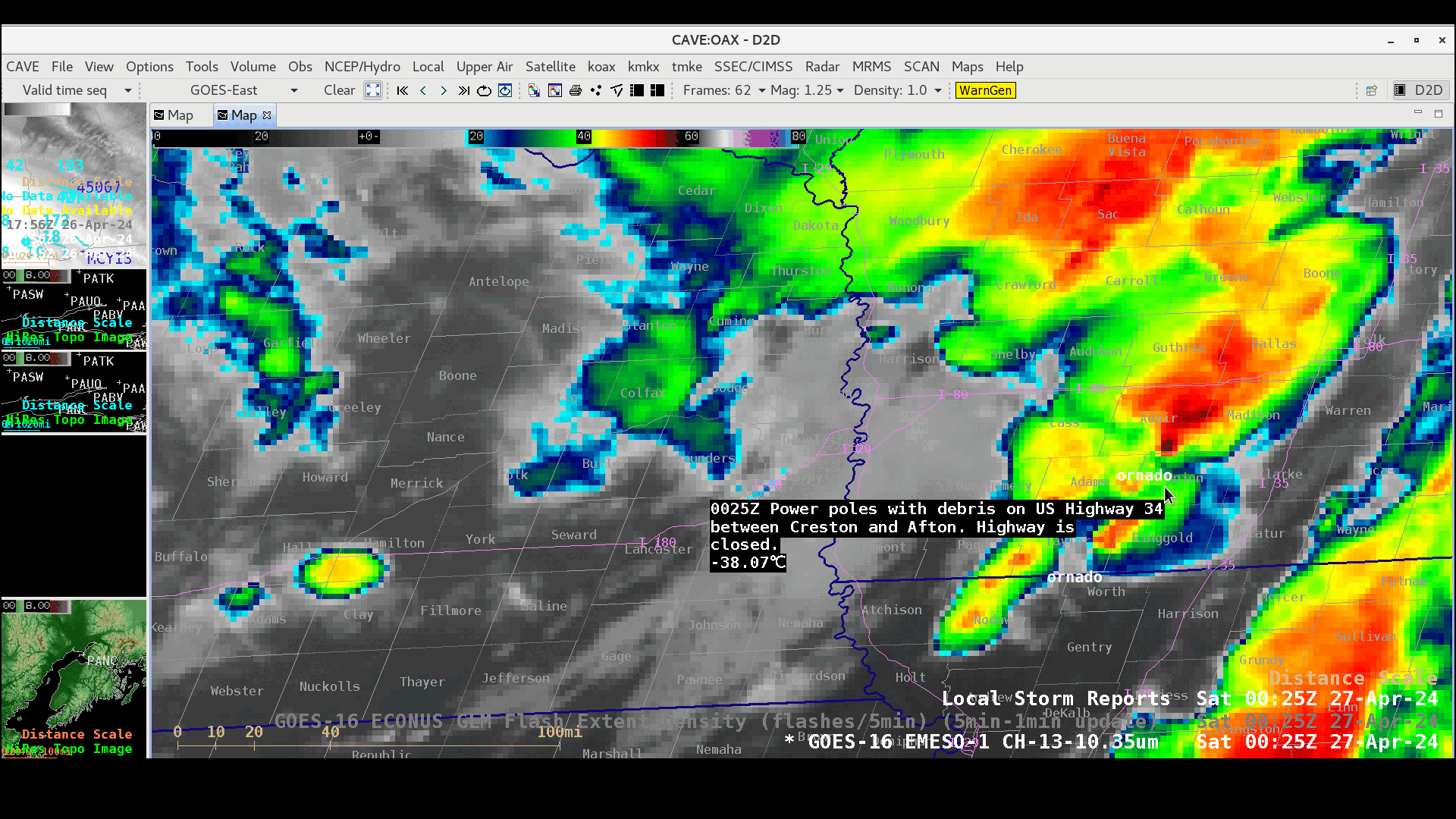
Cursor sample of select Tornado Local Storm Reports across western and central Iowa, from 0025-0159 UTC on 27 April [click to play animated GIF]

1-minute GOES-16 “Clean” Infrared Window (10.3 µm) images with an overlay of GLM Flash Extent Density and time-matched Local Storm Reports plotted in white, from 1630 UTC on 26 April to 0202 UTC on 27 April [click to play animated GIF | MP4]