Deadly tornado in Middle Tennessee

1-minute GOES-16 “Red” Visible (0.64 µm, top) and “Clean” Infrared Window (10.3 µm, bottom) images with plots of Severe Thunderstorm Warning (yellow) and Tornado Warning (red) polygons — with/without an overlay of GLM Flash Extent Density — from 2059 UTC on 08 May to 0000 UTC on 09 May [click to play animated GIF | MP4]
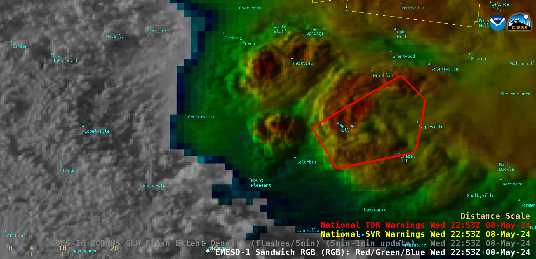
1-minute GOES-16 Visible/Infrared Sandwich RGB images (below) began to exhibit an Above-Anvil Cirrus Plume or AACP (reference | VISIT training | blog posts) about an hour before the tornado began near Columbia around 2237 UTC (damage survey). A Tornado Emergency (bold red polygon) was then issued for the Spring Hill area (and downstream locations) at 2253 UTC.
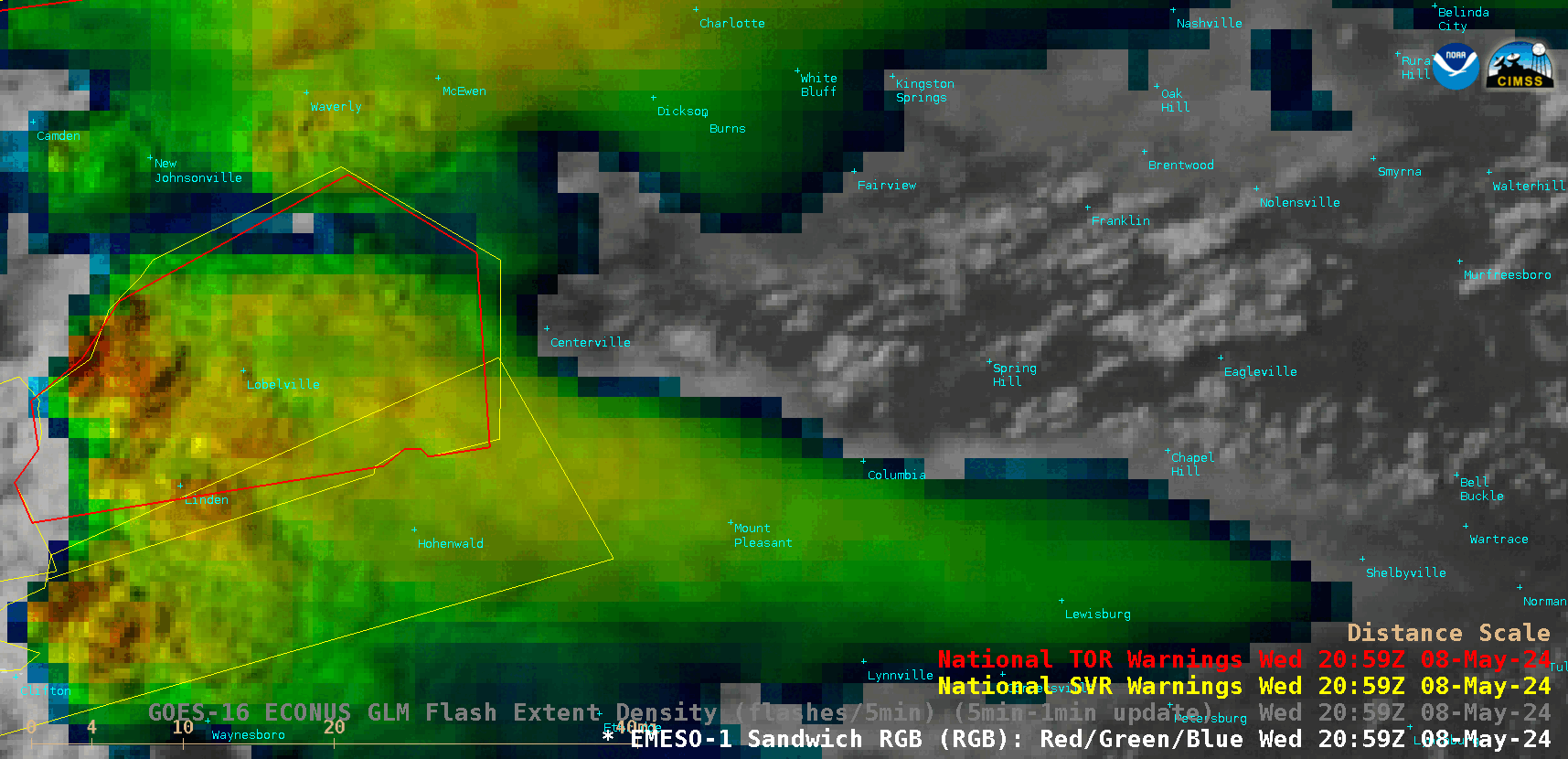
1-minute GOES-16 Visible/Infrared Sandwich RGB images with plots of Severe Thunderstorm Warning (yellow) and Tornado Warning (red) polygons, from 2059-2300 UTC on 08 May [click to play animated GIF | MP4]
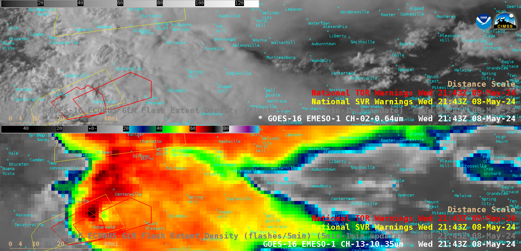
GOES-16 “Red” Visible (0.64 µm, top) and “Clean” Infrared Window (10.3 µm, bottom) images with plots of Severe Thunderstorm Warning (yellow) and Tornado Warning polygons (red) at 2143 UTC on 08 May [click to enlarge]
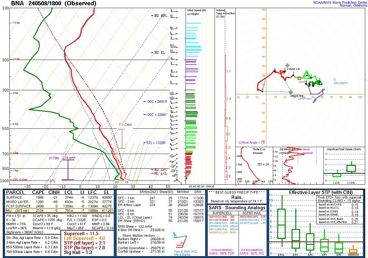
Plot of rawinsonde data from Nashville, Tennessee at 1800 UTC on 08 May [click to enlarge]
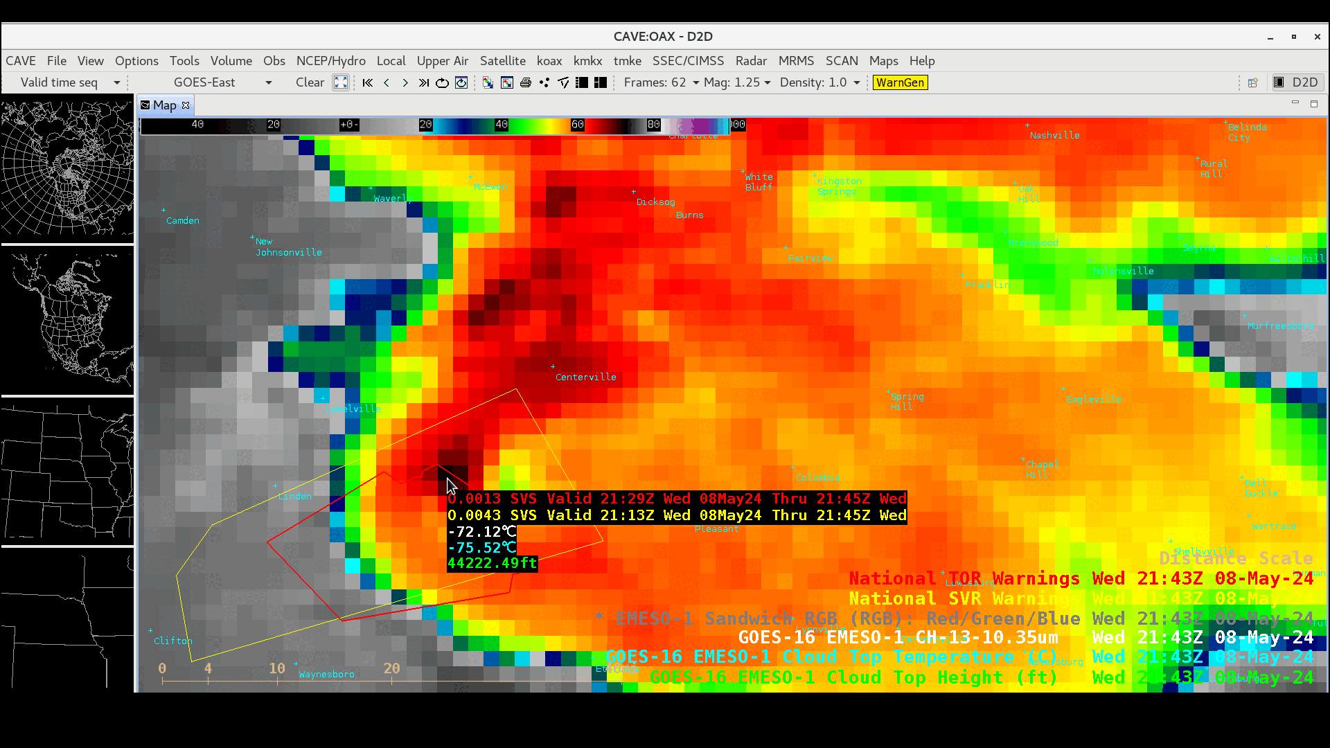
Cursor sample of GOES-16 “Clean” Infrared Window (10.3 µm) infrared brightness temperature (white) along with the Cloud Top Temperature (cyan) and Cloud Top Height (green) derived products for the cloud-top cold/warm couplet at 2143 UTC on 08 May [click to enlarge]