Category: GOES-17
GOES-17 sees Landsat 9 Rocket Plume
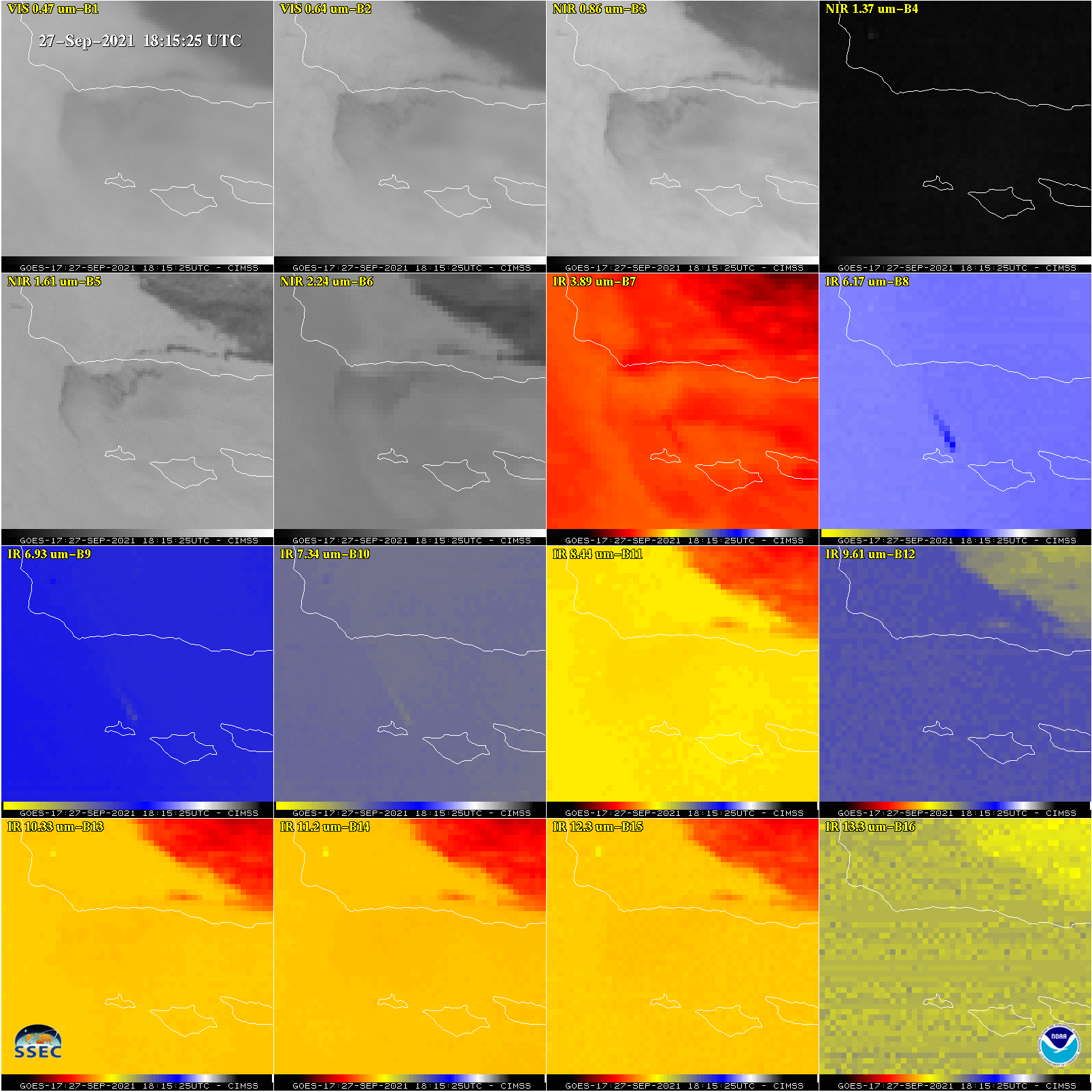
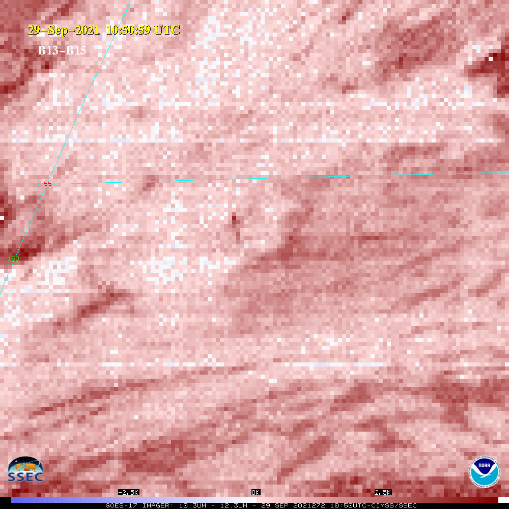
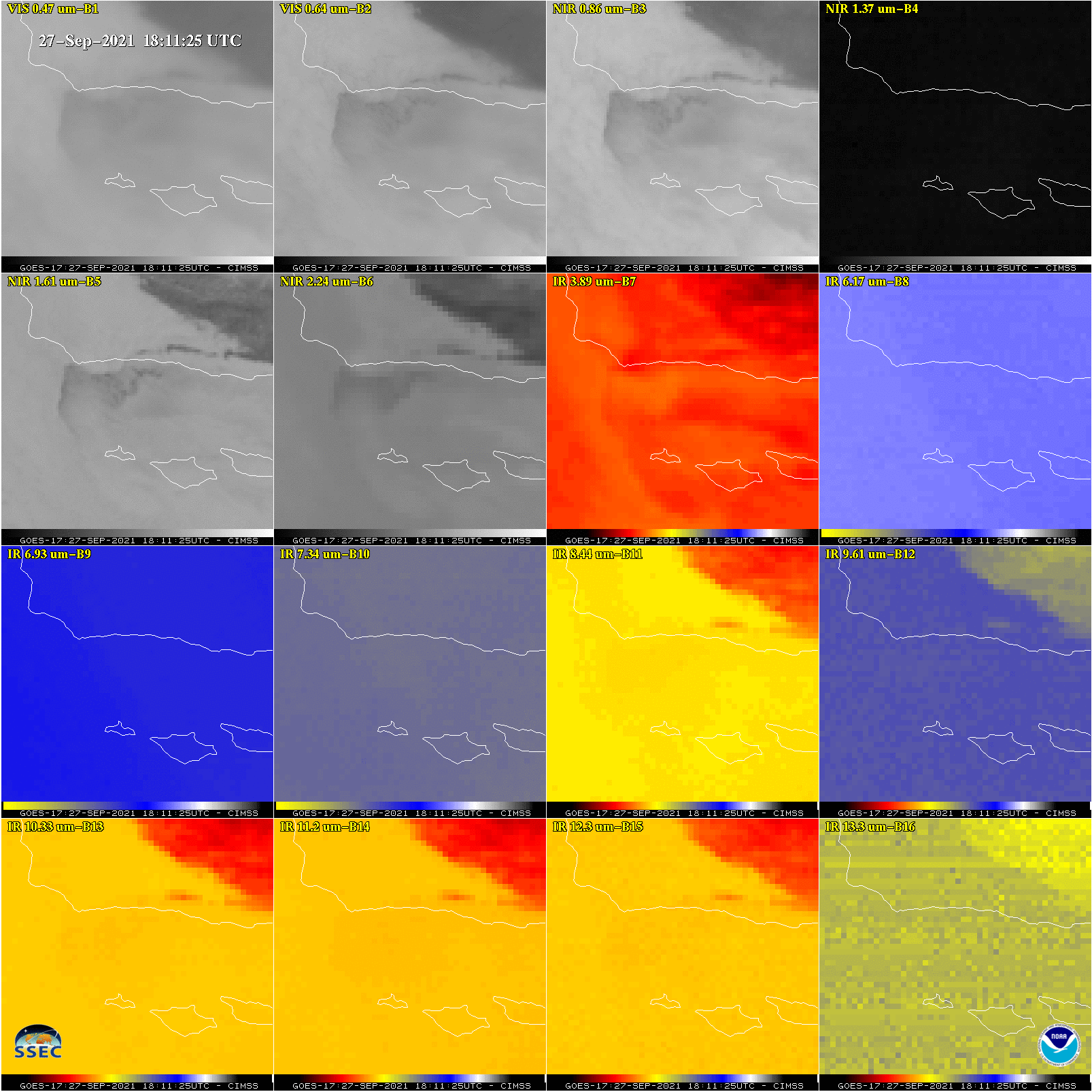
The ABI on NOAA‘s GOES-17 (GOES-West) was able to see the Landsat 9 rocket plume from Vandenberg Space Force base. The plume was most evident on ABI bands 7 (3.9 µm) and 8 (6.2 µm), using the mesoscale sector (1) on September 27, 2021.The same animation as above, but as an animated gif. The 18:15 UTC image. CONUS... Read More
Local Noon imagery near the Equinox
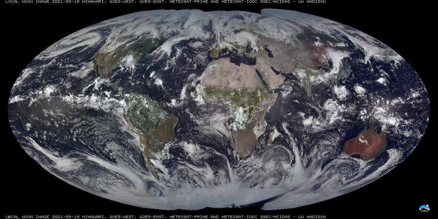
SSEC/CIMSS scientists (notably Rick Kohrs) create daily imagery that blends vertical strips of true-color imagery at local Noon, starting near the dateline and proceeding westward. A year-long animation of this product is available here, and was discussed on this blog previously here (and here). Recent images are available at this website... Read More
Pyrocumulonimbus clouds produced by the Cougar Peak Fire in Oregon
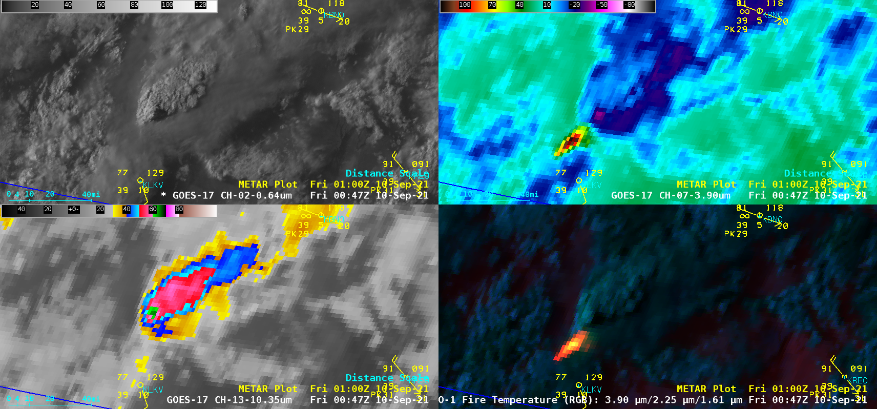
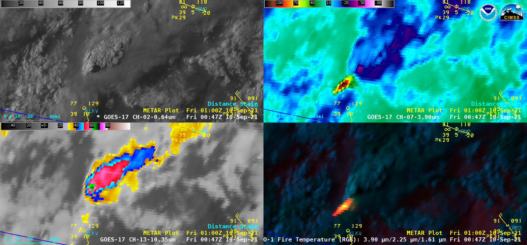
1-minute Mesoscale Domain Sector GOES-17 (GOES-West) “Red” Visible (0.64 µm), Shortwave Infrared (3.9 µm), “Clean” Infrared Window (10.35 µm) and Fire Temperature RGB images (above) revealed that the Cougar Peak Fire in southern Oregon produced a pair of pyrocumulonimbus (pyroCb) clouds— denoted by cloud-top 10.35 µm infrared brightness temperatures of -40ºC or colder (with the coldest being -64.9ºC at 0047 UTC) — late in the day... Read More
