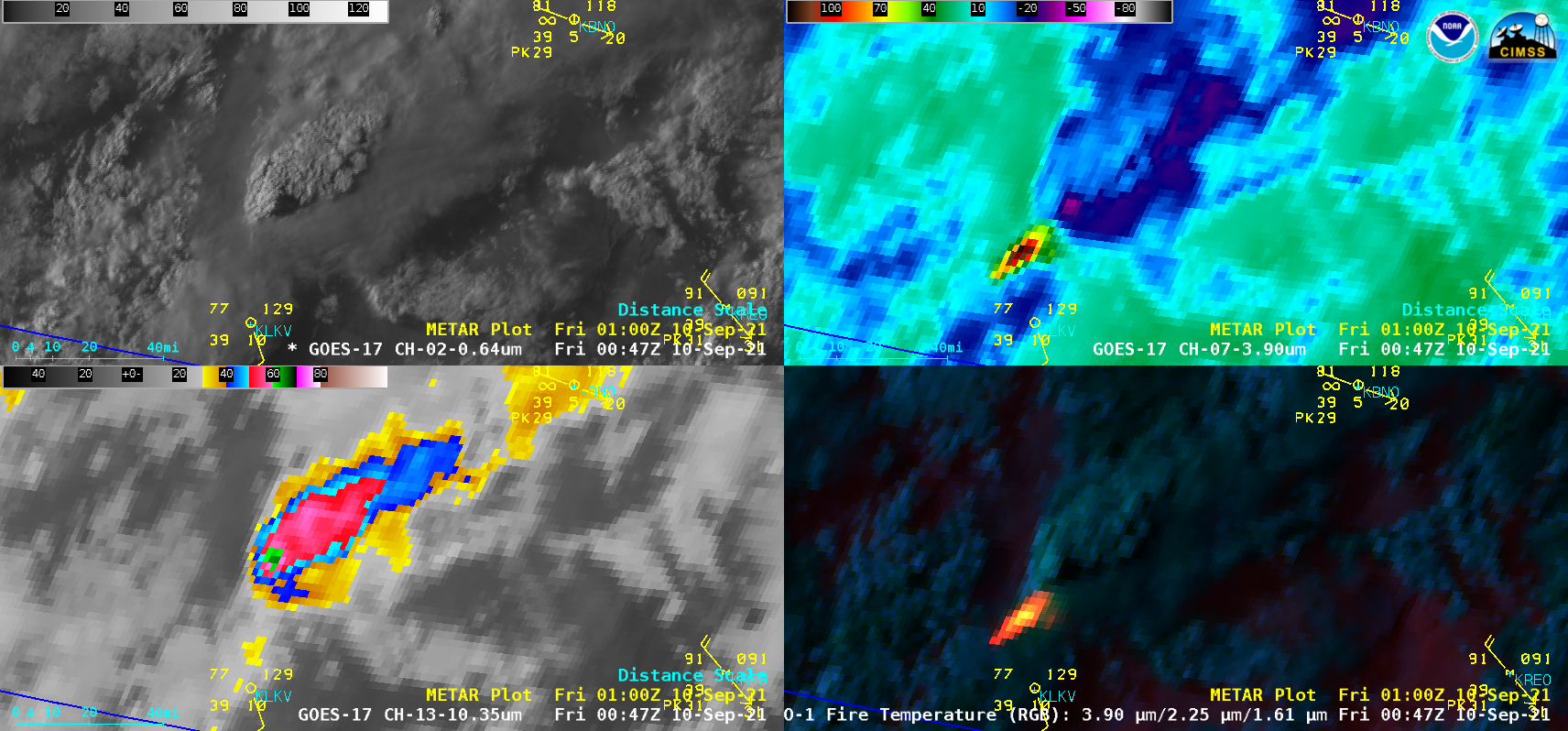
Pyrocumulonimbus clouds produced by the Cougar Peak Fire in Oregon

GOES-17 “Red” Visible (0.64 µm, top left), Shortwave Infrared (3.9 µm, top right), “Clean” Infrared Window (10.35 µm, bottom left), and Fire Temperature RGB (bottom right) [click to play animation | MP4]
1-minute Mesoscale Domain Sector GOES-17 (GOES-West) “Red” Visible (0.64 µm), Shortwave Infrared (3.9 µm), “Clean” Infrared Window (10.35 µm) and Fire Temperature RGB images (above) revealed that the Cougar Peak Fire in southern Oregon produced a pair of pyrocumulonimbus (pyroCb) clouds— denoted by cloud-top 10.35 µm infrared brightness temperatures of -40ºC or colder (with the coldest being -64.9ºC at 0047 UTC) — late in the day on 09 September 2021. The maximum surface 3.9 µm brightness temperature sensed with this fire was 138.7ºC — which is the saturation temperature for the ABI Band 7 detectors. Since it was exhibiting extreme fire behavior during this time, evacuation orders were being increased for the immediate area.
5-minute GOES-17 True Color RGB images created using Geo2Grid (below) showed a larger-scale view of the 2 pyroCb clouds. Also apparent were smoke-filled clouds — characterized by shades of tan to light brown — from fires in northern California, which were drifting north-northeastward across southern Oregon and the Cougar Peak Fire.
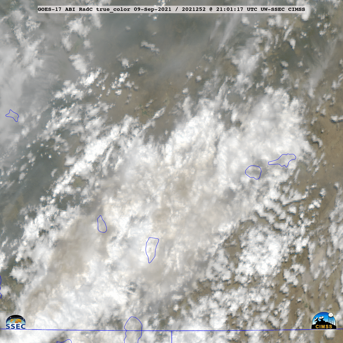
GOES-17 True Color RGB images [click to play animation | MP4]