This website works best with a newer web browser such as Chrome, Firefox, Safari or Microsoft Edge. Internet Explorer is not supported by this website.

Category: GOES-16

Thundersnow in the Upper Midwest, and 30-second imagery of severe thunderstorms across the Deep South

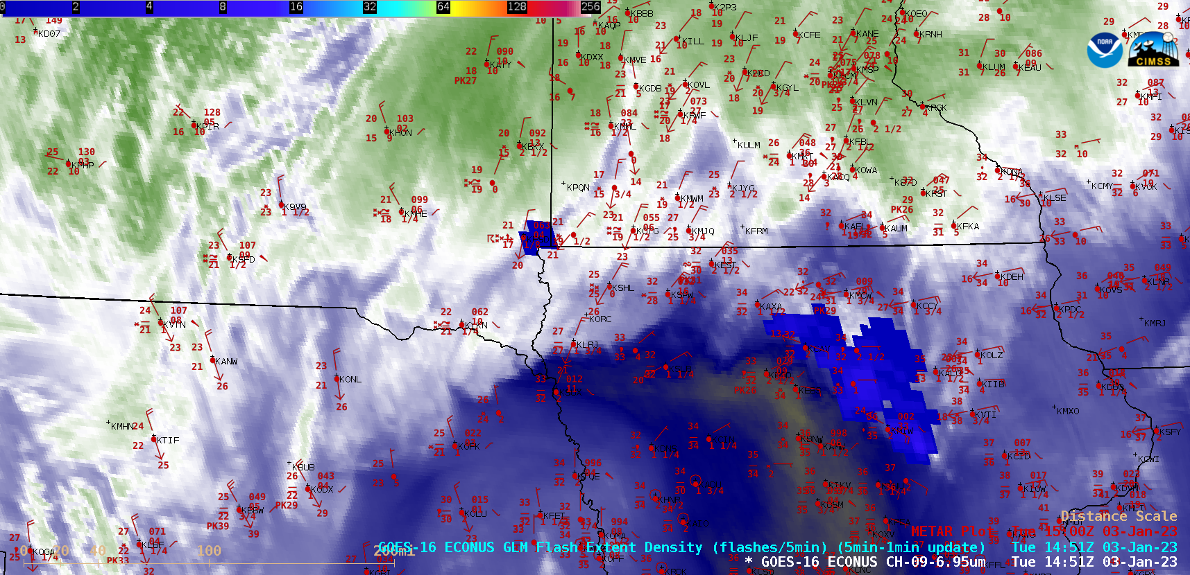
GOES-16 (GOES-East) Mid-level Water Vapor (6.9 µm) images with an overlay of GLM Flash Extent Density (above) covered part of a widespread winter storm event — which included thundersnow in parts of Nebraska, Iowa, South Dakota and Minnesota — that occurred on 03 January 2023. Areas that reported thundersnow experienced convectively-enhanced snowfall rates... Read More

There GOES 2022

Daily Full Disk imageryBy animating daily NOAA GOES-16 ABI Full Disk composite imagery, the year 2022 can be shown quickly. The GOES-16 loop below displays a 17 UTC image from each day of 2022 (the images are Rayleigh-corrected True Color RGB composites). This GOES-16 loop is similar to a loop... Read More