Warm Seclusion off the US East Coast
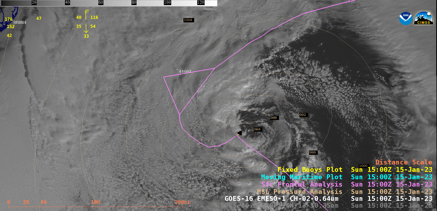
1-minute Mesoscale Domain Sector GOES-16 (GOES-East) “Red” Visible (0.64 µm) and “Clean” Infrared Window (10.3 µm) images (above) displayed the small eye-like feature associated with a warm seclusion that developed about 200 miles southeast of the New Jersey coast on 15 January 2023. Areas of deep convection around the periphery of the seclusion occasionally... Read More
