Satellite signature of blowing snow across the north-central US
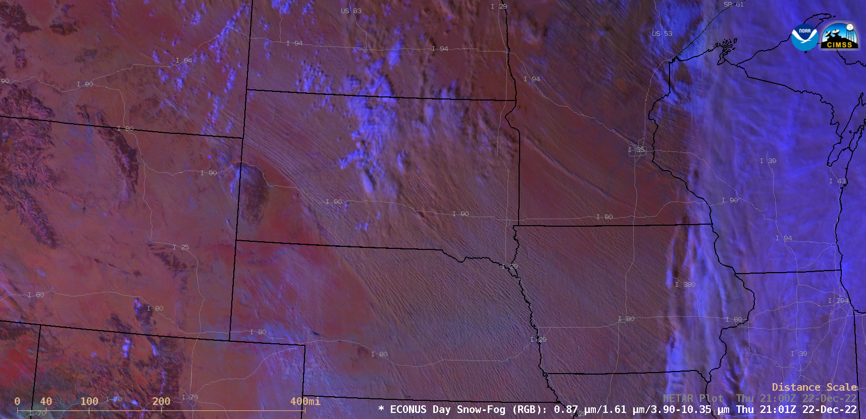
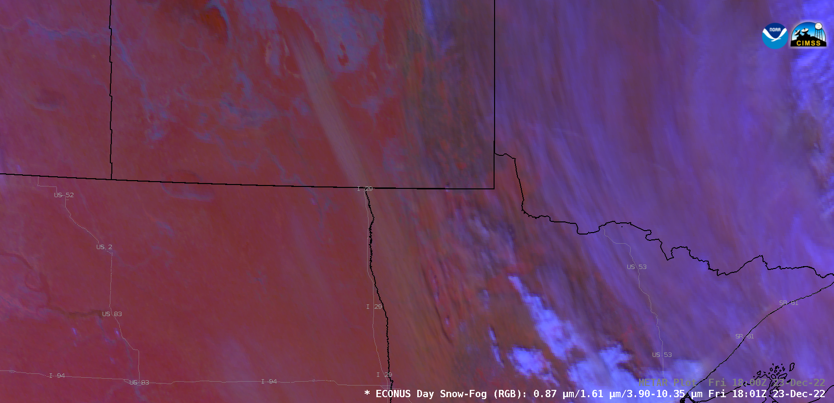
GOES-16 (GOES-East) Day Snow-Fog RGB images (above) showed widespread horizontal convective rolls (HCRs) that were streaming southeastward across much of the north-central US — in the wake of a strong arctic cold front — on 22 December 2022. This HCR signature is often accompanied by significant blowing snow; in fact, many Interstate highways were closed on this day in portions of North Dakota, South Dakota and Iowa. Wind gusts as high as 60 mph were recorded in South Dakota.On 23 December, GOES-16 Day Snow-Fog RGB images (below) displayed a long but narrow plume of HCRs that originated over the southern end of Lake Manitoba — which crossed the US/Canada border and streamed across far northeastern North Dakota and northwestern Minnesota. Surface visibility was reduced to 1/4 mile at some sites in Minnesota where the HCR signature was observed; wind gusts as high as 52 mph were reported across that area.
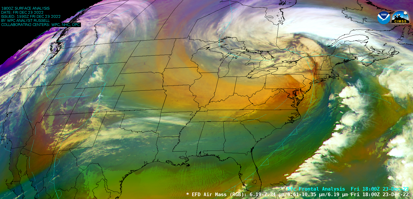
These blowing snow events occurred during a significant and widespread outbreak of arctic air across much of the Lower 48 states during the 21 December – 23 December period, as an anomalously-deep mid-tropospheric trough descended southward and southeastward from Canada — GOES-16 Air Mass RGB images (below) displayed the beige to pale orange hues that are normally associated with such arctic outbreaks (for example, in January 2019). On the morning of 22 December, two locations in western Montana reported low temperatures of –50ºF (the first occurrence of -50ºF in the Lower 48 states during the 2022-2023 winter season). Additional details and imagery of this arctic outbreak and associated episodes of blowing snow can be found on the Satellite Liaison Blog.