Thundersnow in the Upper Midwest, and 30-second imagery of severe thunderstorms across the Deep South
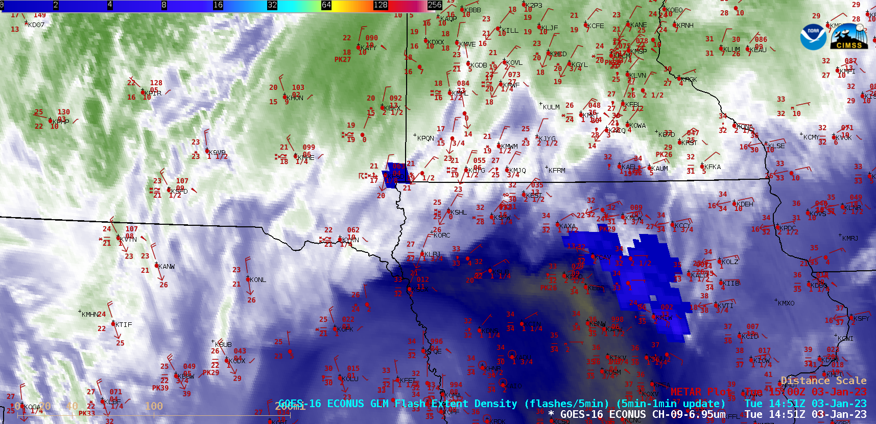
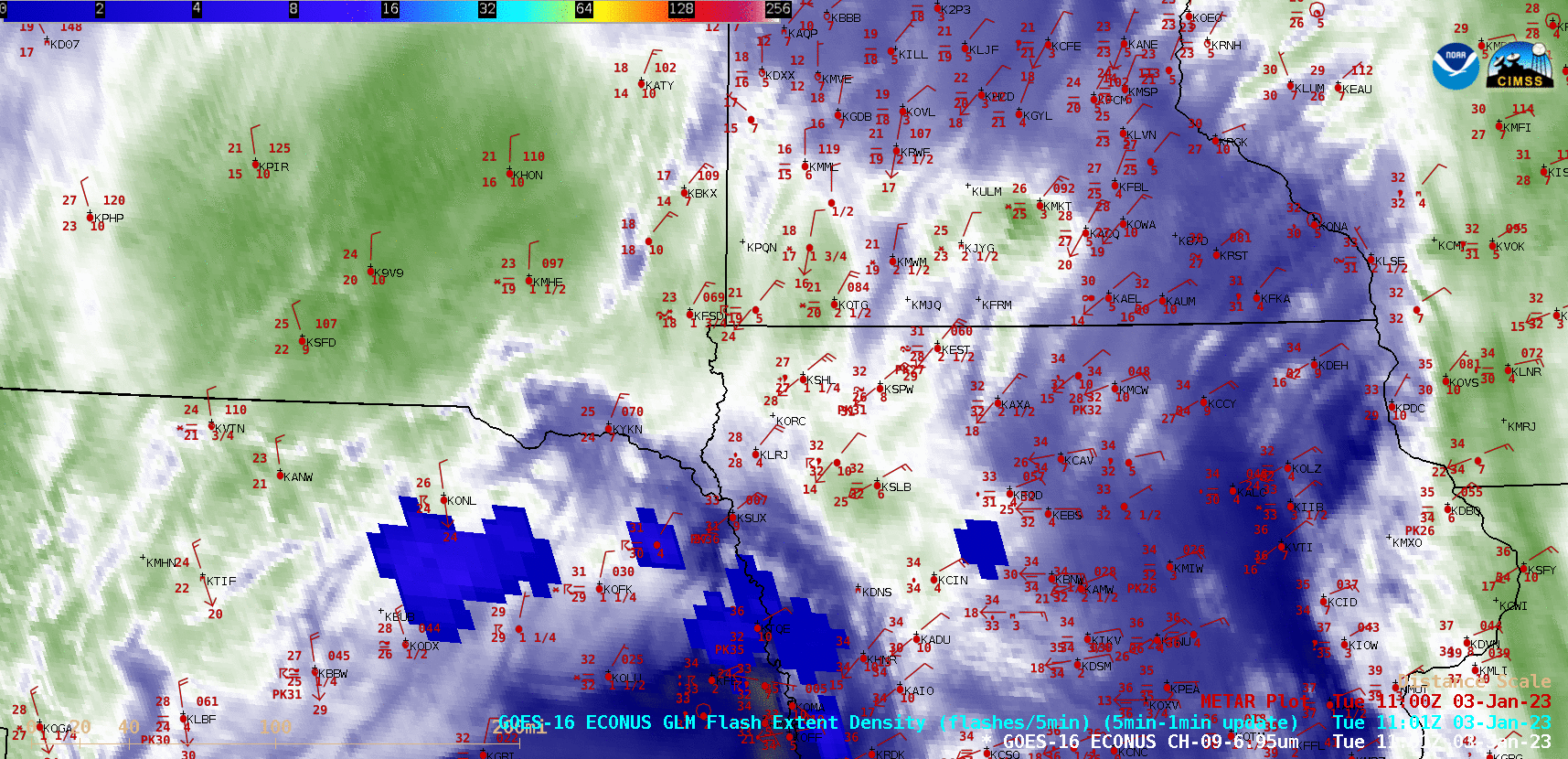
GOES-16 Mid-level Water Vapor (6.9 µm) images with GLM Flash Extent Density and plots of hourly surface reports [click to play MP4 animation | animated GIF]
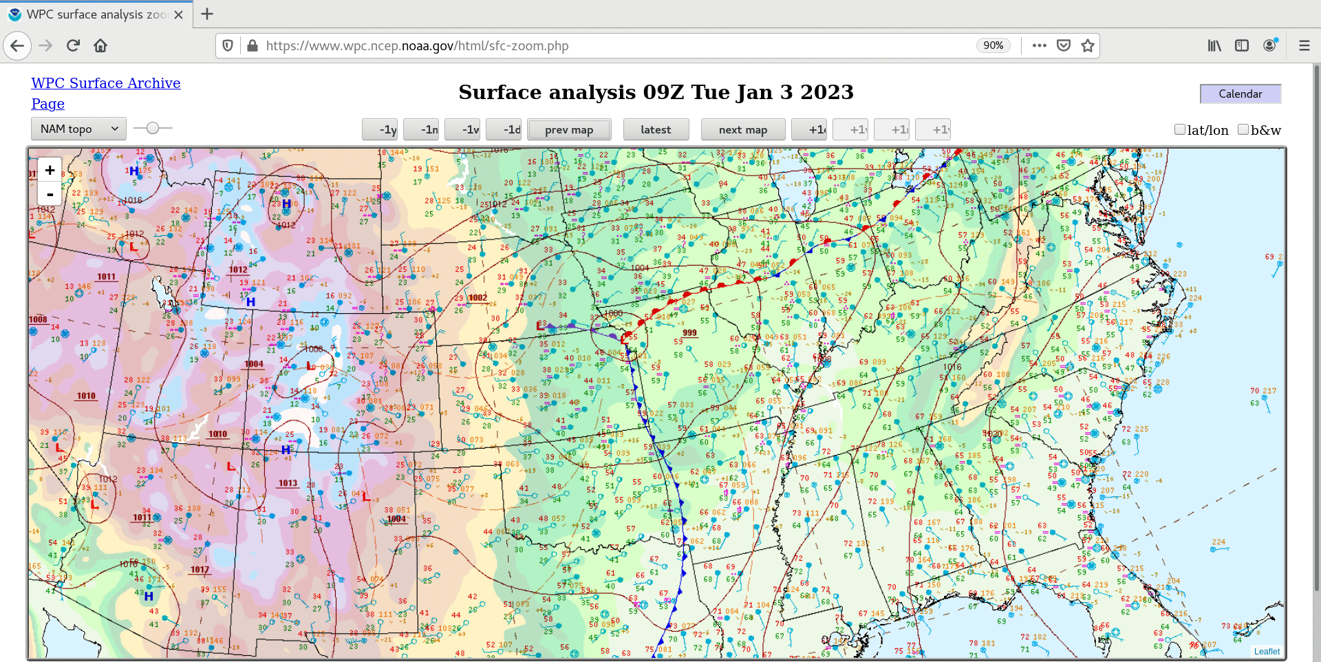
Ahead of the cold front associated with this winter storm (surface analyses), severe thunderstorms produced tornadoes, large hail and damaging winds (SPC Storm Reports) from the Upper Midwest to the Deep South. Overlapping GOES-16 Mesoscale Domain Sectors provided imagery at 30-second intervals over parts of Mississippi, Alabama, Georgia and Tennessee where some of the severe weather occurred — “Red” Visible (0.64 µm) and “Clean” Infrared Window (10.3 µm) images that include time-matched plots of SPC Storm Reports are shown below. With some of these thunderstorms, pulsing overshooting tops exhibited infrared brightness temperatures as cold as -70 to 75ºC.
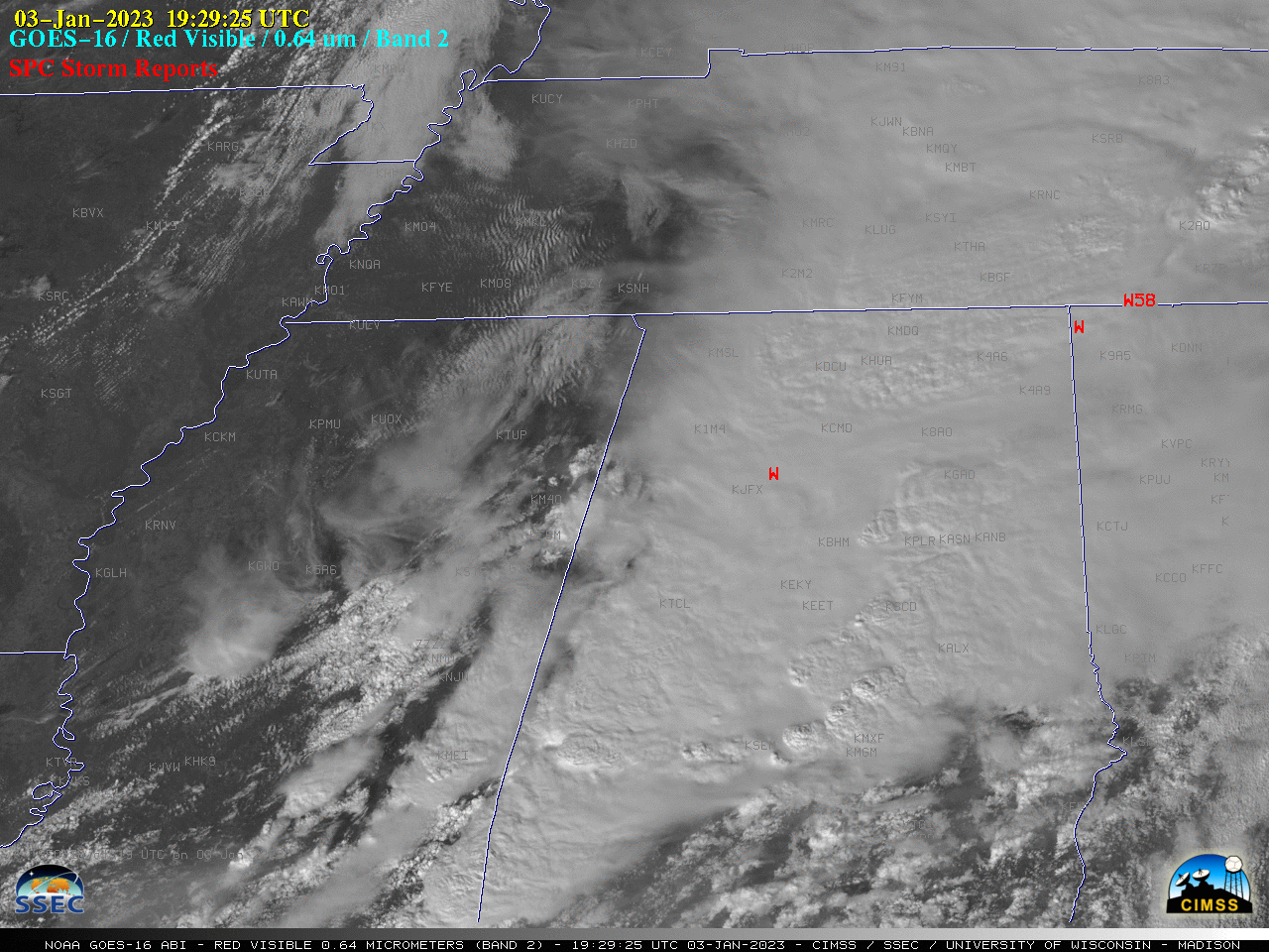
GOES-16 “Red” Visible (0.64 µm) images, with time-matched SPC Storm Reports plotted in red [click to play MP4 animation | animated GIF]
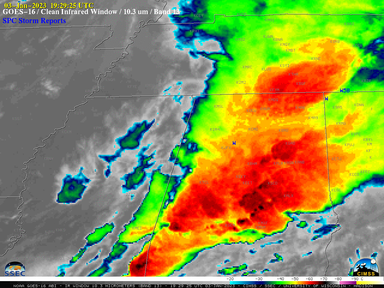
GOES-16 “Clean” Infrared Window (10.3 µm) images, with time-matched SPC Storm Reports plotted in blue [click to play MP4 animation | animated GIF]