Ocean effect snow in Connecticut, Rhode Island and Massachusetts

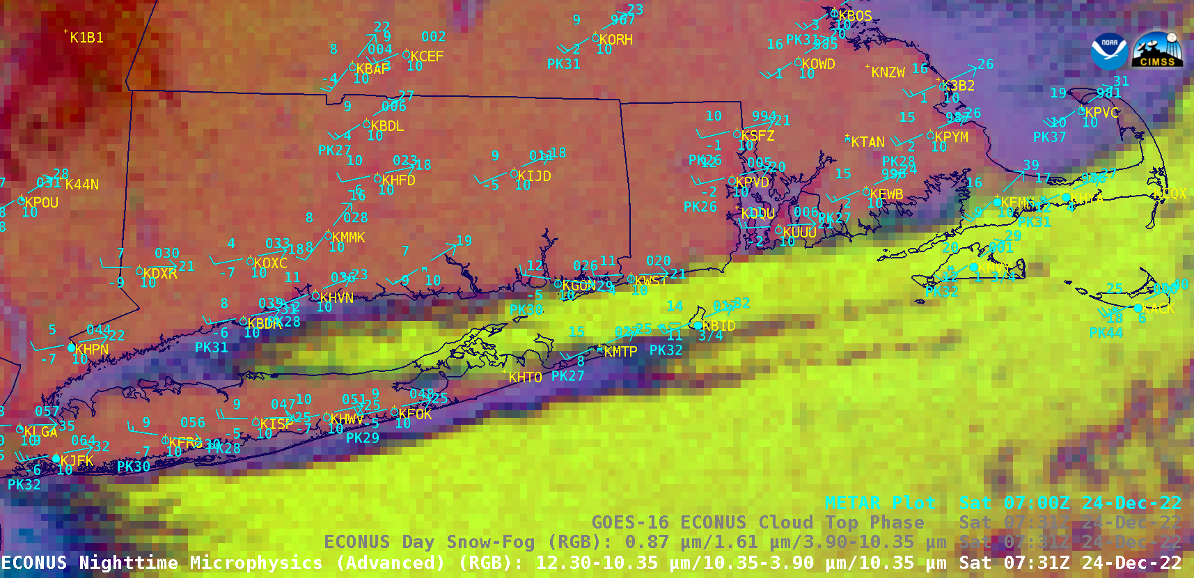
GOES-16 Nighttime Microphysics RGB and Day Snow-Fog RGB images [click to play animated GIF | MP4]
A sequence of GOES-16 (GOES-East) Nighttime Microphysics RGB and Day Snow-Fog RGB images (above) showed plumes of “ocean effect” clouds (including a “sound effect” cloud band, originating over Long Island Sound) that produced periods of snowfall from coastal Connecticut and Rhode Island (as well as Block Island) to Martha’s Vineyard, Nantucket Island and Cape Cod in Massachusetts during the 24 December – 25 December 2022 period — with notable snowfall accumulations occurring across Martha’s Vineyard (NWS Public Information Statement | NOHRSC). The northern edge of the sound effect cloud band only passed over coastal Connecticut and Rhode Island briefly, producing moderate snow at Groton CT (KGON) and light snow at Westerly RI (KWST).
As mentioned in Area Forecast Discussions from NWS Boston, this configuration of a significant Long Island Sound effect snow band was rare, with most of their ocean effect snow events occurring with northerly flow.
An extremely rare and significant snow band has been impacting
Marthas Vineyard this morning on very cold west to southwest
flow. Most of the time our ocean effect snow events are dealing
with northerly flow with a shallow inversion layer and often a
limited fetch. This results in very minor snow accumulations in
most cases. In this situation...rare arctic air invaded the
region on a 240/250 degree wind. The soundings indicate a rather
deep mixed layer up to the inversion at 4-5 thousand feet with
uniform WSW winds. Large temp differentials from the top of the
mixed layer to the SST were on the order of 22C/23C.
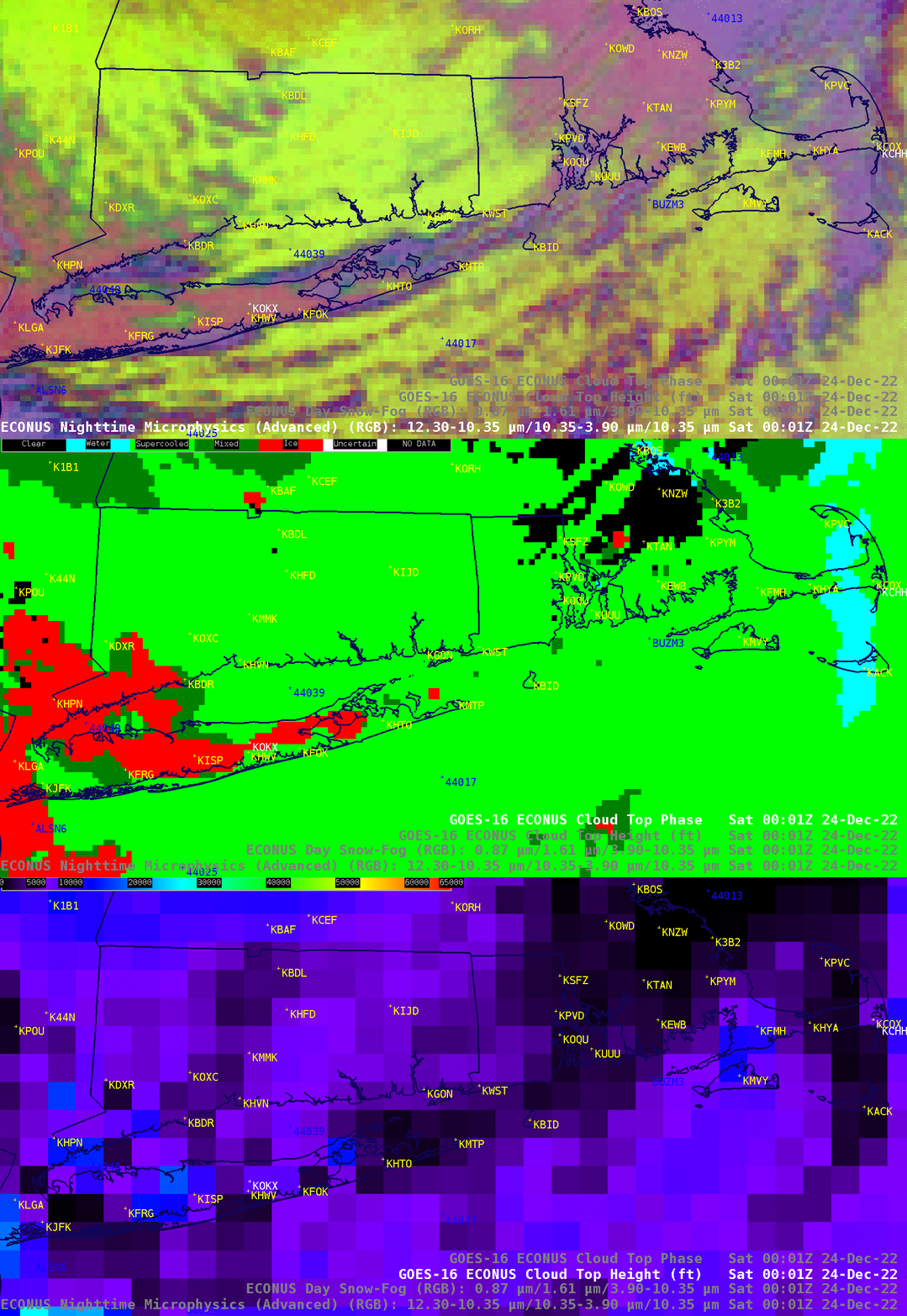
A comparison of GOES-16 Nighttime Microphysics RGB, Cloud Top Phase and Cloud Top Height images at 0001 UTC on 24 December (below) showed that the Long Island Sound effect cloud band’s top was composed of supercooled water droplets, with cloud top height values in the 5000-7000 feet range. As this cloud band was passing over Central Long Island Sound Buoy 44039 during the 24-25 December period, strong surface winds caused an upwelling of cooler sub-surface water which reduced sea surface temperatures about 3ºF.

GOES-16 Nighttime Microphysics RGB, Cloud Top Phase and Cloud Top Height images at 0001 UTC on 24 December [click to enlarge]
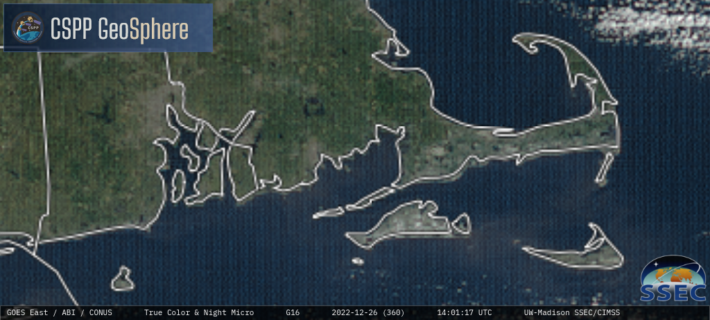
On 26 December, GOES-16 True Color RGB images from the CSPP GeoSphere site (below) revealed the whiter shades of snow cover across Martha’s Vineyard, Nantucket Island and southern portions of Cape Cod — with the lesser snow depths across Nantucket Island and Cape Cod beginning to melt more quickly compared to the deeper snow cover across Martha’s Vineyard.


