Severe thunderstorms produce large hail and damaging winds in parts of North Carolina and South Carolina
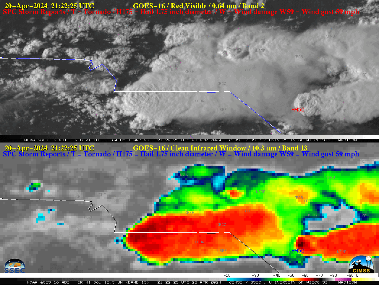
1-minute Mesoscale Domain Sector GOES-16 (GOES-East) images showed clusters of severe thunderstorms that developed in the vicinity of the North Carolina / South Carolina border on 20 April 2024 — “Red” Visible (0.64 µm) and “Clean” Infrared Window (10.3 µm) images (above) included time-matched plots of preliminary/filtered SPC Storm Reports for these thunderstorms, which produced wind gusts as high... Read More
